


UAV Aerial Surveying Imaging
UAV Aerial Surveys
UAV Aerial Surveying Imaging
UAV Aerial Surveys
BETTER PROJECT INSIGHTS FROM DRONE AERIAL IMAGING
AND INFORMATION-RICH GEOSPATIAL DATASETS.
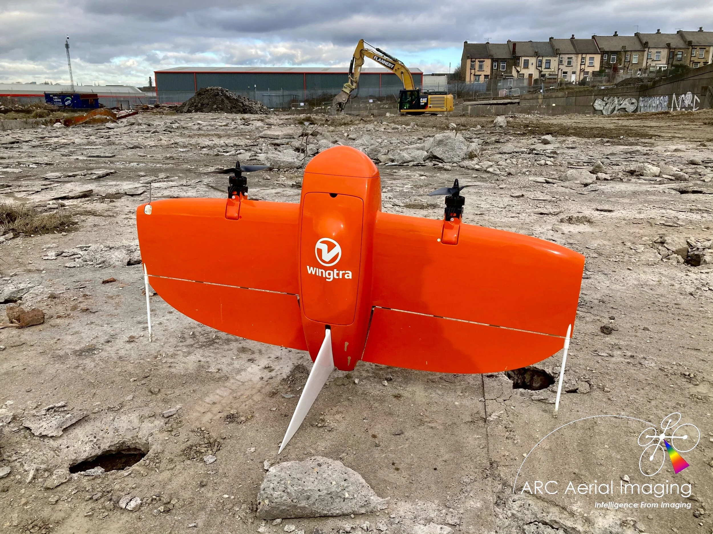
From agriculture to utilities, ARC Aerial Imaging has been professionally mapping and surveying a broad spectrum of subjects for its clients over the years through various aerial imaging acquisition techniques with the use of its adaptable, highly capable aerial platforms and remote sensing formats to collect multiple forms of imaging to provide highly-accurate geospatial datasets.
Are there different types of topographic surveys? And how accurate are topographic surveys?
There are many types of topographical surveys, and with technology continually evolving, new ways of surveying continues to develop.
The inclusion of drones and drone-based surveys has provided surveyors with many more tools for their toolboxes, and some drone payloads are capable of accuracies in the order of +/-30mm for hard surfaces, +/-50mm for soft surfaces. Professional surveyors must take great care when instructing a drone survey as there are many different factors which can affect the achieved accuracy.
We’ve seen first-hand the impact that the right tools and technologies can have on job site efficiency and few match the transformative potential of drones and the advanced deliverables they provide:
Reduce Risk: Mitigate potential hazards with precise aerial assessments and 3D models.
Enhance QA/QC: Elevate quality assurance and quality control with high-resolution visuals and analytics.
Validate As-Built Conditions: Accurately capture and confirm site conditions as they evolve with CAD drawing integration.
Document Critical Project Aspects: Create and analyze a comprehensive visual record of your project's progress.
Boost Collaboration and Coordination: Share clear actionable insights across your team in near real-time.
Empower Your Project Team: Equip everyone with powerful visual data to drive decisions and capture a data-rich digital record of your project.


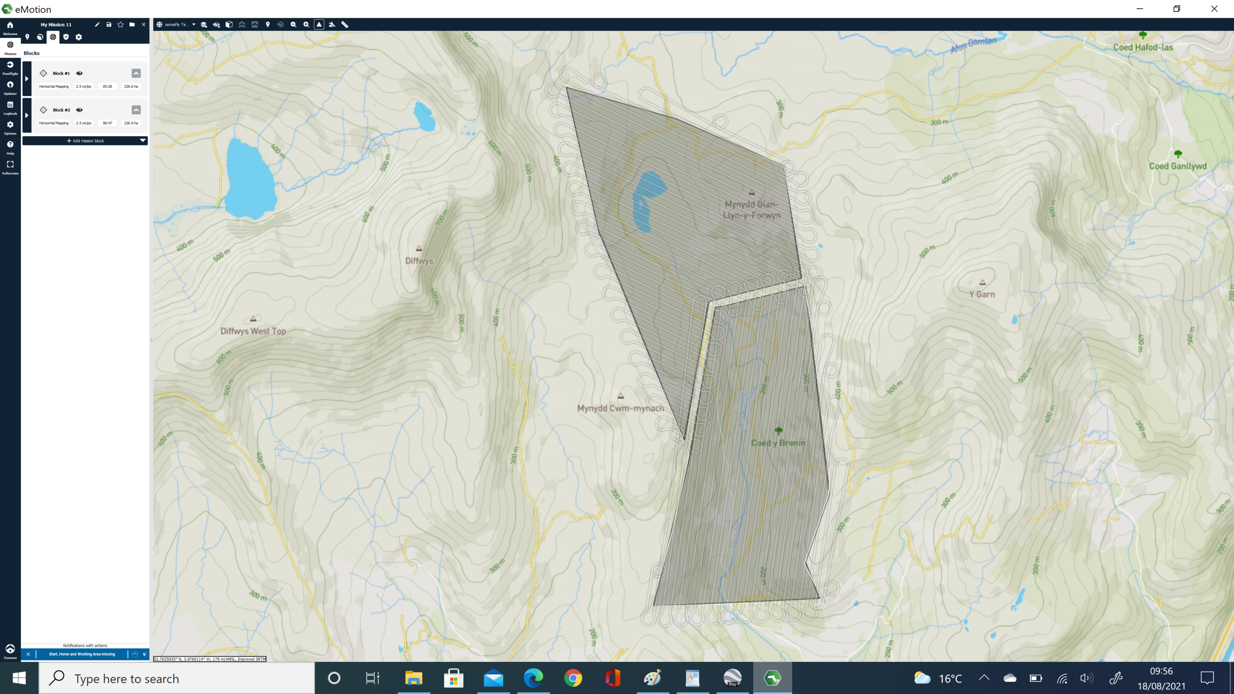
There are several key stages to a successful topographic task with UAVs which in summary involves:
- Defining the desired client deliverables and in their formats;
- Utilising the appropriate data-collecting platform and sensor;
- Planning the acquisition mission;
- Data collection;
- Processing and correcting;
- Delivery of geospatial products;
- Extracting valuable intelligence insights.
Our drone surveys typically capture hundreds, sometimes thousands of high resolution geo-tagged nadir-orientated aerial images during a survey from accurately planned automated UAV flight plans with various software.
With the correct planning approaches and methodologies in place to conduct repeatable autonomous drone flights, accurately collected UAV aerial imaging and processed geospatial datasets that would be aligned with ground control can provide clients with accurate valuable information and spatial data of a civil engineering project’s ongoing progression and development.
Why outsource your UAV surveys to us?
Approximate BUSINESS costs for EMPLOYING INTERNAL UAV-OPERATING STAFF
£40,000+ Salary/Pension/Holiday Allowances/Sick Leave.
£2,000+ UAV CAA UAV Training (GvC) and CPD.
£4,000+ UAV Equipment.
£300 Annual CAA Operational Authorisation fee.
£1,000+ UAV (Public Liability) Insurance.
£4,000+ Photogrammetry processing software and user licenses.
£2,000+ GNSS Rover and RTK licenses.
BUSINESS Risks involved
Once trained that employee could leave to a competitor.
Can only work on one project per time, taking anything from 1 day to 10 days to complete.
Does not gain the experience of working on a variety of geospatial-related tasks and with various clients.
So it makes sense to task us for your UAV surveys!
So check out just how cost-effective our UAV surveying service rates are…
Applications
Surveying with a drone offers enormous geodata information to GIS professionals. With a drone it is possible to carry out topographic surveys of the same quality as the highly accurate measurements that would be collected by traditional methods but in a fraction of the time. This substantially reduces the cost of a site survey and the workload of specialists in the field.
Furthermore, we can survey otherwise unreachable areas yet deliver high resolution aerial maps that would be otherwise impossible to produce in a safe and cost-effective way.
Surveying and GIS
Land surveying.
Cadastral maps and cartography.
Topographical surveys.
Precise measurements.
Land management and development.
Urban planning.
Assisting construction to quickly map large areas for pre-built/pre-cursor evaluations. Our drone-derived data has already been used in many land development projects on the behalf of several large entities - from the early stages of planning, continuous project updates right up to their ‘as-built’ conclusions. It also decreases costs and improves the turnaround time for surveying and construction while helping projects to stay on track with budgets and timelines throughout their durations.
Construction
Datasets for pre-cursor project planning.
Time-lapse aerial imaging and site maps.
Tracking construction project progress for stakeholder updates.
3D models of sites.
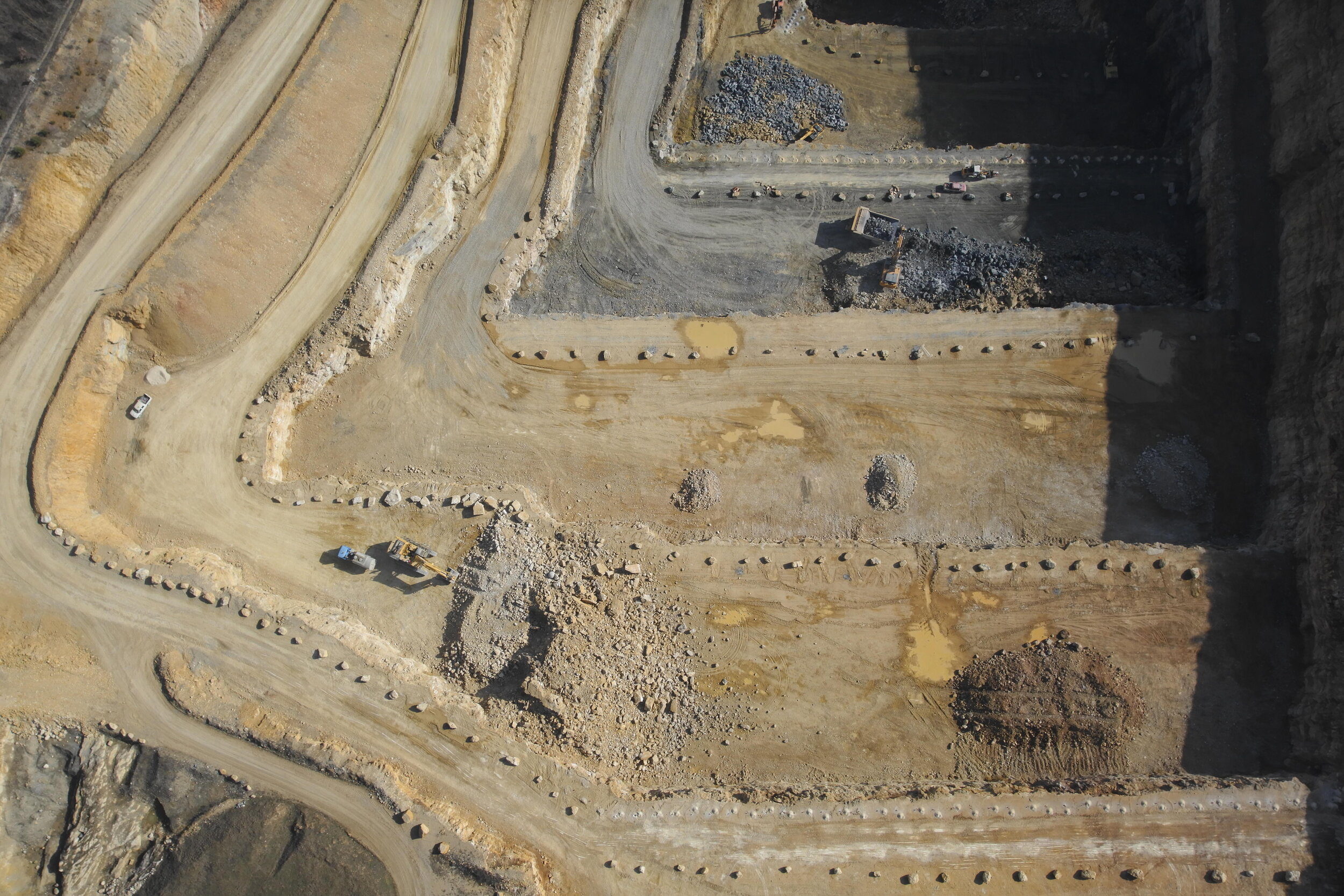
Improve the management efficiency of large mining sites and quarries by providing complete data about the state of the site in a short turnaround timelines. Data can be safely produced by us on site without the danger of climbing stockpiles or walking amidst moving plant equipment. All of this at a fraction of the cost and time of traditional surveying methods and without disruptions to site operations.
Mining and aggregates
Inventory and management of stockpile volumes.
Mine or quarry monitoring and operation planning.
Quantity analysis before/after drilling and blasting.
Slope monitoring.
Our typical UAV aerial imagery and processed geospatial outputs…
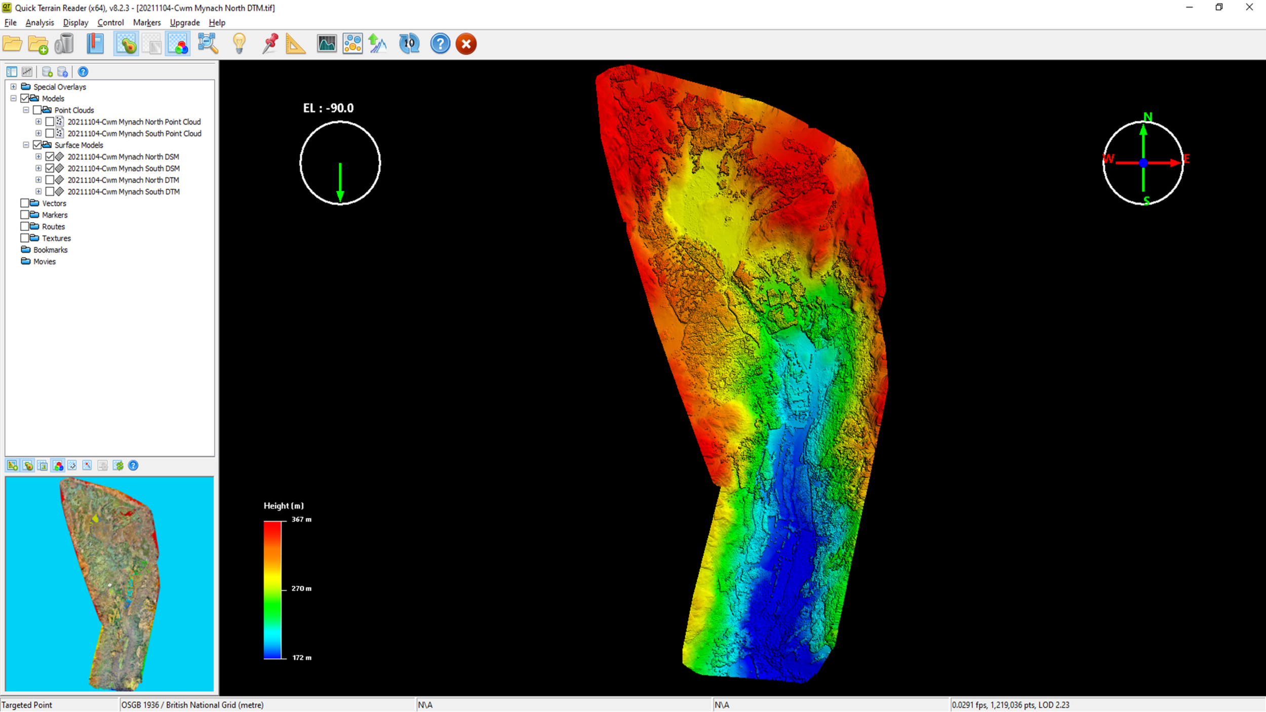
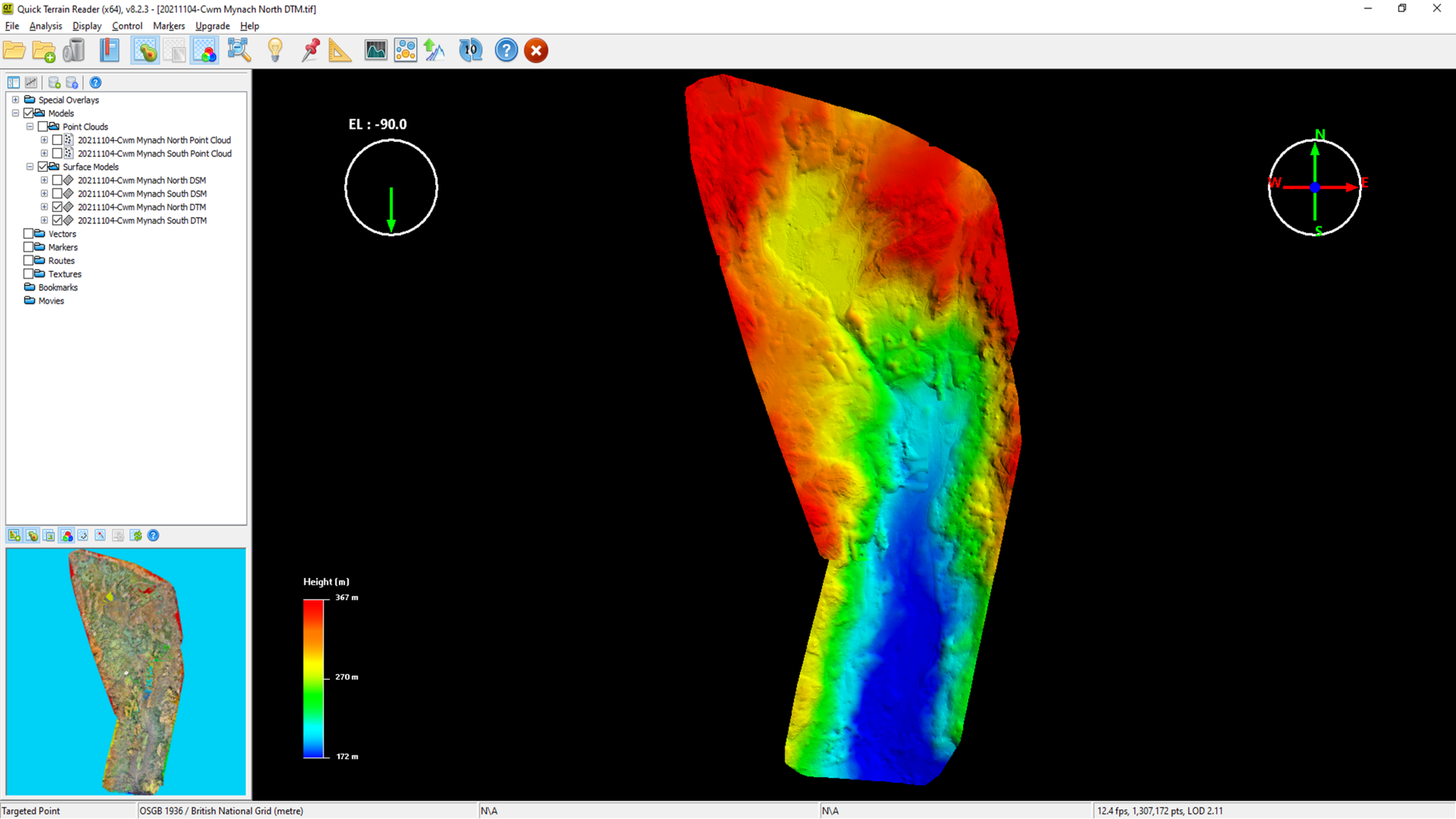
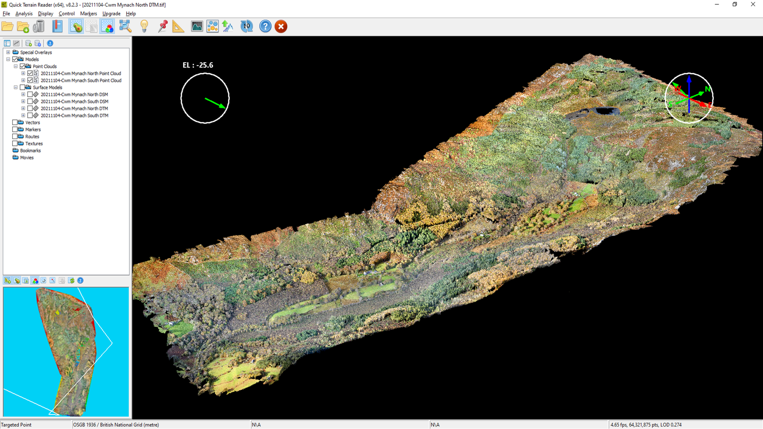
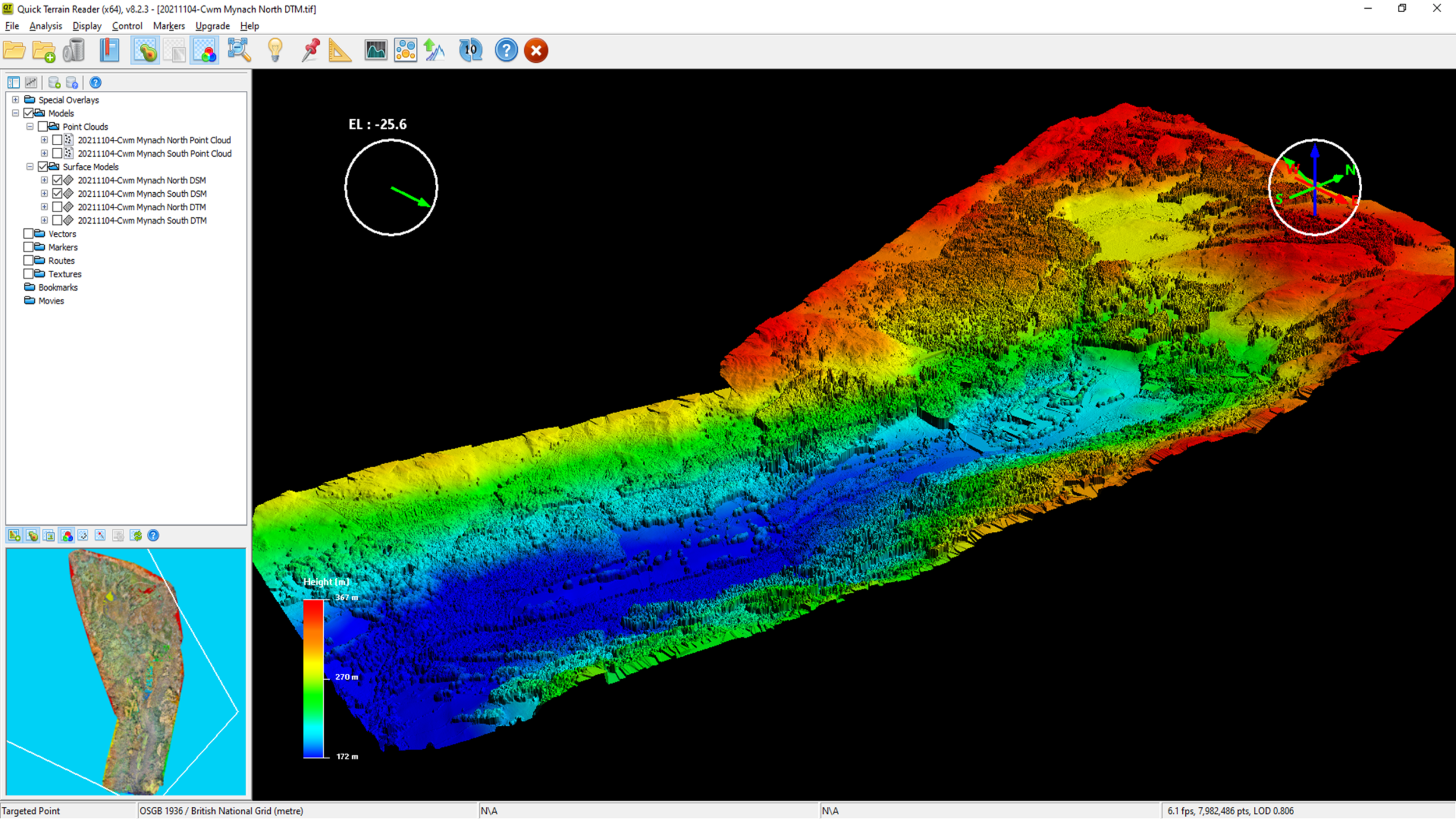
From this imaging accompanied with GCP data, our in-house photogrammetry processing can create and provide those survey-grade geo-referenced geospatial products such as orthomosaics, elevation products and other types of raster and vector data of a tasked surveyed area.
These products can also be exported in multiple and client-specified formats which are compatible and can be ingested into various CAD/BIM/GIS suites to accompany other raster and vector data forms supporting that project.
High resolution (ultra-low/under 5cm/px GSD) geo-tagged aerial imagery
Geo-referenced/rectified to BNG OSGB36/OSGM15 true orthorectified 20-50mm RMSE accuracy
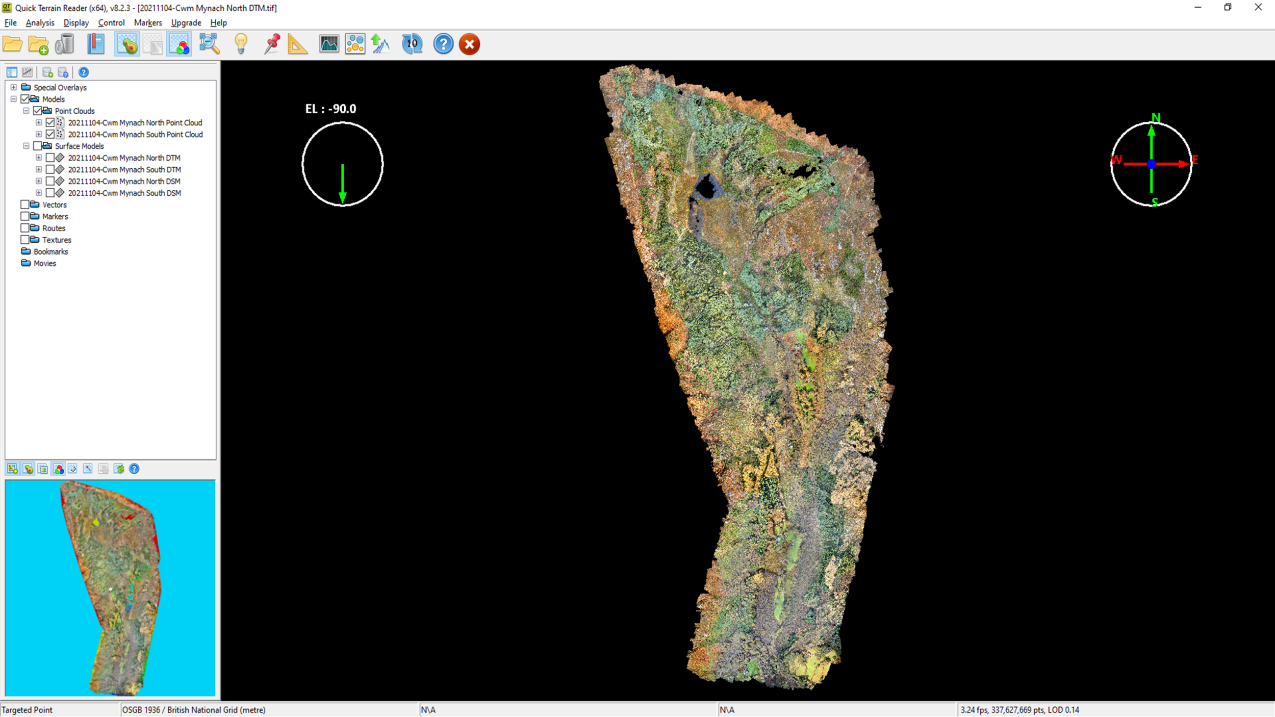
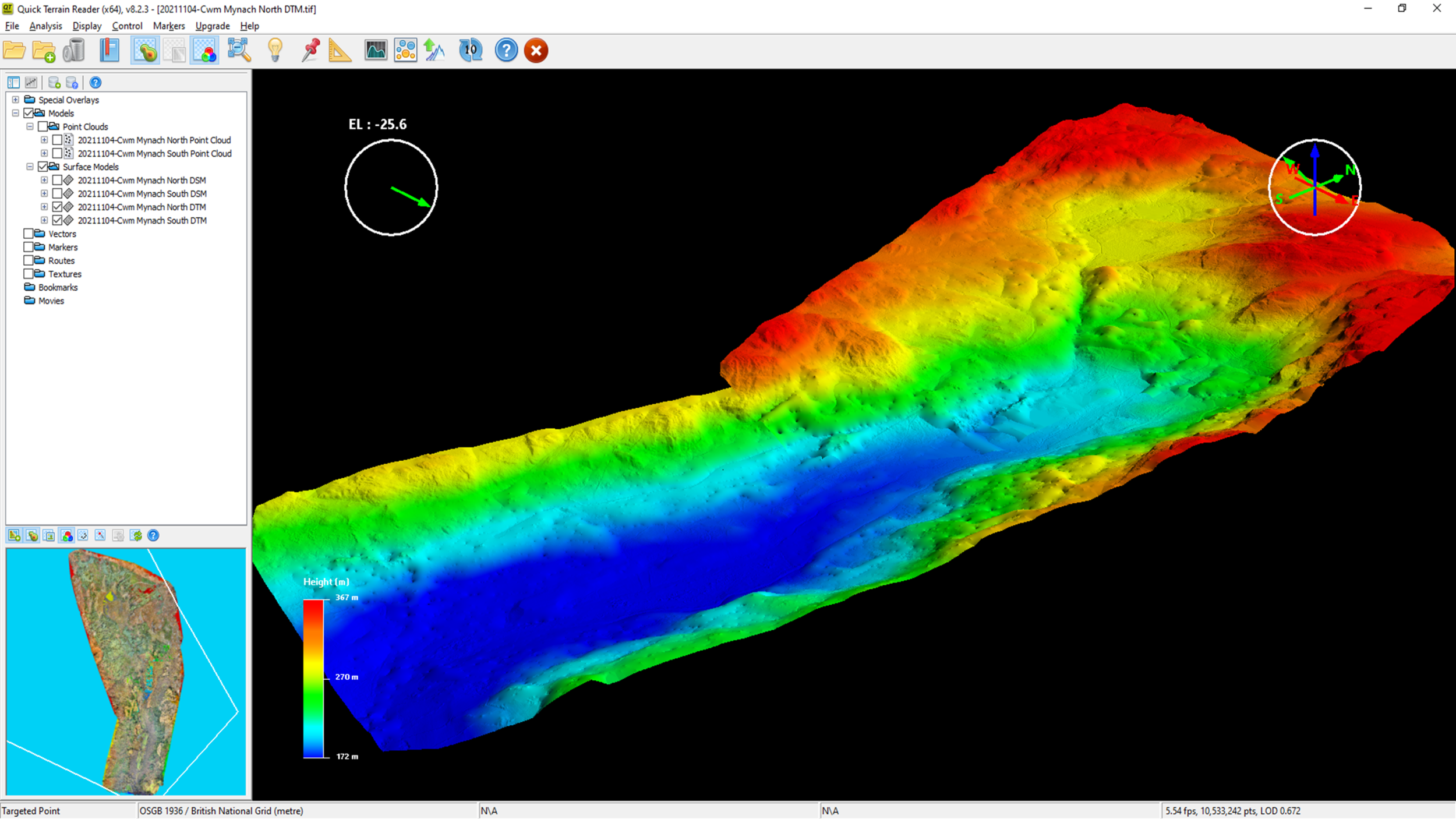
Point Clouds
Digital Elevation Models
(Digital Surface Models/Digital Terrain Models)
Contour Projections
3D Mesh Models
Orthomosaics
Our drone images are used to recreate highly-accurate, high resolution orthomosaic maps of a variety of tasked subjects. Each pixel contains 2D geo-referenced information (X, Y) which can be used for the recording of distances and surface measurements when controlled with known positional data (GCPs) and with involved scaled for accurate distancing.
Common file formats: GeoTIFF (.tiff), .ecw .jpg, .png, Google tiles (.kml, .html)
point cloud
A highly-densified Point Cloud can be generated from drone images through the practice of photogrammetry. Each processed ‘point’ extracted from imaging pixels that’s been cross-referenced with the same pixels on other images contains valuable geospatial (X, Y, Z) and categorised information which can provide an accurate, if control methods are in place, 3D spatial model for precise and visual insights of a site. Densified point clouds can also be gridded and edited to ‘spatially thin’ them into more manageable and client-stipulated point distancing requirements. Other dataset types, such as Digital Elevation Models (DSMs/DTMs), can be produced from a Point Cloud.
Common file formats: .las, .laz, .ply, .xyz
Digital ELEVATION modelS
Point Clouds can be used to create Digital Elevation Models. Other DEM types such as Digital Terrain Models can be created from filtering and removing above surface matter such as buildings, trees etc from a Digital Surface Model with each pixel representing ground elevation information (X, Y and Z values). These models can also be used to create other dataset types such as contour elevation projections.
Common file format: GeoTiff (.tif)
3D textured mesh
A 3D textured mesh is a reproduction of the edges, facades, vertices and textures of the subject and this output is most useful for the user with appropriate viewing software to interact, visualise and communicate with other project stakeholders with the site.
Common file formats: .ply, .fbx, .dxf, .obj (.mtl & .jpg), .pdf

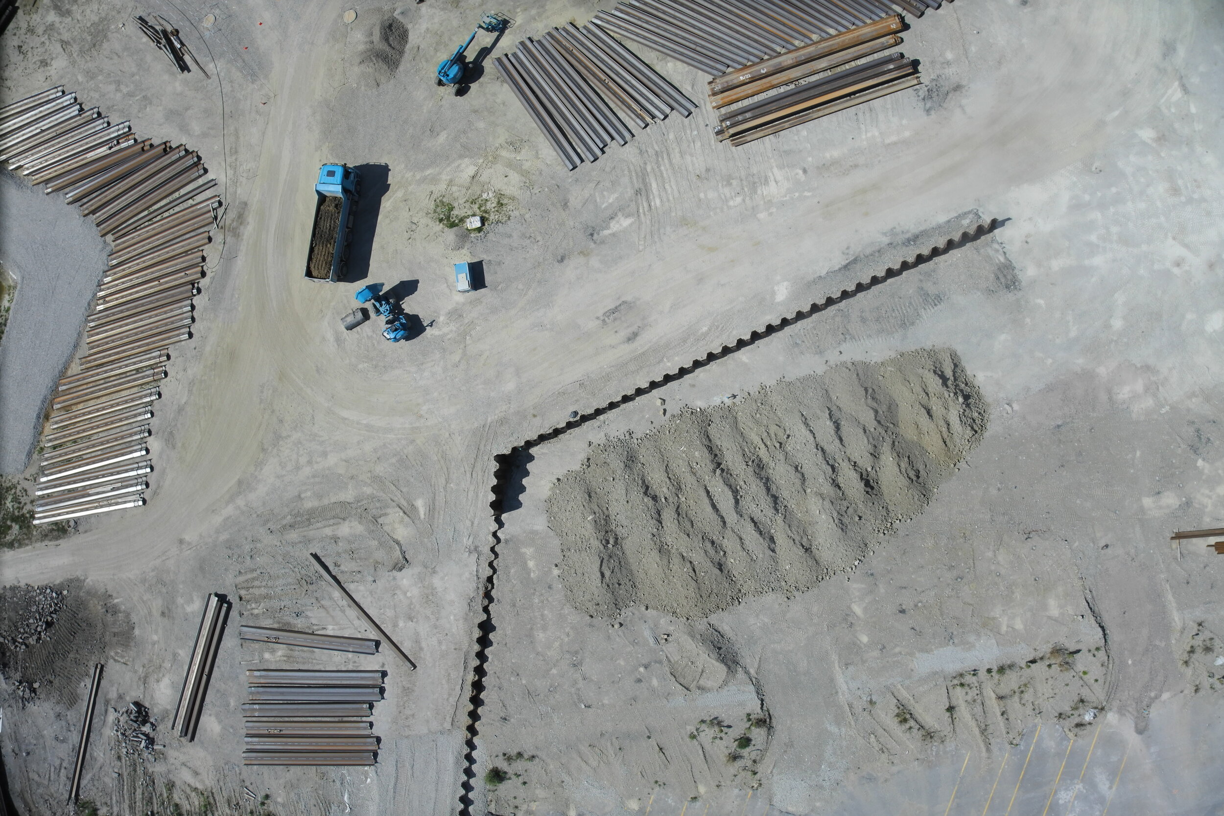
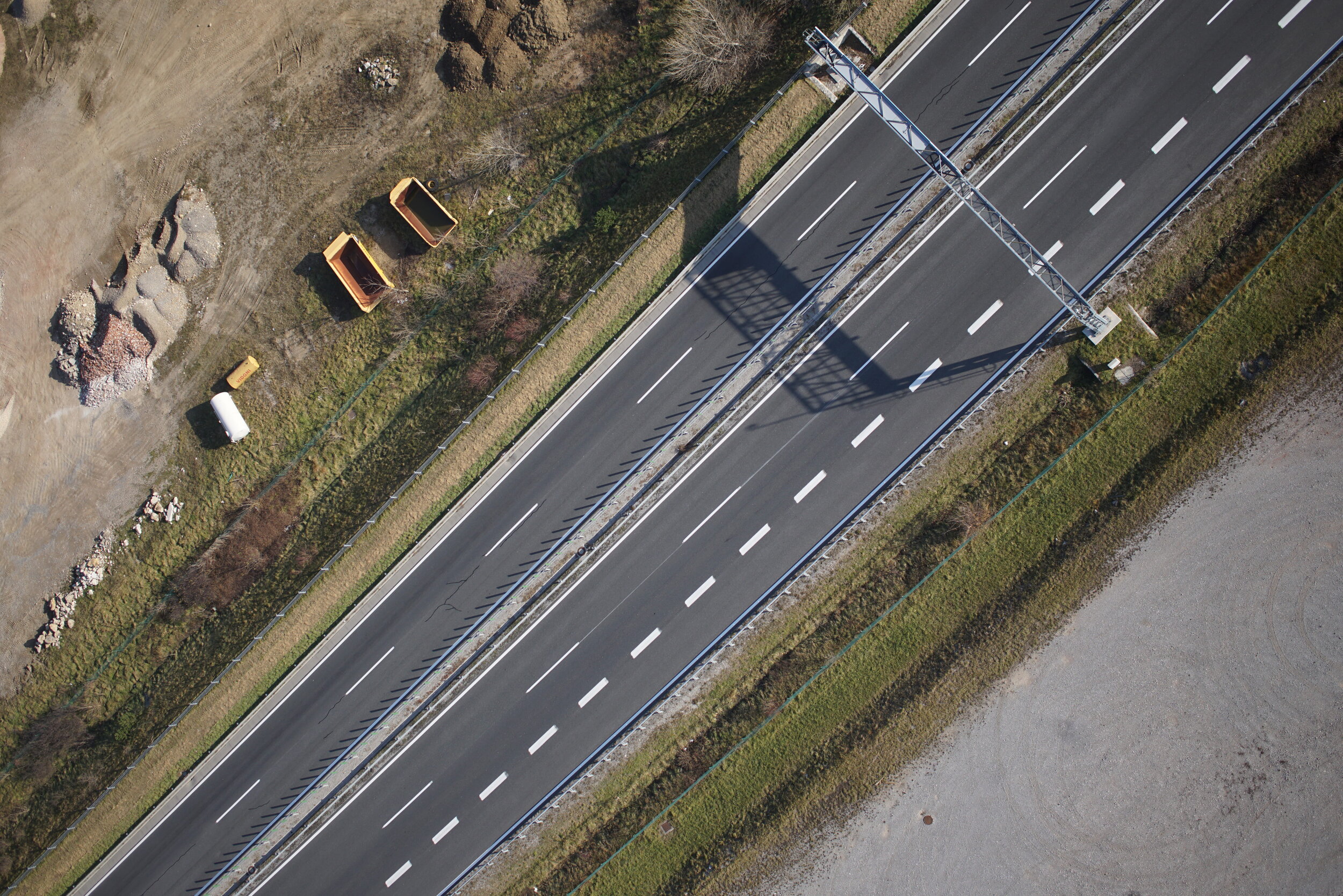
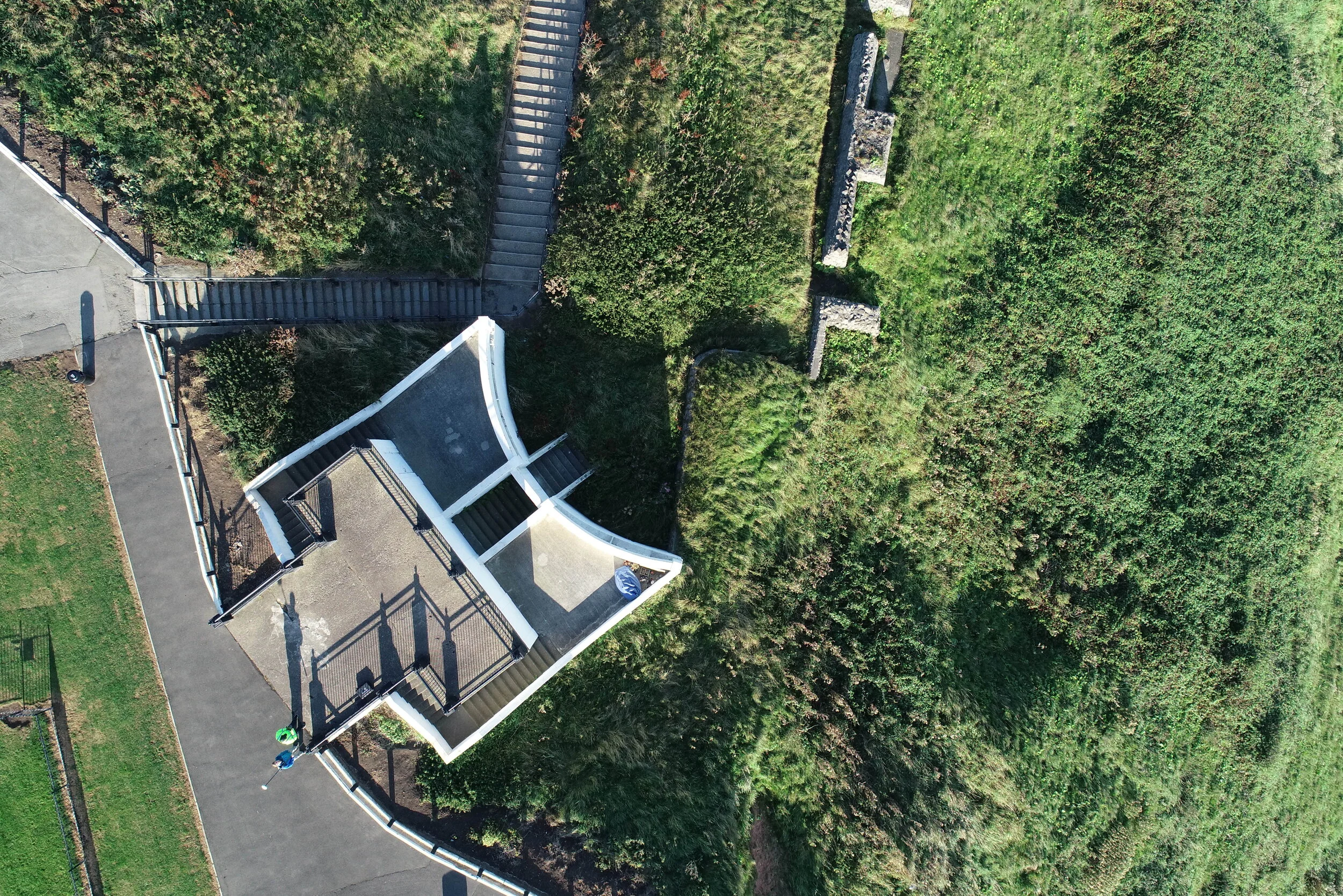
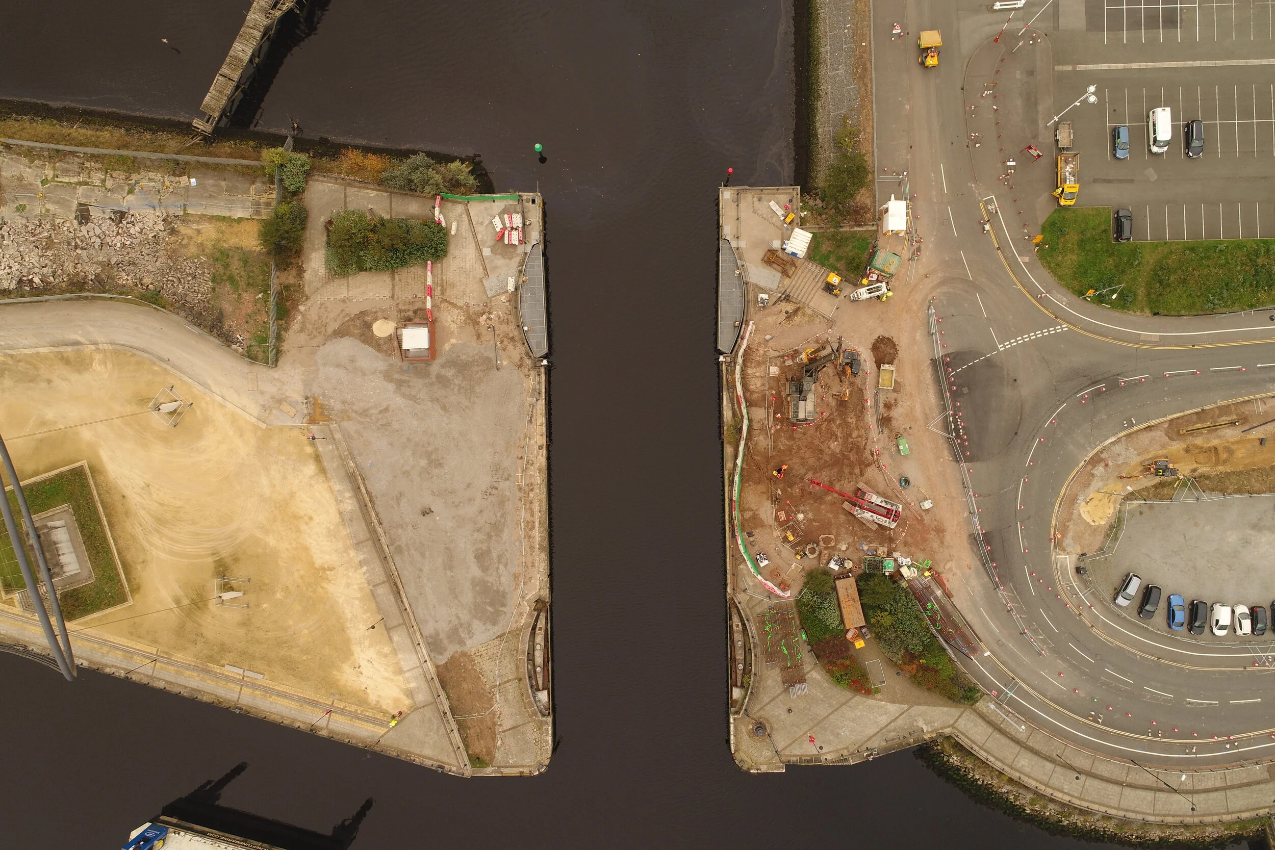
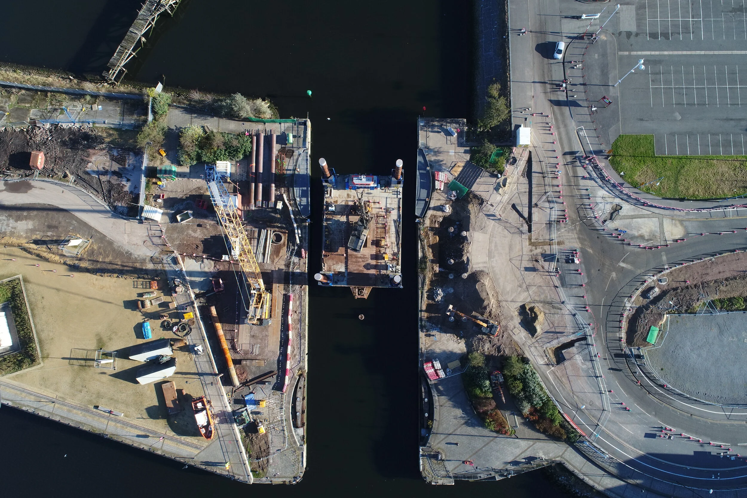
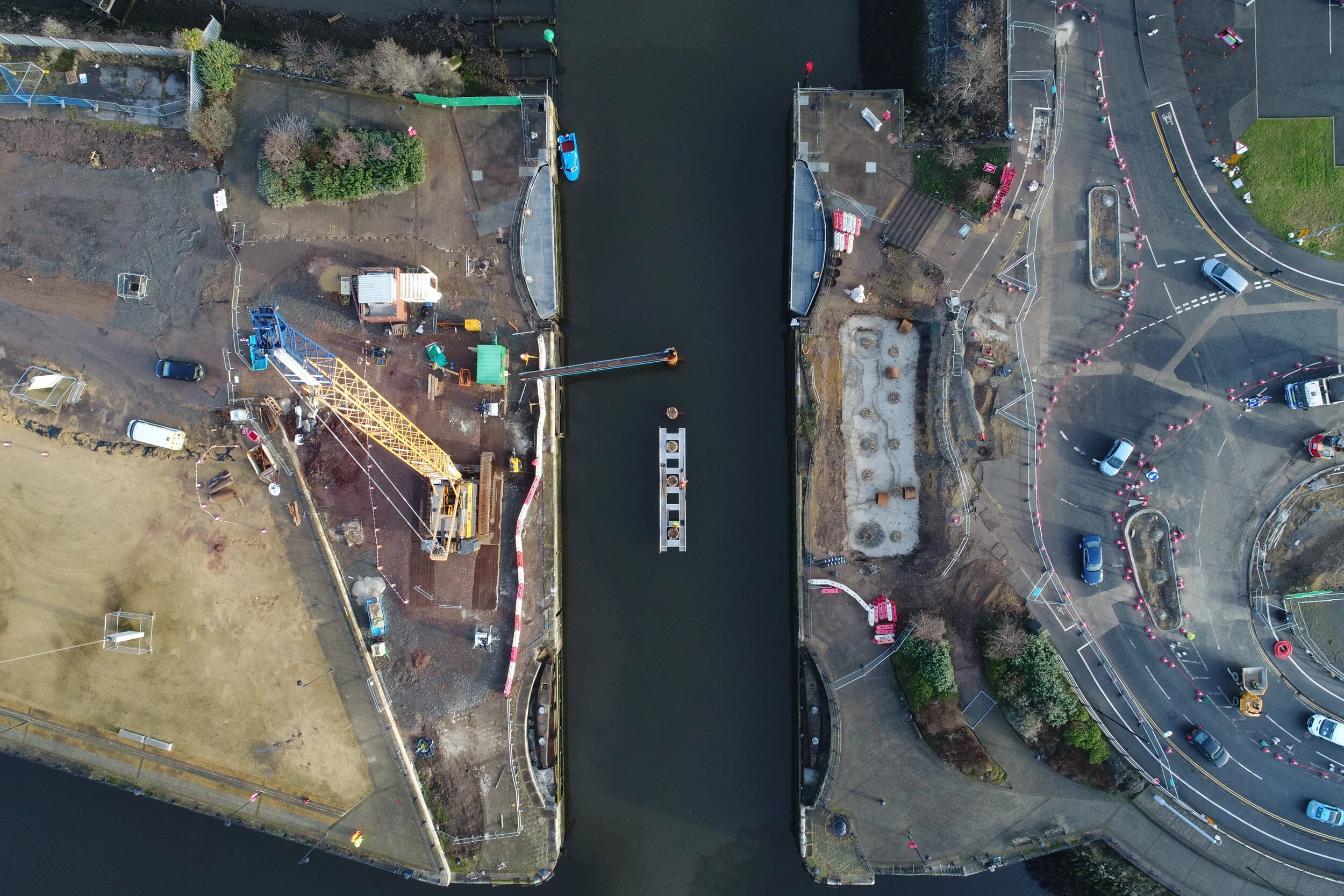
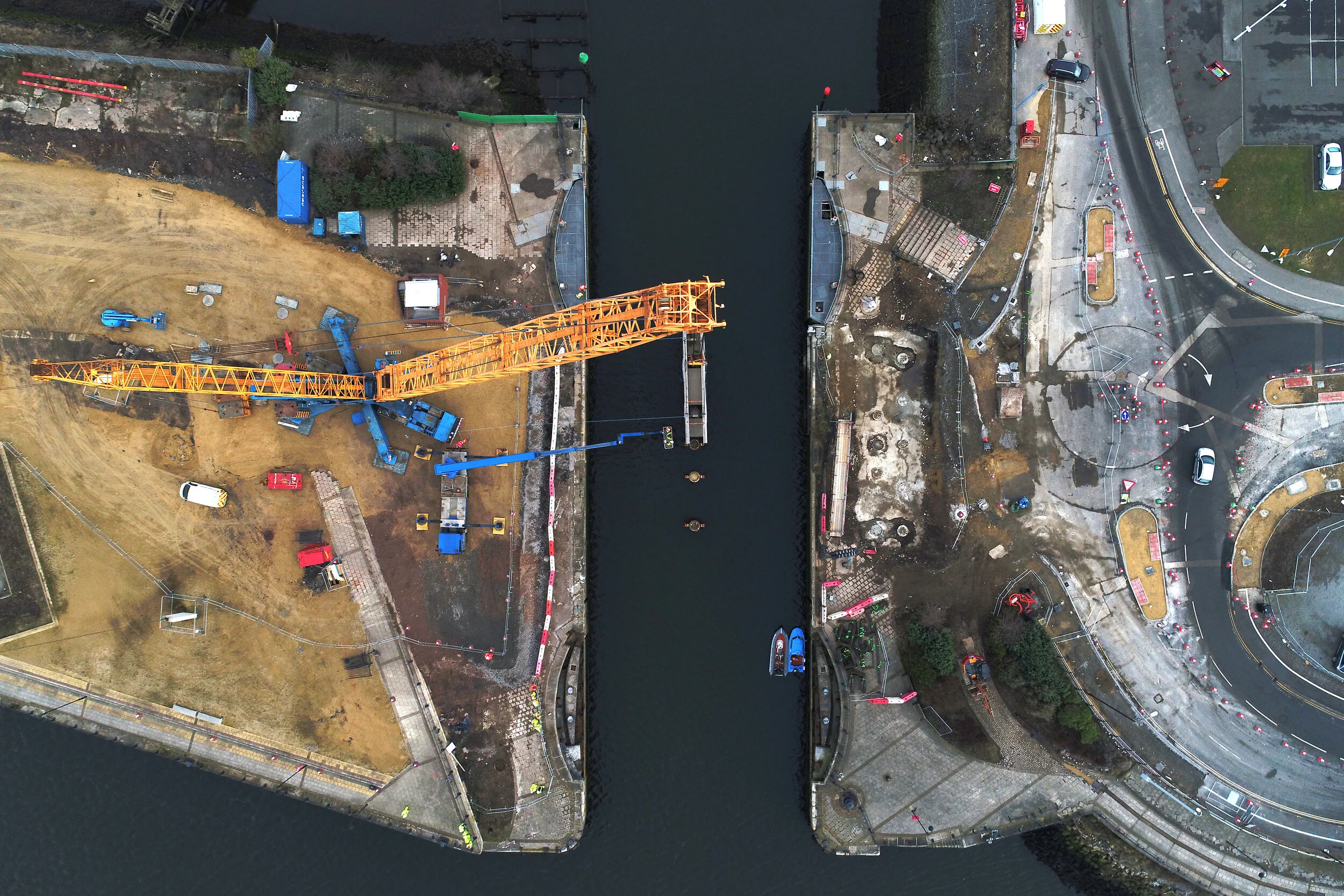
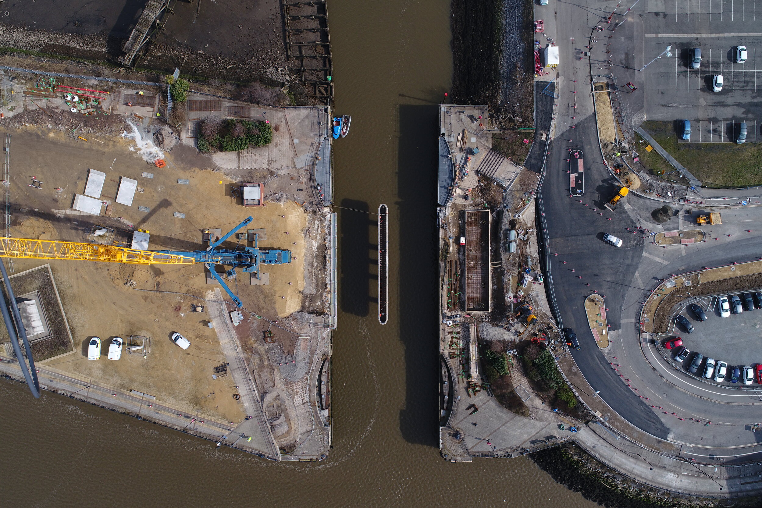
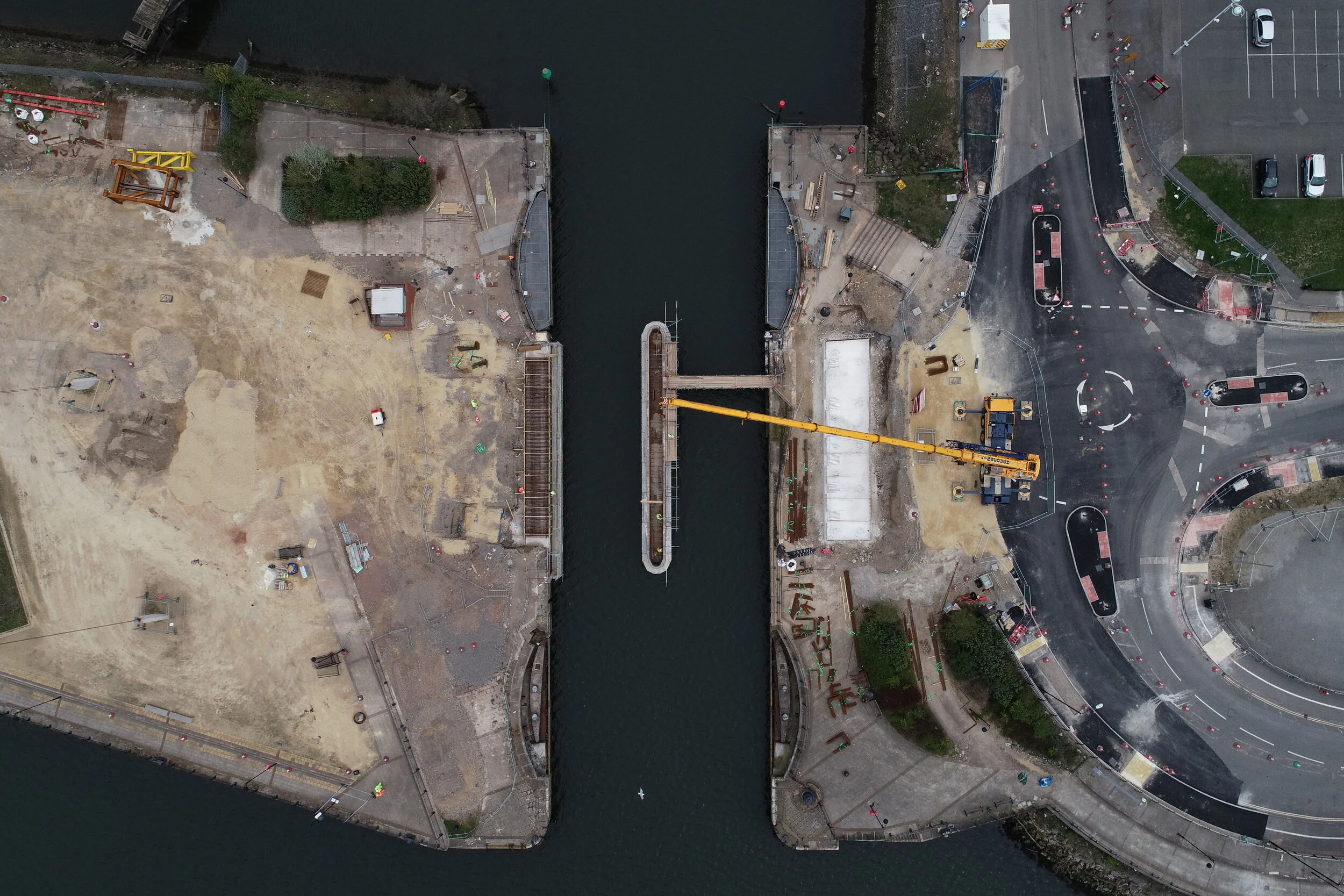
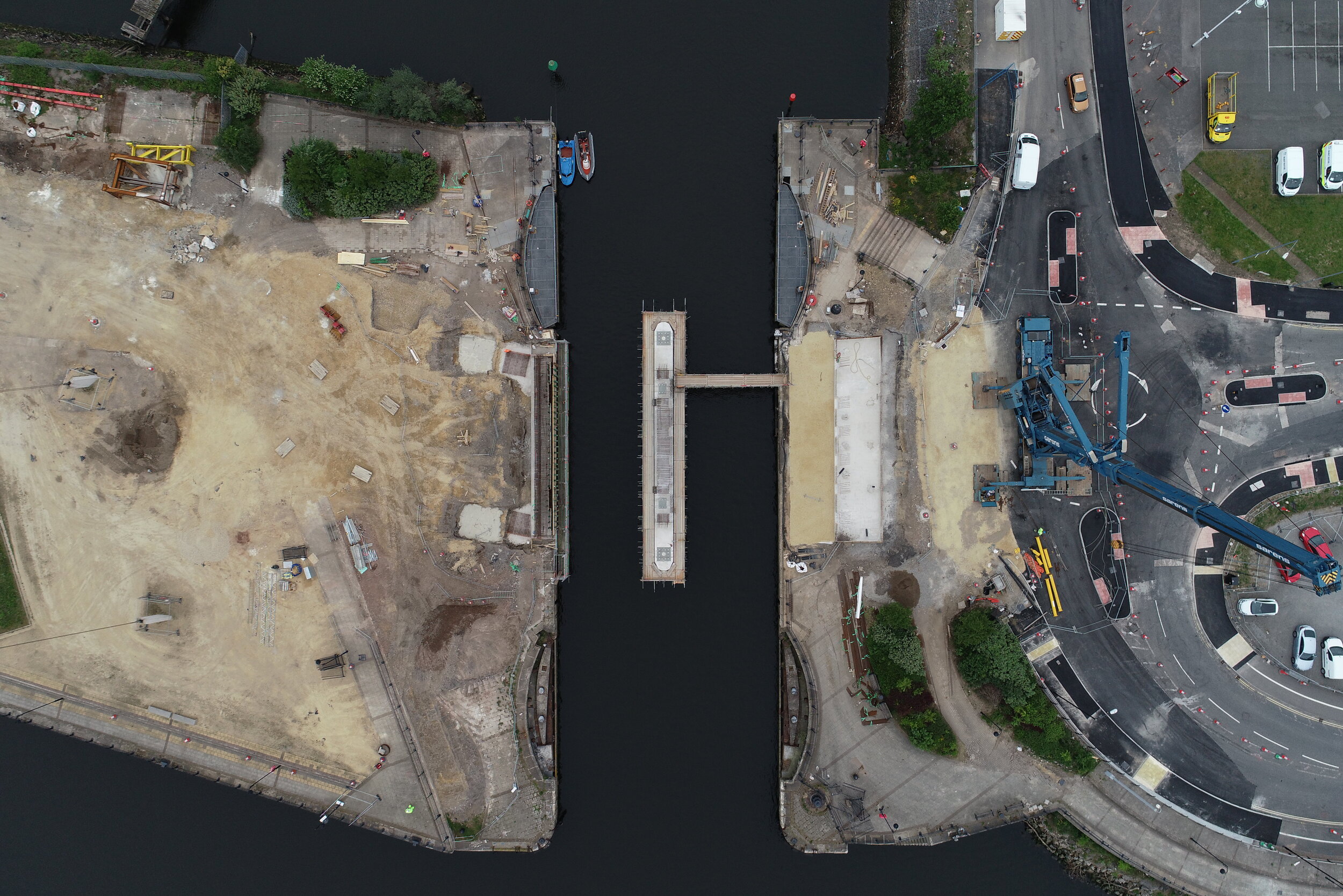
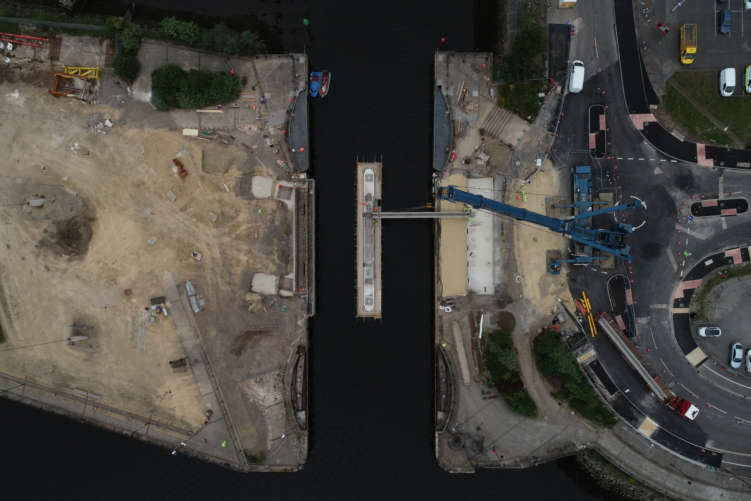
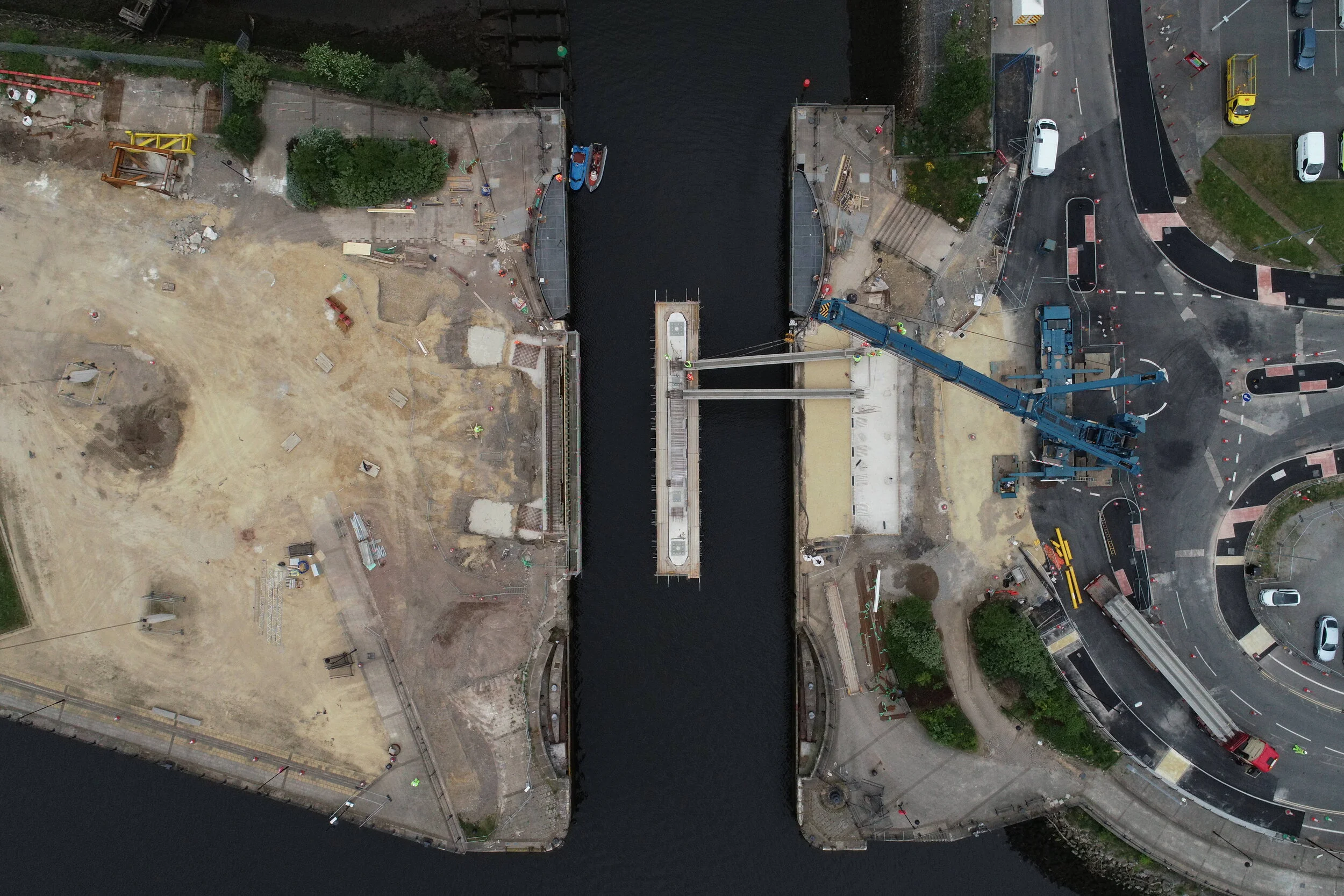
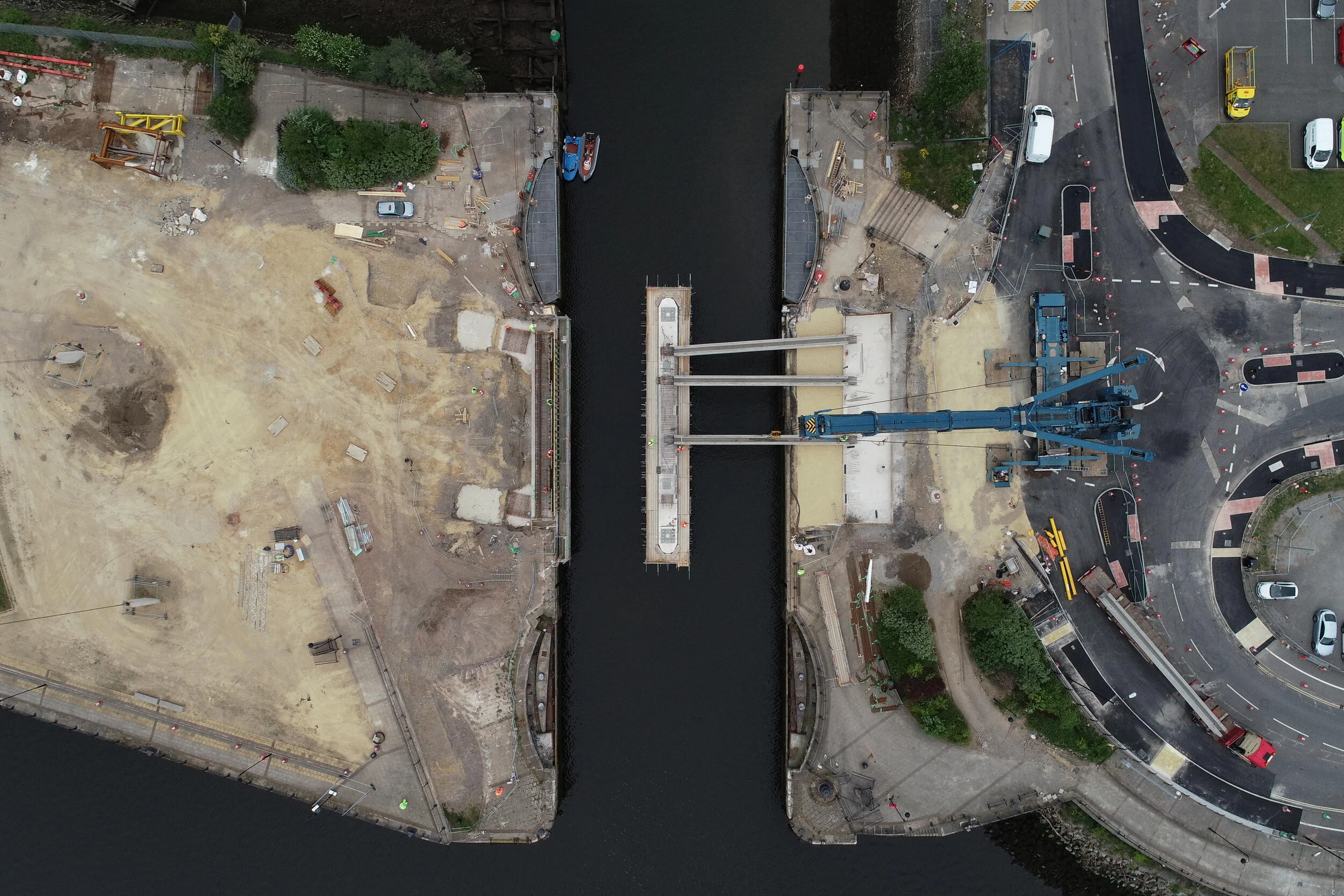
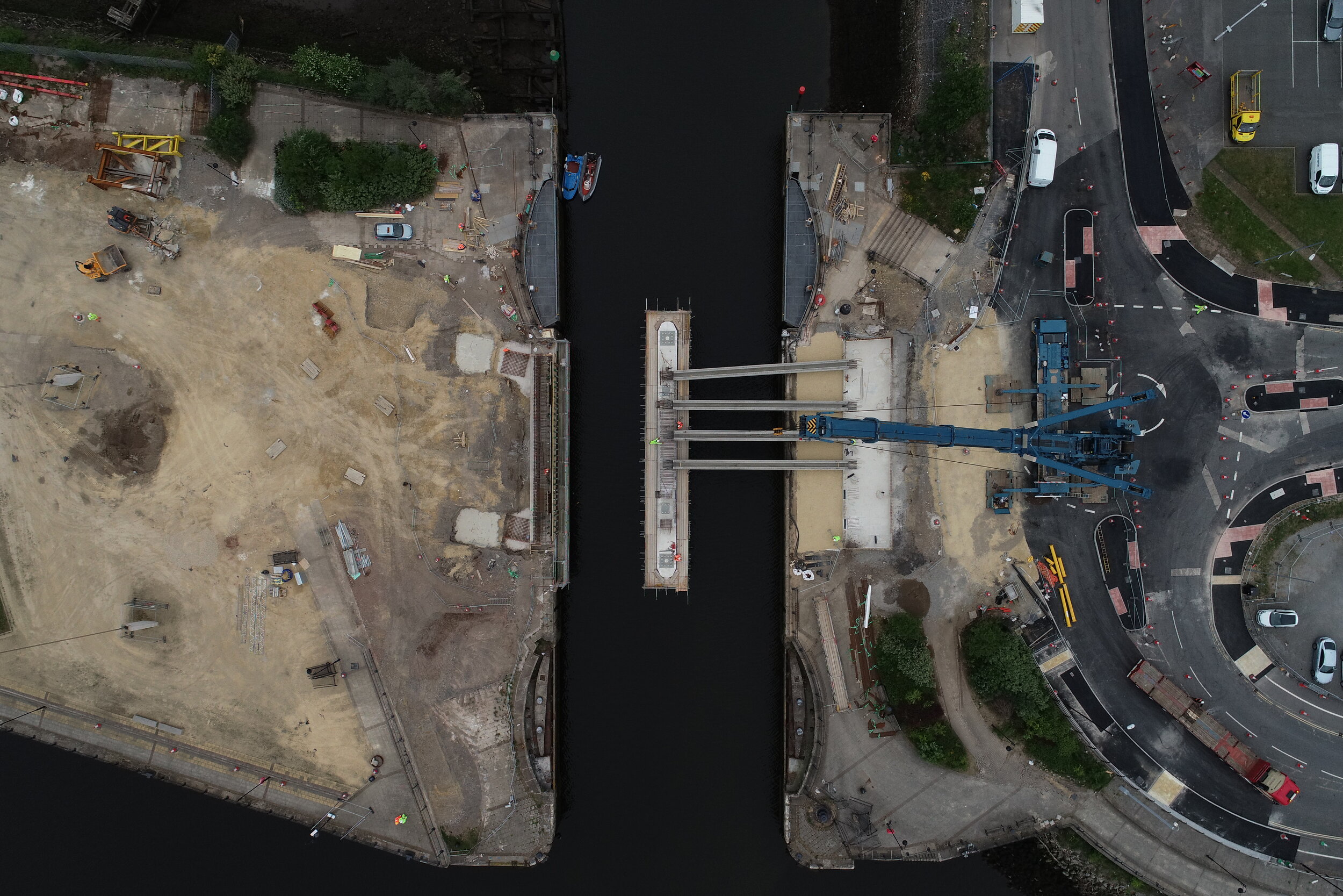
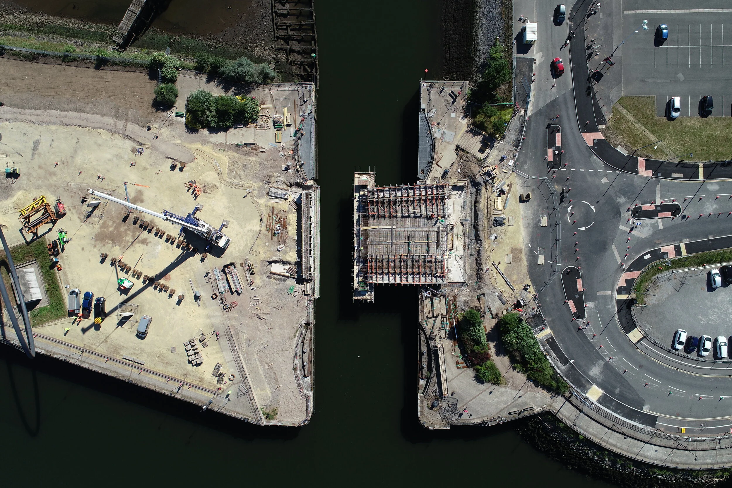
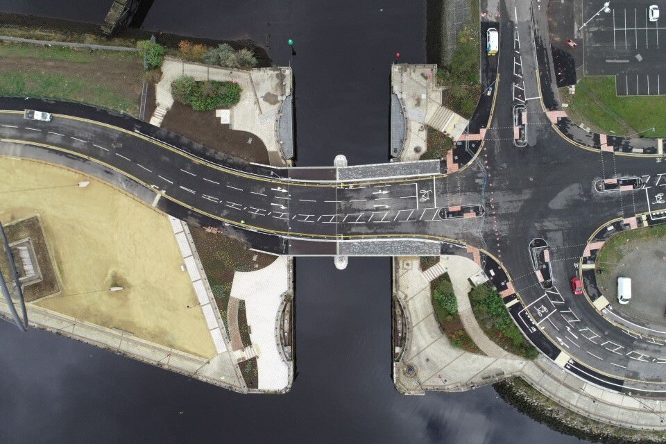
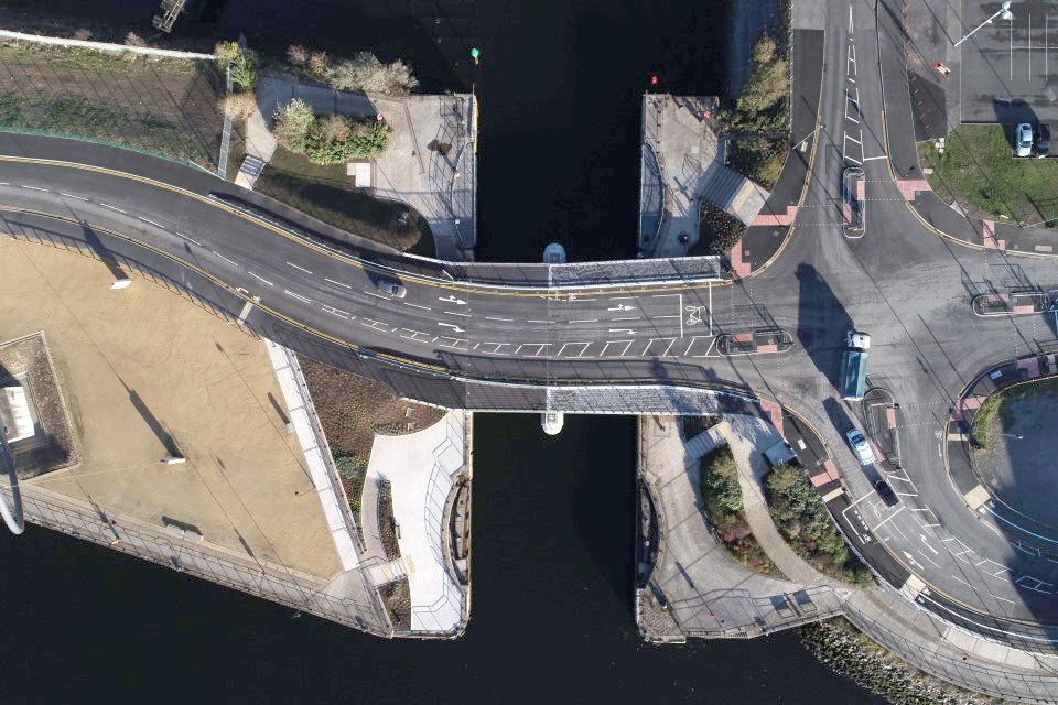
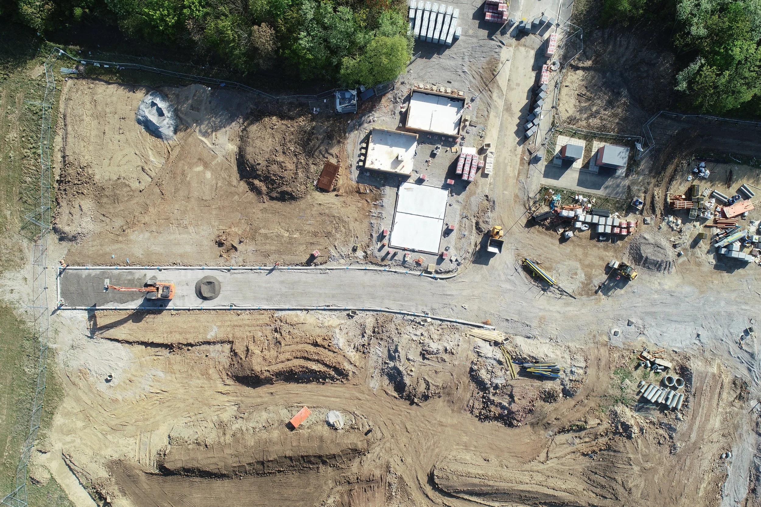
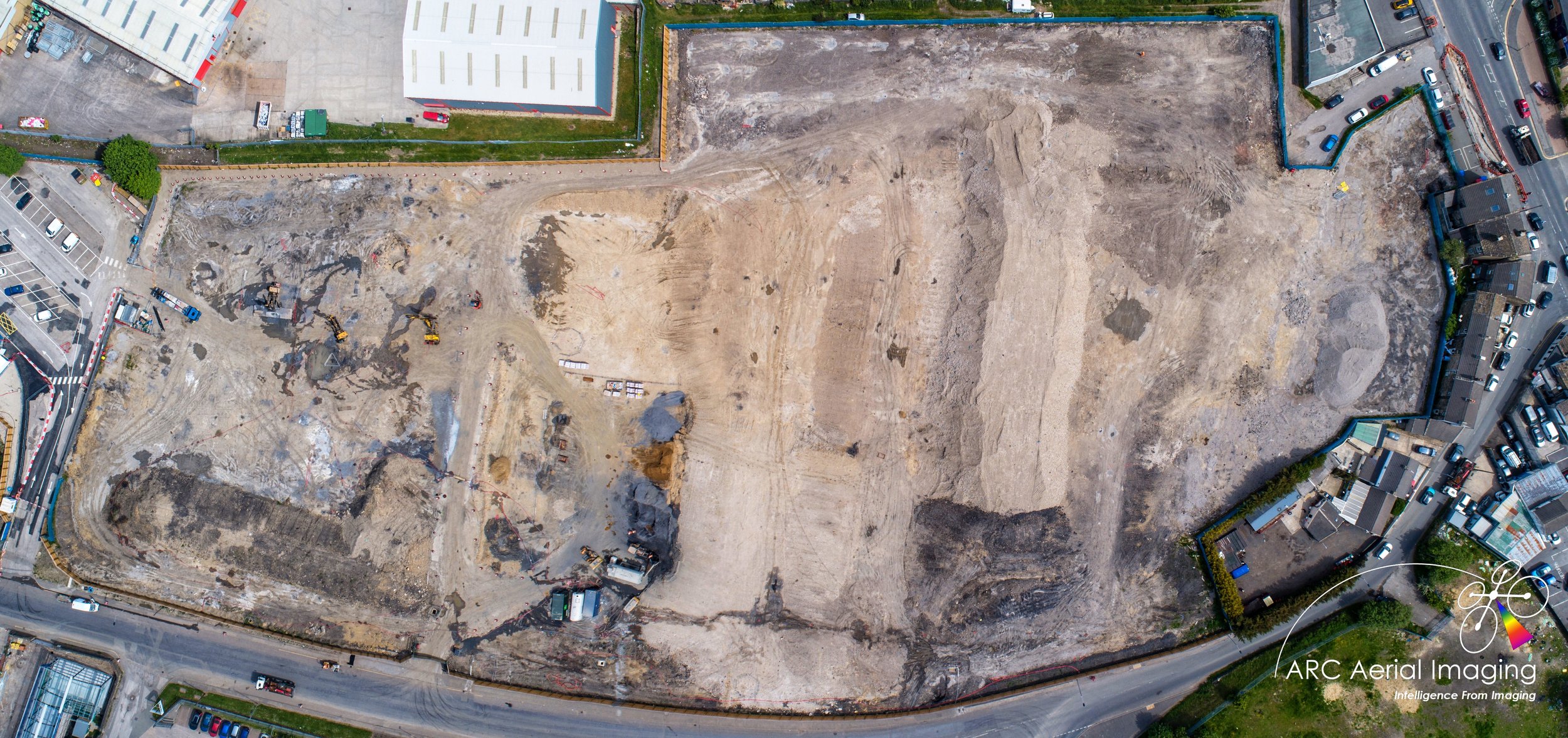
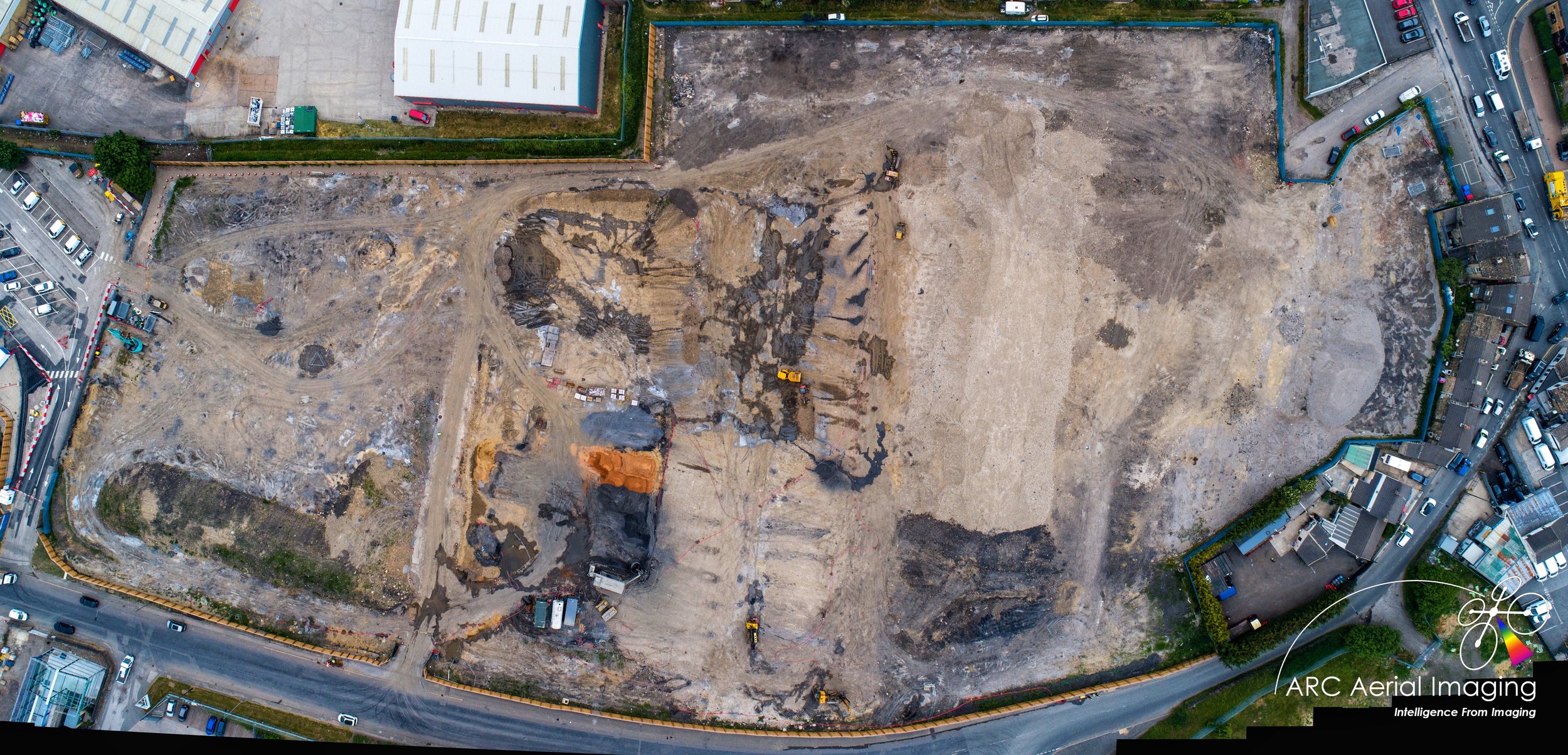
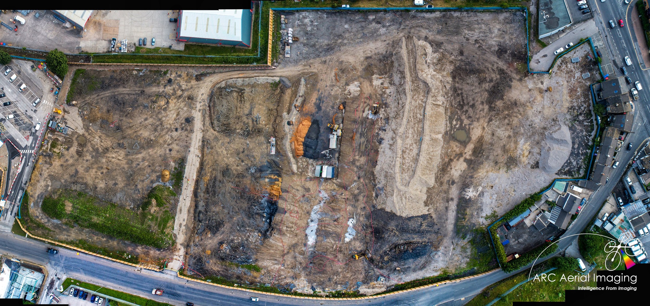
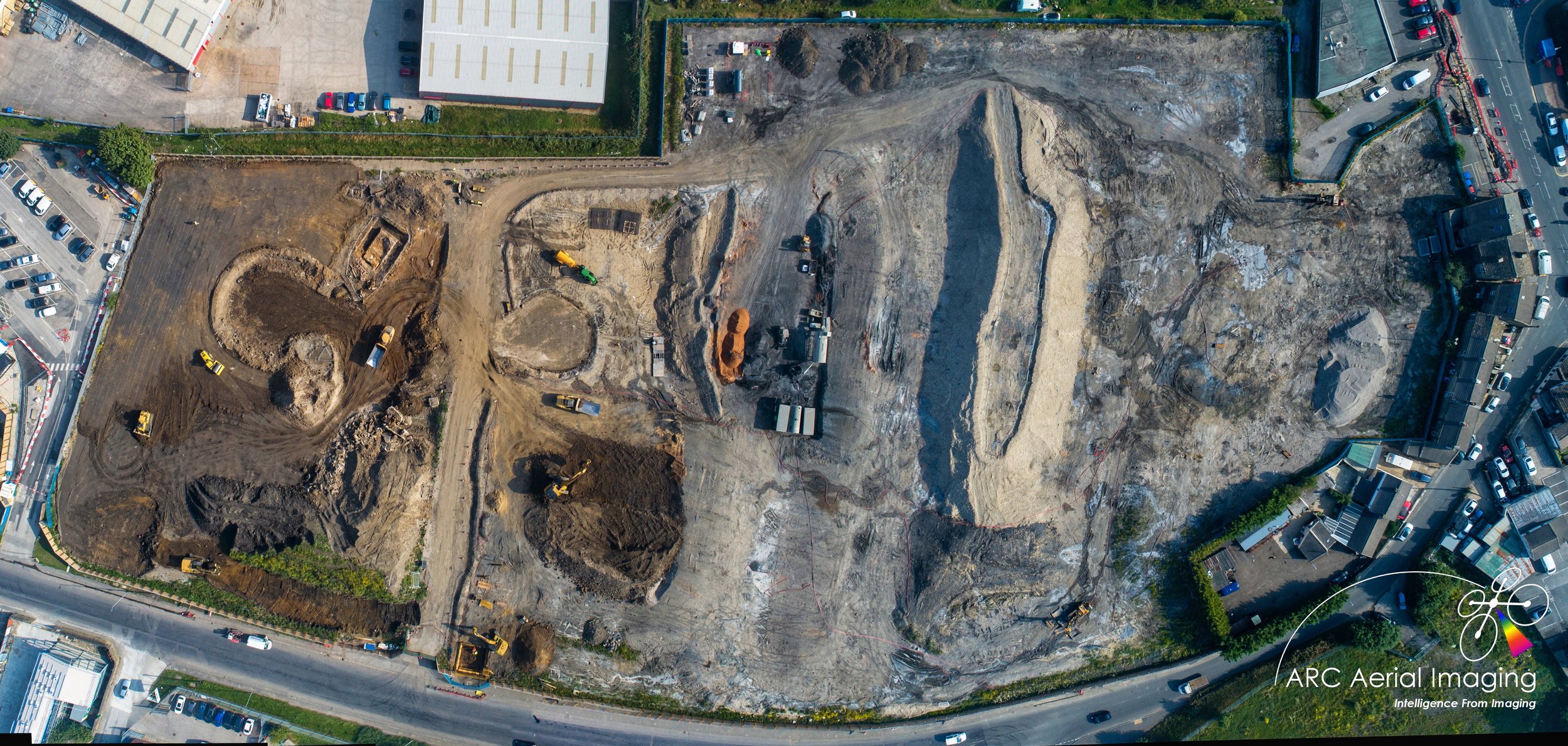
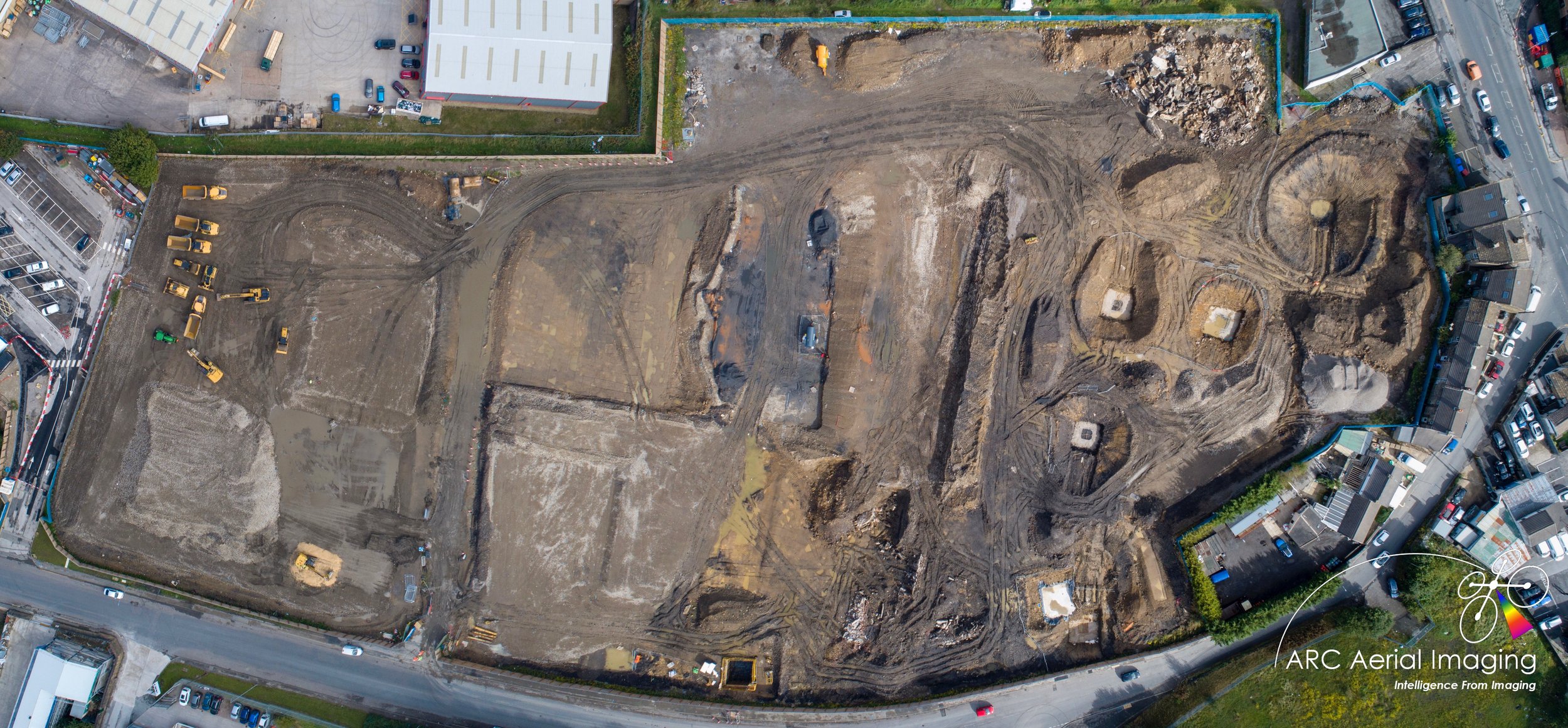
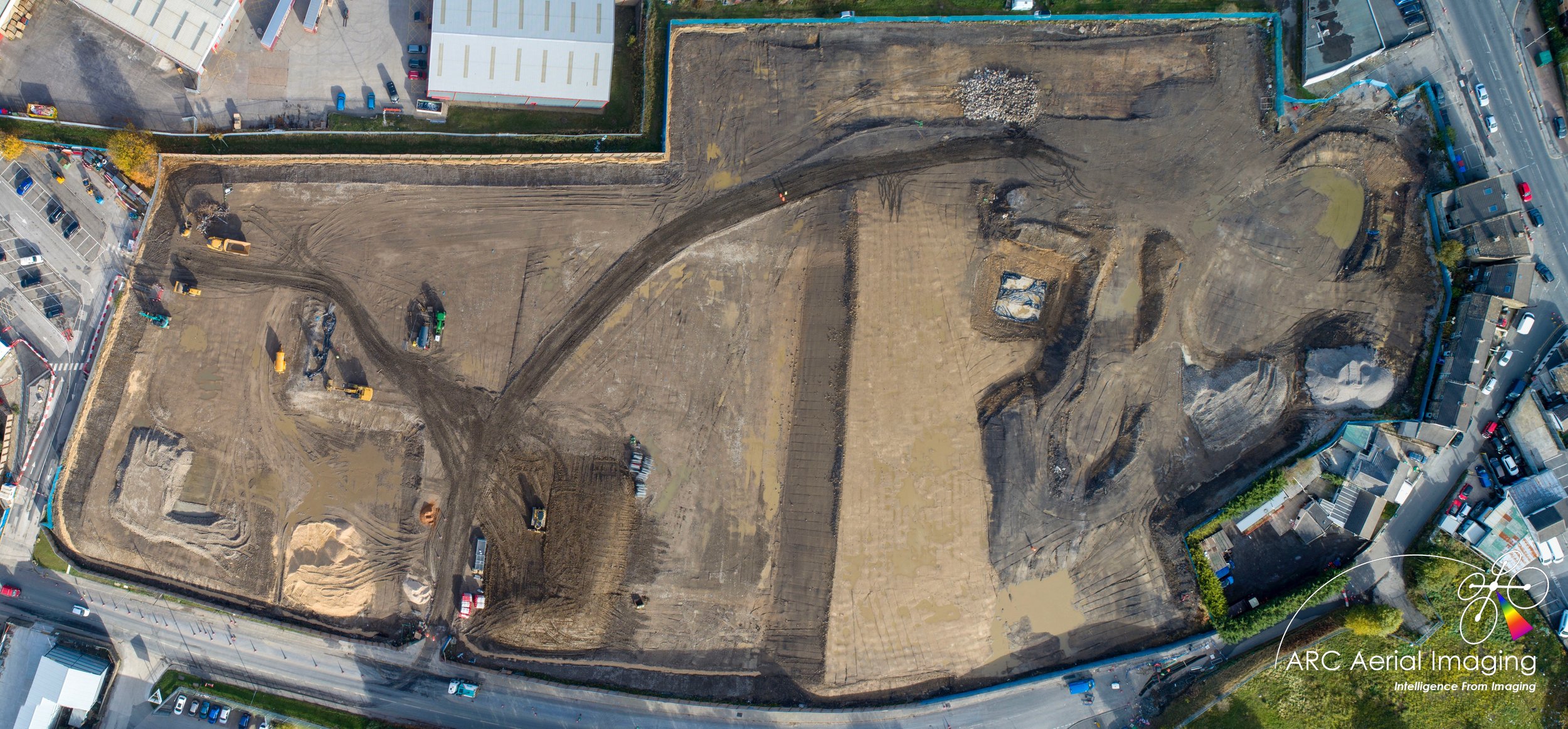
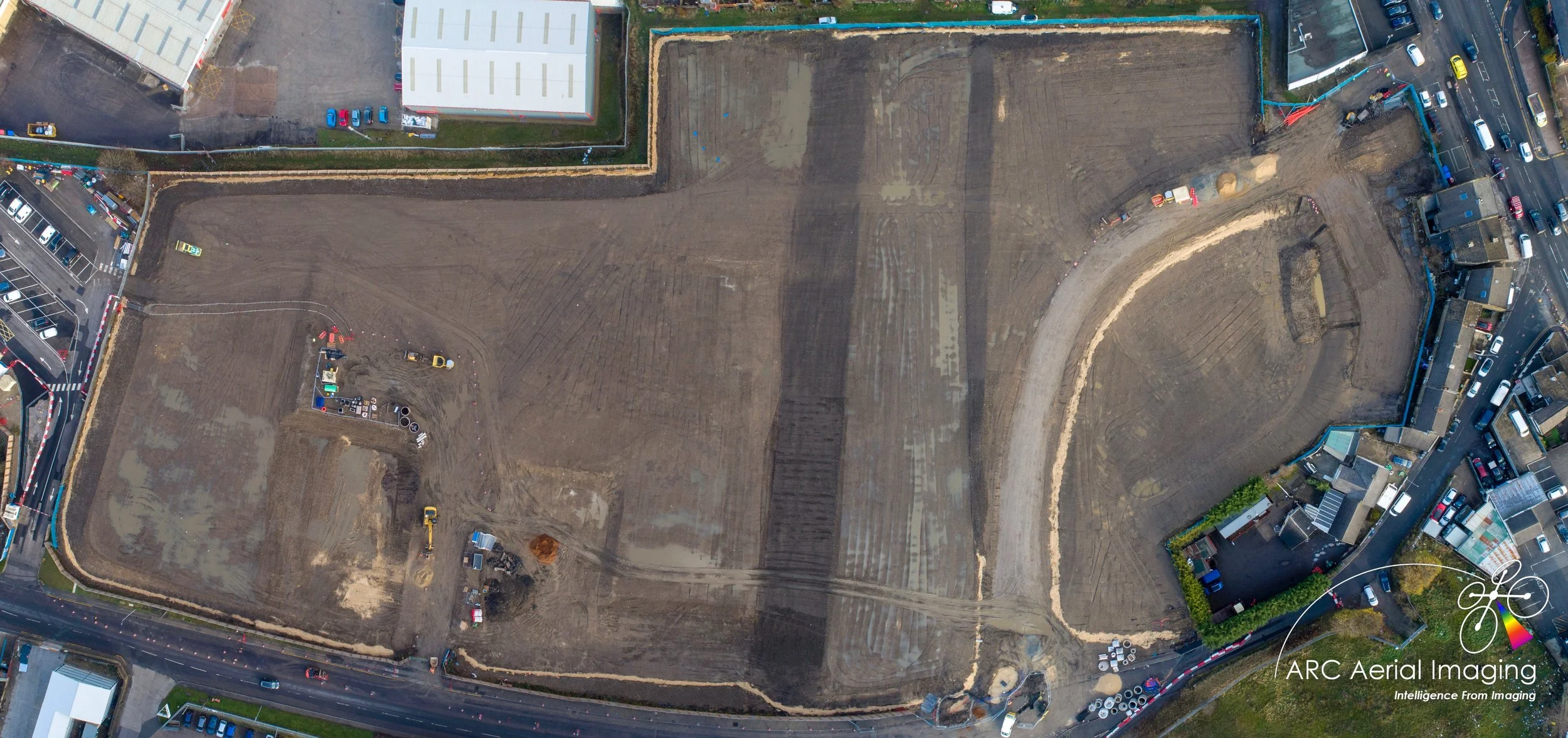
Civil Engineering and Construction Projects
Civil Engineering and Construction Projects
Civil Engineering and Construction Projects
Civil Engineering and Construction Projects
8 Effective Ways That UAVs Can Enhance Construction Projects

Site Surveys and Mapping
Capturing accurate, high-resolution and ortho-corrected geospatial datasets for planning and project developments.
3D Modelling from Photogrammetry
Turning construction sites into measurable and sharable 3D models.
Stockpile Volume Measurments
Calculate materials on-site without the needs for ‘boots on the ground’ to record those measurements.
Progress Tracking
Regular flyovers to document every build phase from above.
preconstruction visuals
Capturing ‘before’ images to aid planning and permits.
Safety and compliance Audits
Remotely inspect sites for potential hazards and regulatory issues.
AS-built verification
Confirmation of final site layouts and utility placements with ease.
Time-lapse documentation
Creating visual timelines of the project from start to completion.
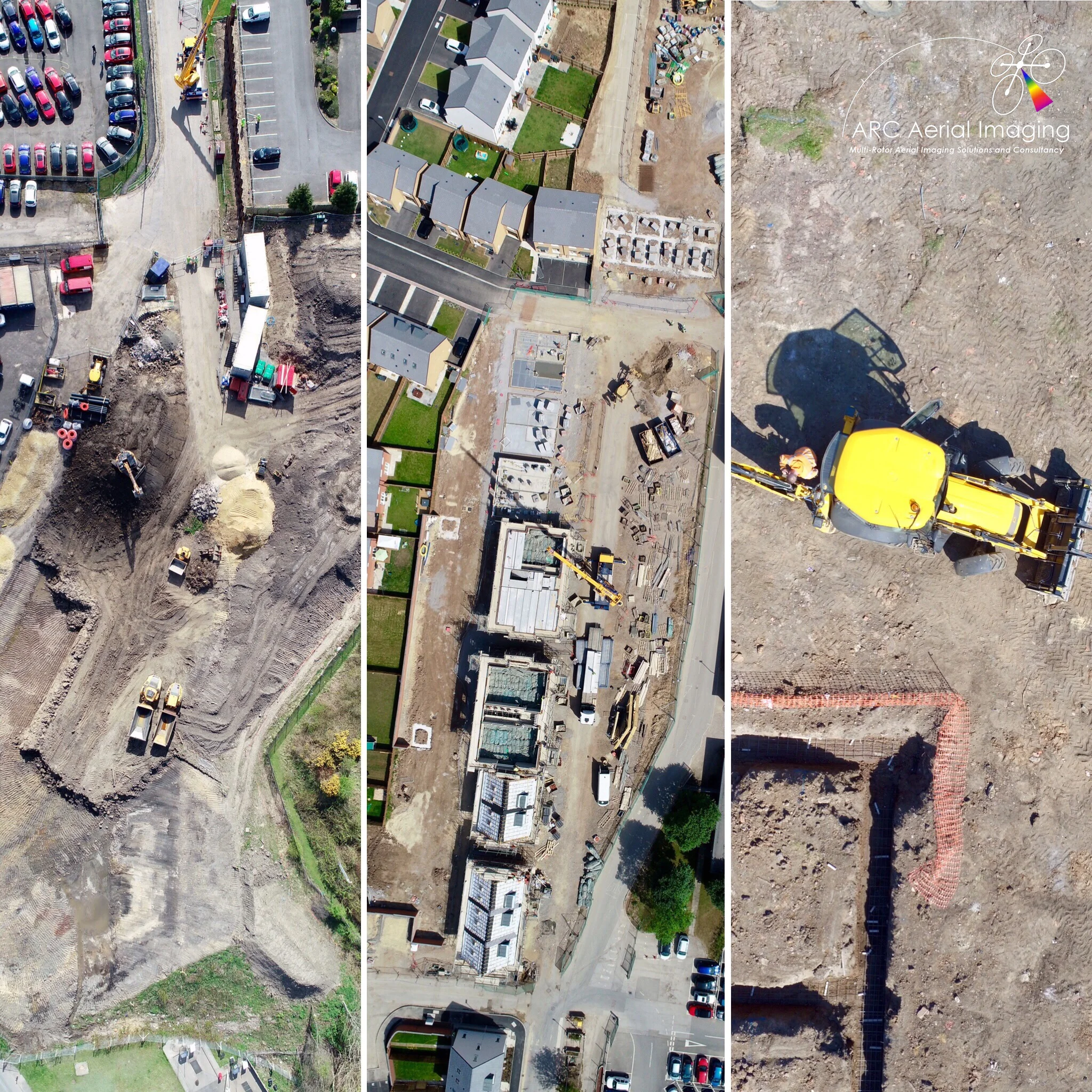
Using drone-derived data in civil construction to track job progress, monitor quality saves you time and money when compared to traditional survey methods.
UAVs can provide time-lapse aerial imaging to project stakeholders involved in the project an enhanced way to appreciate the scale, layout and complexity of large projects from various collection aspects. Additional benefits of multi-rotor aerial imaging include:
ARC Aerial Imaging's multi-rotor UAV platforms are much more flexible than a fixed mast, cheaper and safer than using a helicopter even for large construction projects. The platforms require little space to take off/land and can be prepared relatively quickly before each flight.
A "live" video downlink feed from an attached monitor or tablet capability for the benefit of onsite consultation with the project and construction site managers for imagery acquisitions.
On board cameras can be instantaneously switched from stills to video and vice-versa both on the ground and whilst airborne enabling to capturing of more and varied aerial content of the project.

Many UAV uses in construction fall under the broad header of project support. That includes construction progress reporting, providing images for documentation and monitoring safety. Overall, our UAVs can help with scheduling, communication, and improving accuracy on all types of project functions.
For mapping and surveying of sites, our UAVs can also fly at low level, serpentine flights over projects by often recording hundreds of images in the process. Our photogrammetry software can be used to stitch/mosaic together the images creating a single, large image of a site for those project communication purposes.
Furthermore and by collecting regular aerial stills and video from the same captured angles via automated way-pointing flight protocols, construction companies can obtain a comprehensive time-lapse aerial portfolio including immersive 360 degree panoramas of sites documenting how their projects are progressing from static aerial aspects and viewpoints for additional stakeholder updates.


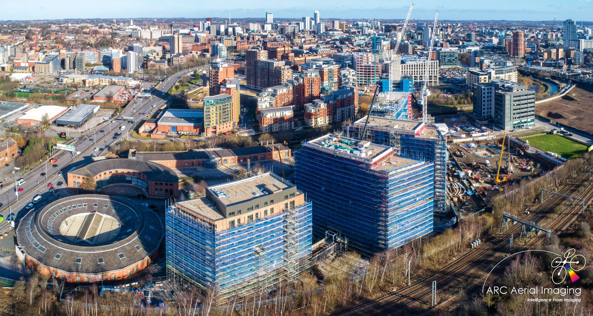
We’ve provided and continue to deliver UAV aerial imaging support for these entities and on their significant civil engineering and award-winning construction projects…

Precision Point Positioning
Precision Point Positioning
Precision Point Positioning
Precision Point Positioning
ACCURATE POSITIONAL INFORMATION
TO PROVIDE ACCURATE UAV GEOSPATIAL DATASETS.
It's GPS, but not as you know it…

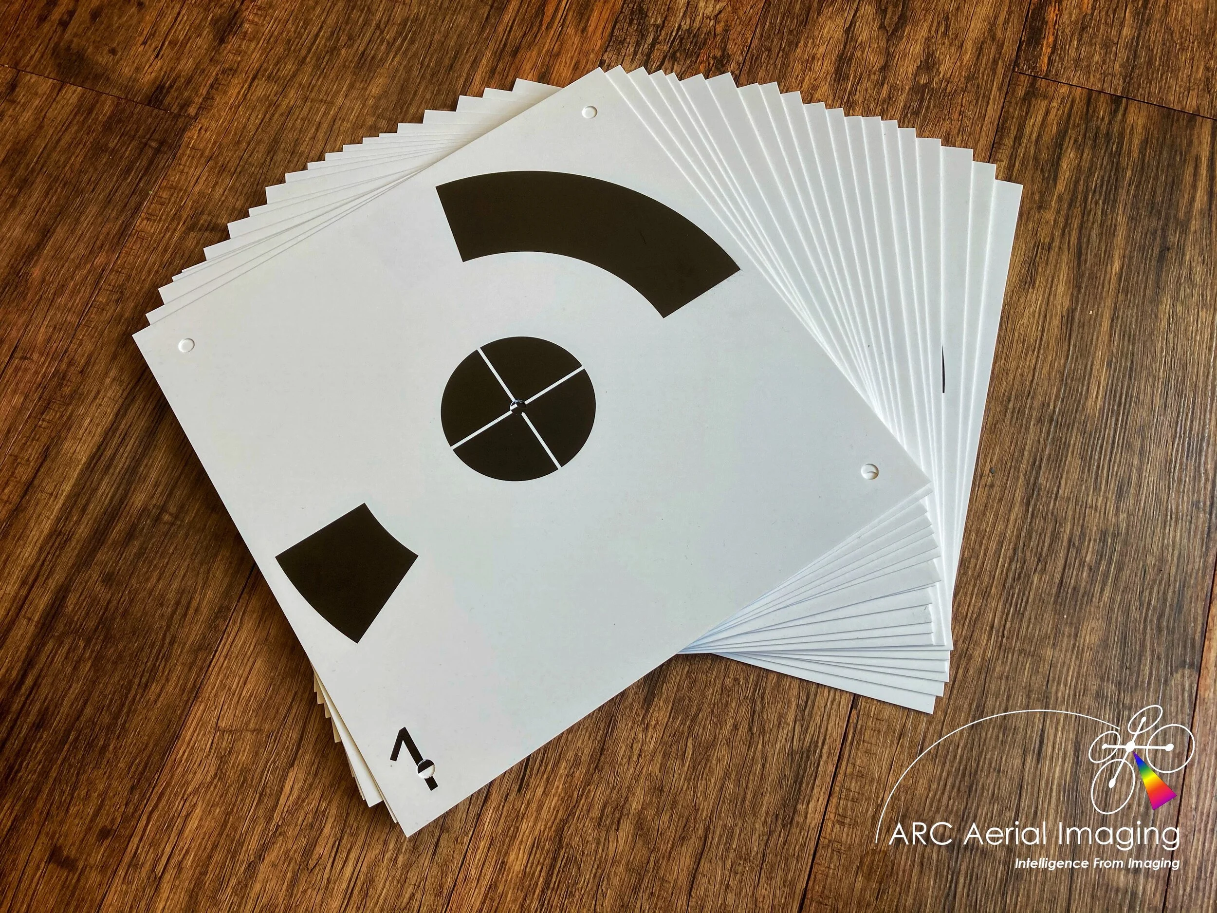
Accredited by an approved training provider, ARC Aerial Imaging can provide accurate point positioning gathering via its Trimble Catalyst networked RTK GNSS.
This professional-grade positioning system is utilised for the recording of 1cm-2cm accurate location data in so that we can acquire highly-precise 3D ground positional information, namely Ground Control Points (GCPs), to accurately align our UAV-acquired aerial imaging within photogrammetry software to produce and provide client-stipulated survey-grade geospatial outputs.
The Trimble Catalyst is the ideal tool towards our efficient and streamlined UAV mapping and surveying workflows.

Multispectral Aerial Imaging
Multispectral Aerial Imaging
Multispectral Aerial Imaging
Multispectral Aerial Imaging
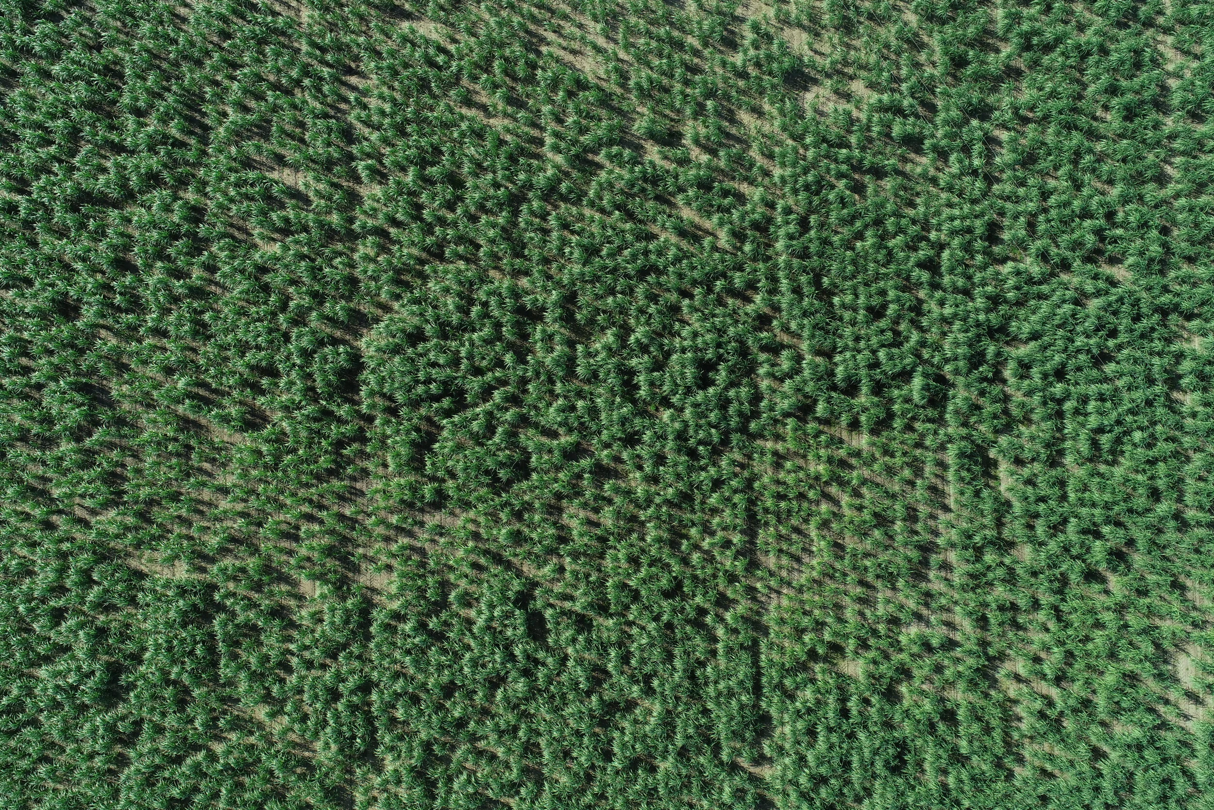
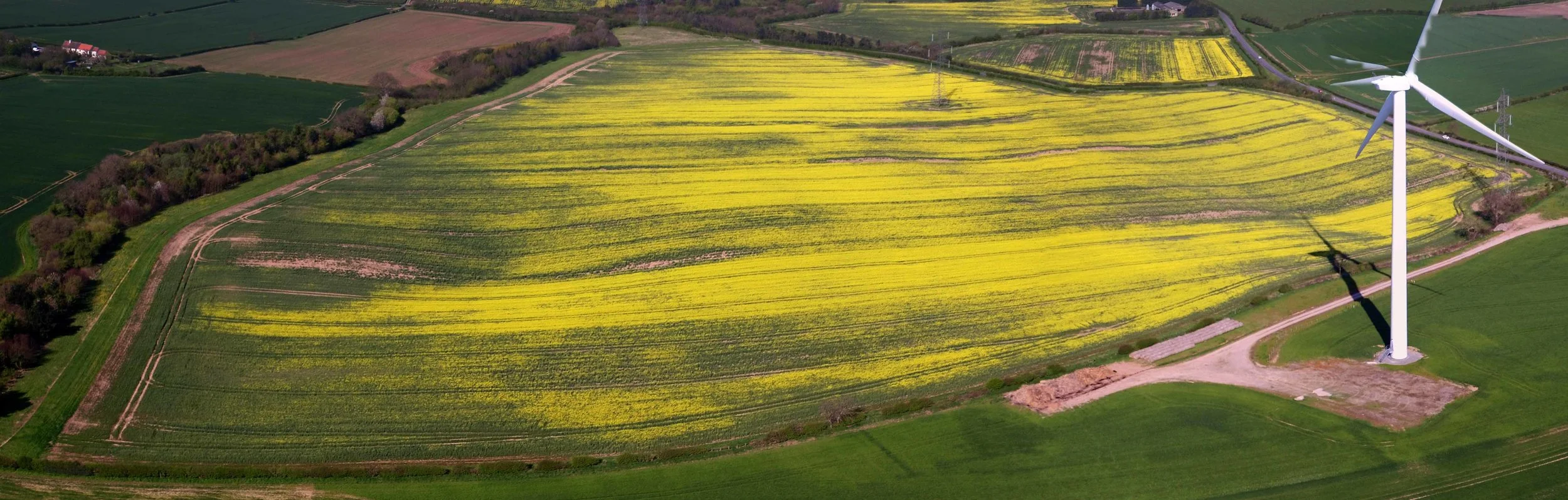
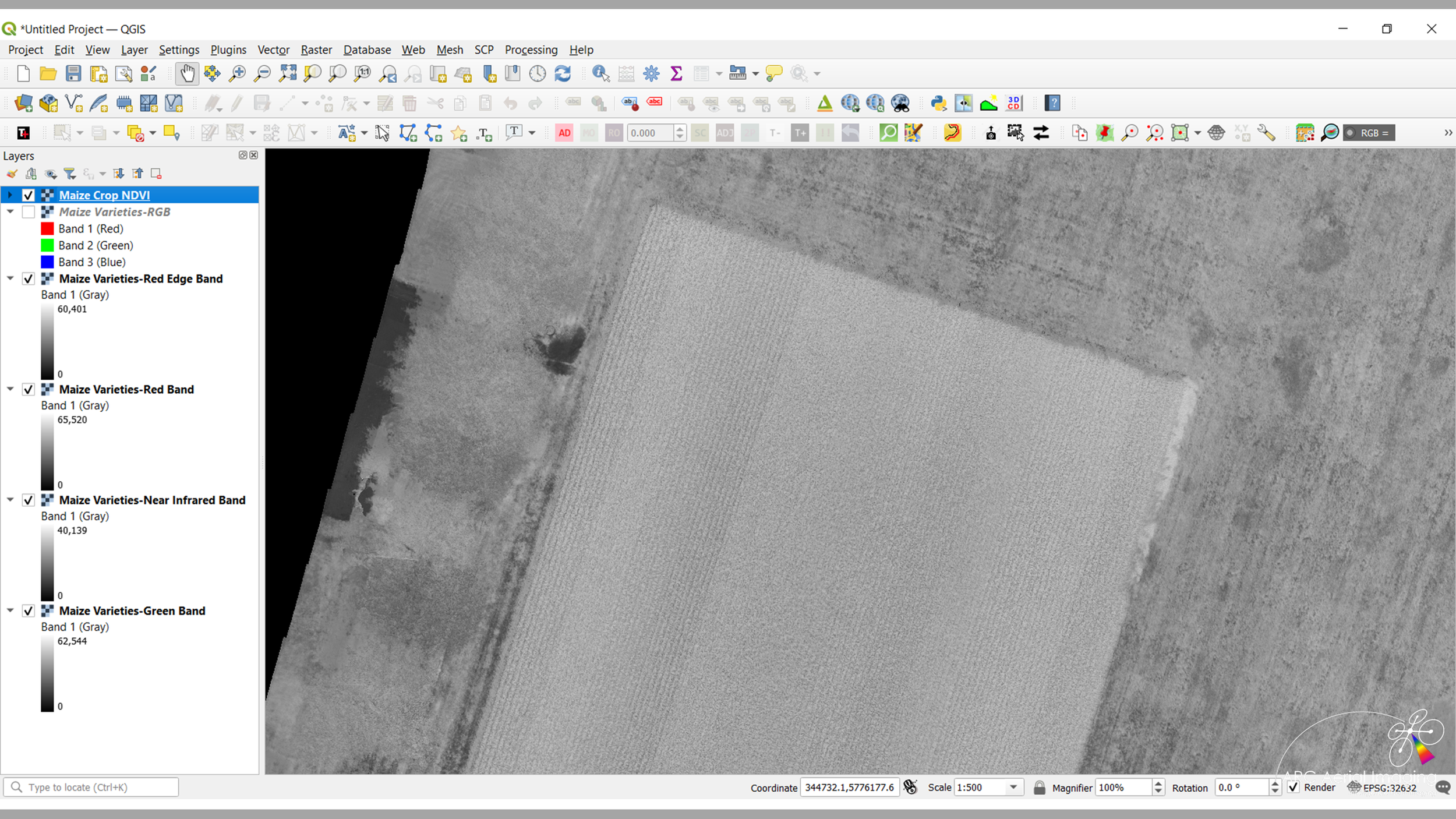
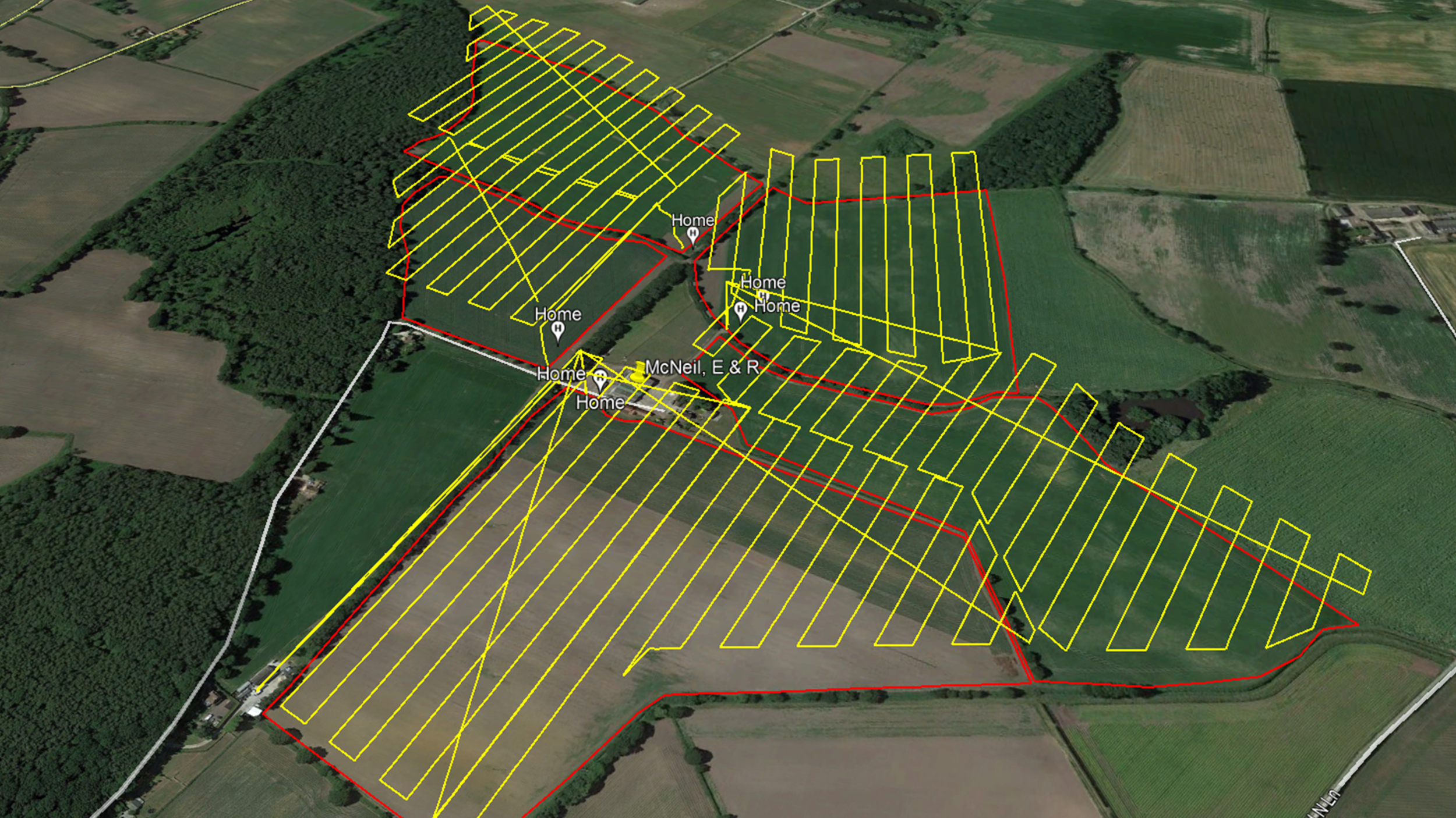
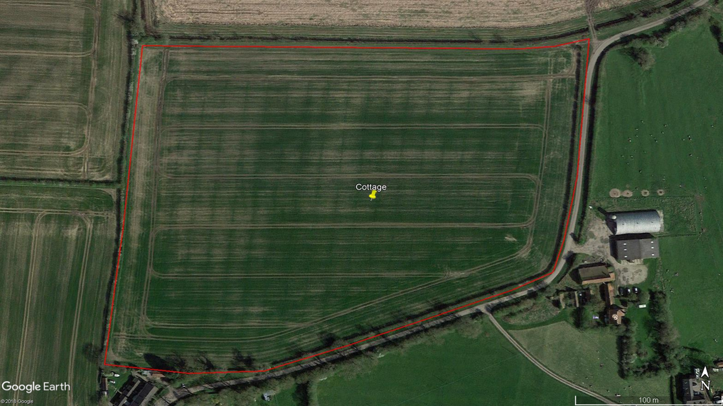
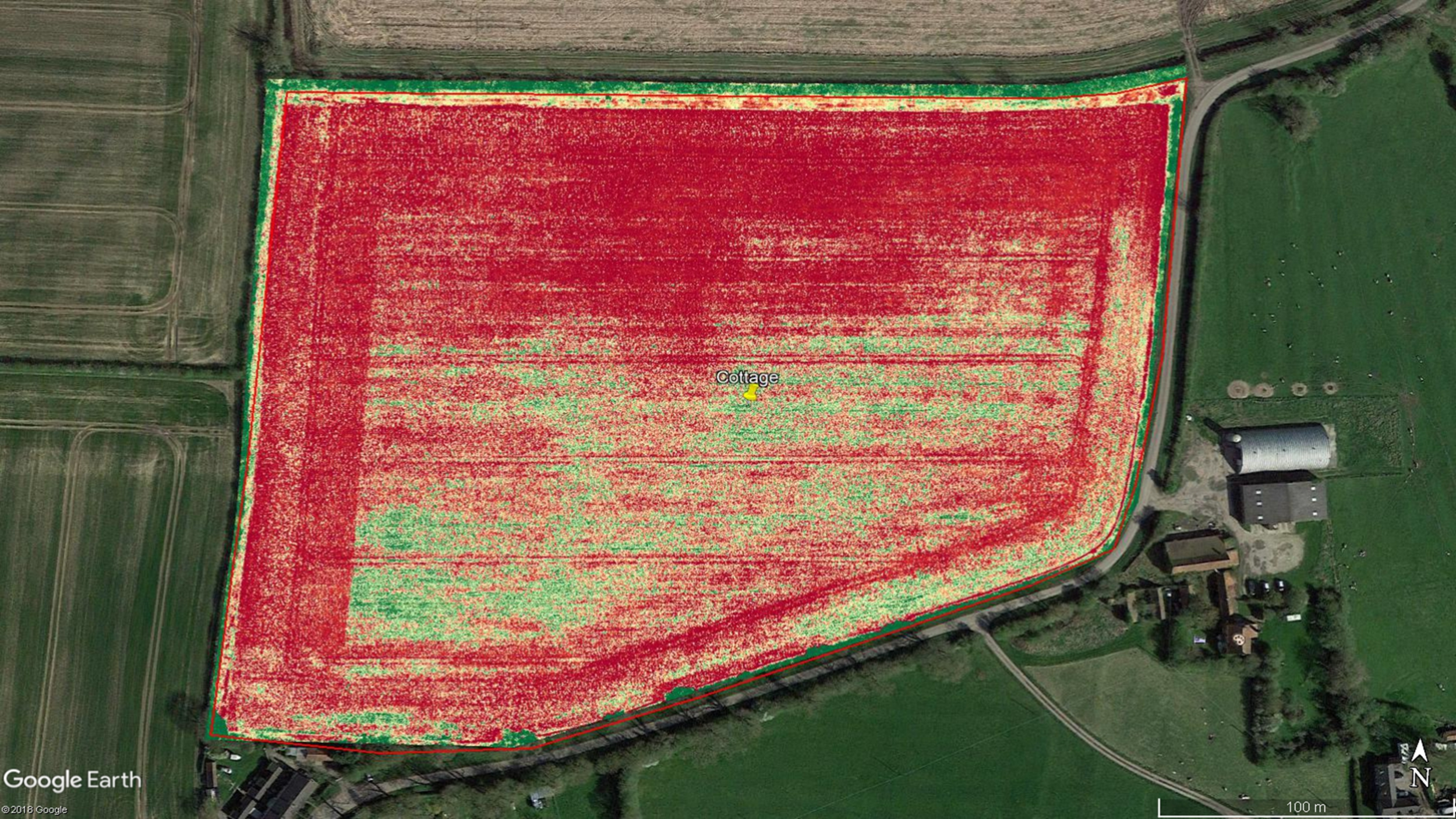
DRONE-BASED MAPPING FOR AGRICULTURE
AUGMENTING AGRONOMY, ASSISTING TO DETECT POTENTIAL ISSUES, MINIMISING COSTS!
With our ability to collect and analyse drone aerial imaging data, our comprehensive specialist services could augment and enhance the services of agricultural subject matter experts such as agronomists who may wish to take the advantage to identify potential crop growing problems promptly. This can be whilst reviewing live imaging on site and/or also through onward processed technical imaging data to be included into their assessments whilst making actionable decisions more promptly.
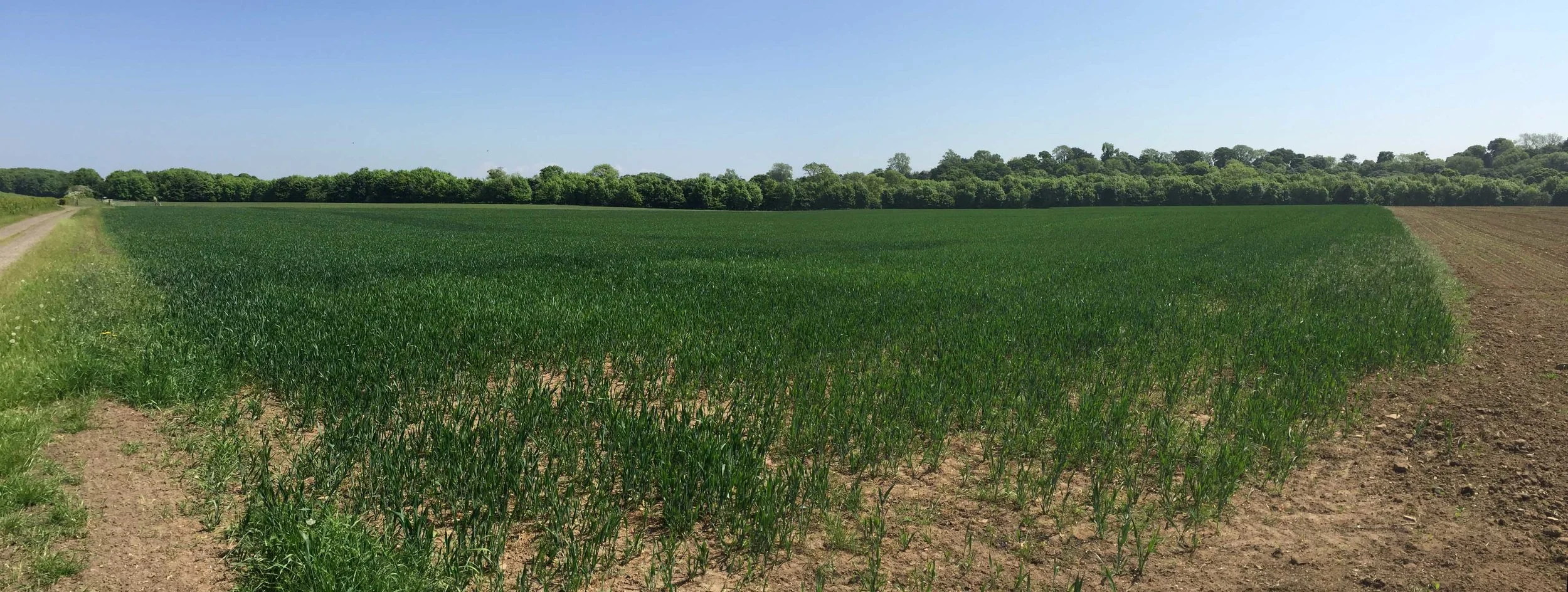
Initially assessing a crop condition can be both difficult to ascertain and time-consuming from the ground...
... yet through the use of aerial imaging, assessing continued crop growth conditions and to detect any potential problems can be timely ascertained from the air.
How precision multispectral drone aerial imaging can assist agriculture...
This process of collecting aerial imagery can be further repeated by applying the same autonomous flight protocols in so that, for example, periodic environmental monitoring can be continually conducted.
Prompt decisions can be crucial as it can potentially save a whole crop landholding from being affected by unhealthy sub-areas. In addition, and as soon as a potential issue is detected, a more precise or tailored crop and landholding remedy can be applied and then be further monitored.
🌱 𝗢𝗽𝘁𝗶𝗺𝗶𝘀𝗶𝗻𝗴 𝗖𝗿𝗼𝗽 𝗠𝗮𝗻𝗮𝗴𝗲𝗺𝗲𝗻𝘁
Drones can capture high-resolution imagery, enabling farmers to monitor crop health, detect issues, and make informed decisions about irrigation, fertilisation, and pest control.
🌾 𝗜𝗻𝗰𝗿𝗲𝗮𝘀𝗲𝗱 𝗬𝗶𝗲𝗹𝗱𝘀
Drone technology enables farmers to improve crop health and resource management, leading to higher yields and increased profitability.
💧 𝗪𝗮𝘁𝗲𝗿 𝗖𝗼𝗻𝘀𝗲𝗿𝘃𝗮𝘁𝗶𝗼𝗻
Drones can assist with irrigation management, providing data on water distribution and crop water needs, helping farmers conserve water and reduce costs.
🌎 𝗘𝗻𝘃𝗶𝗿𝗼𝗻𝗺𝗲𝗻𝘁𝗮𝗹 𝗦𝘂𝘀𝘁𝗮𝗶𝗻𝗮𝗯𝗶𝗹𝗶𝘁𝘆
By promoting targeted pesticide application and optimising resource use, drones contribute to more sustainable agricultural practices, reducing the industry’s environmental impact.
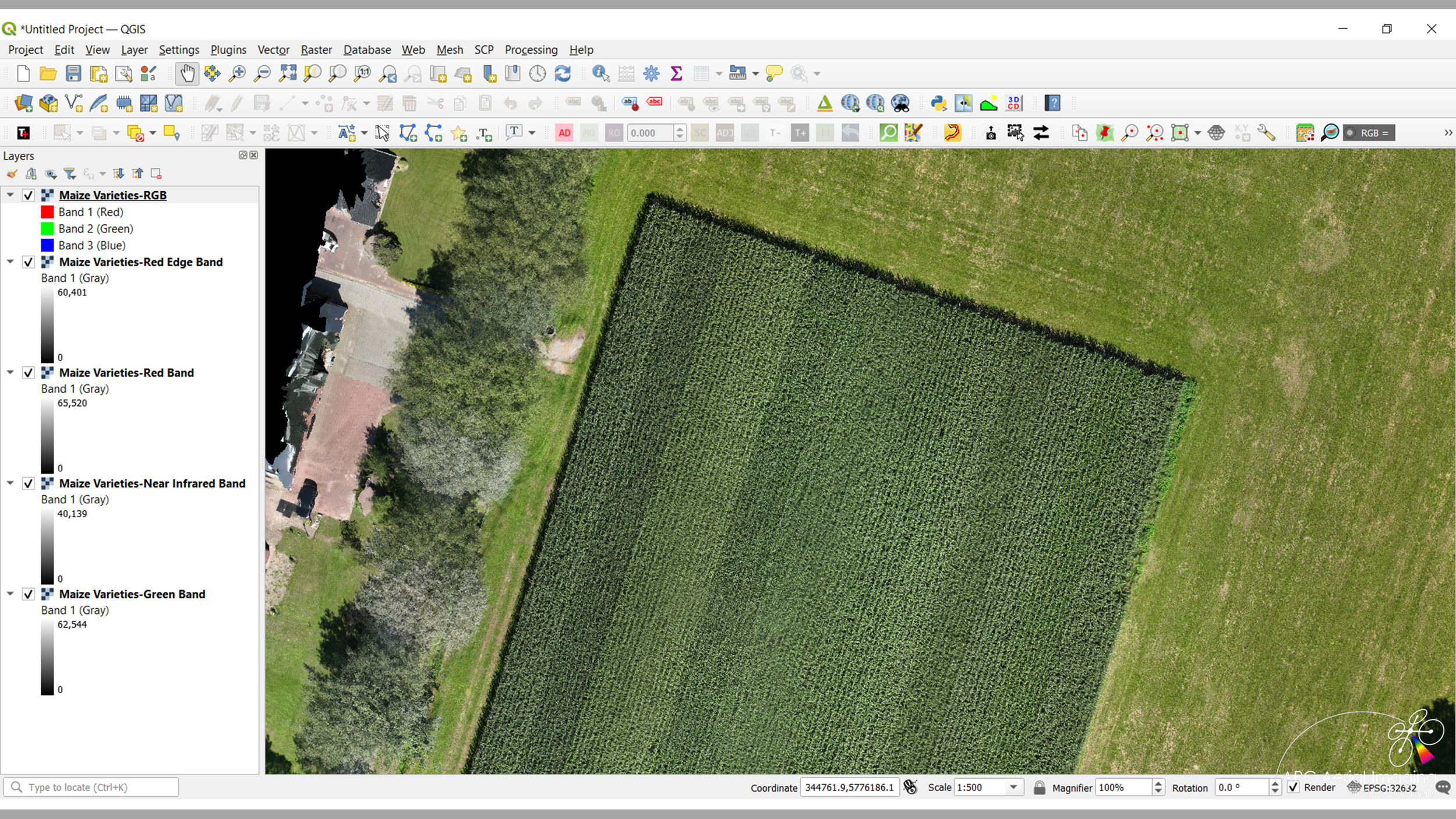
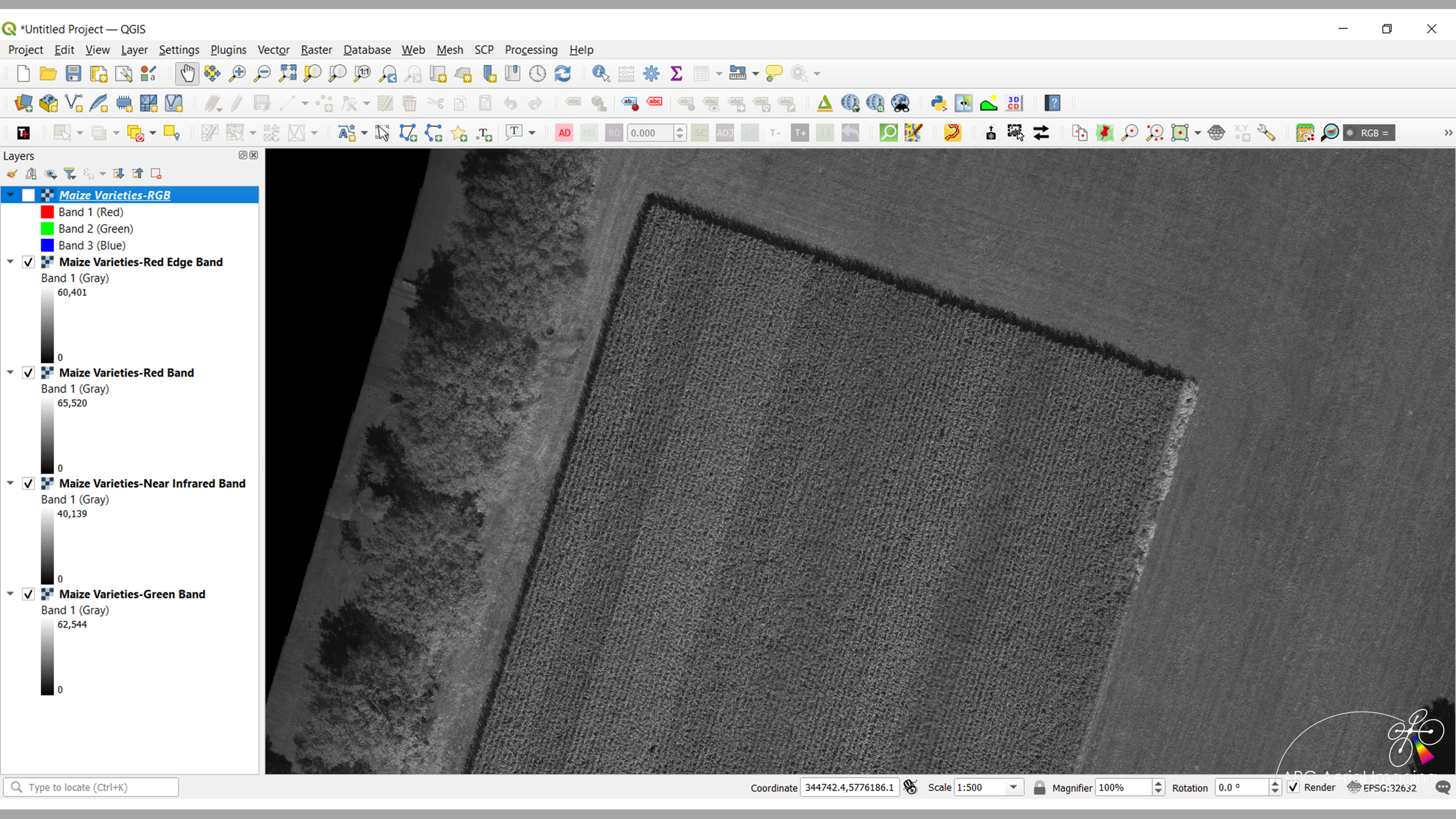

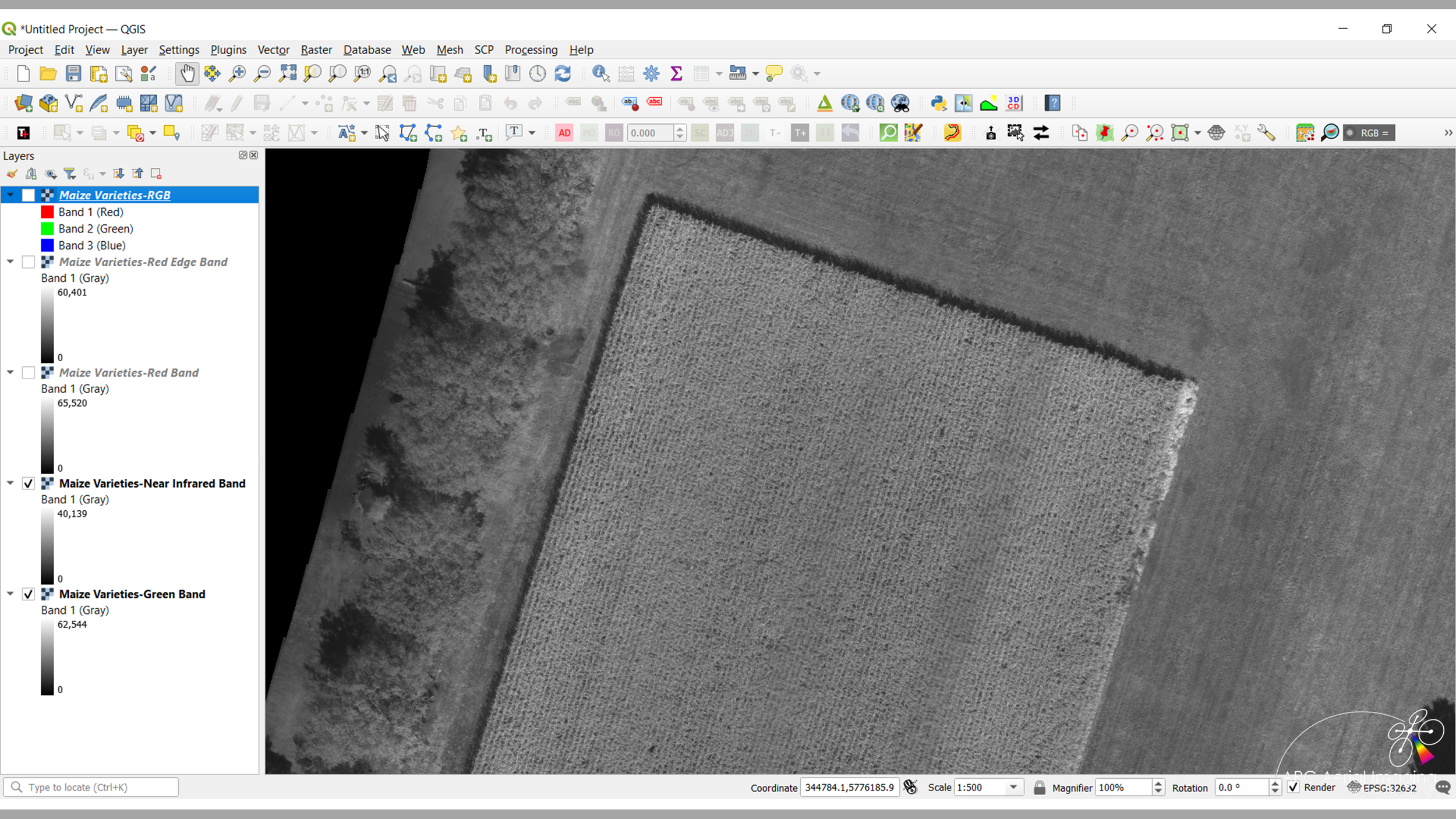
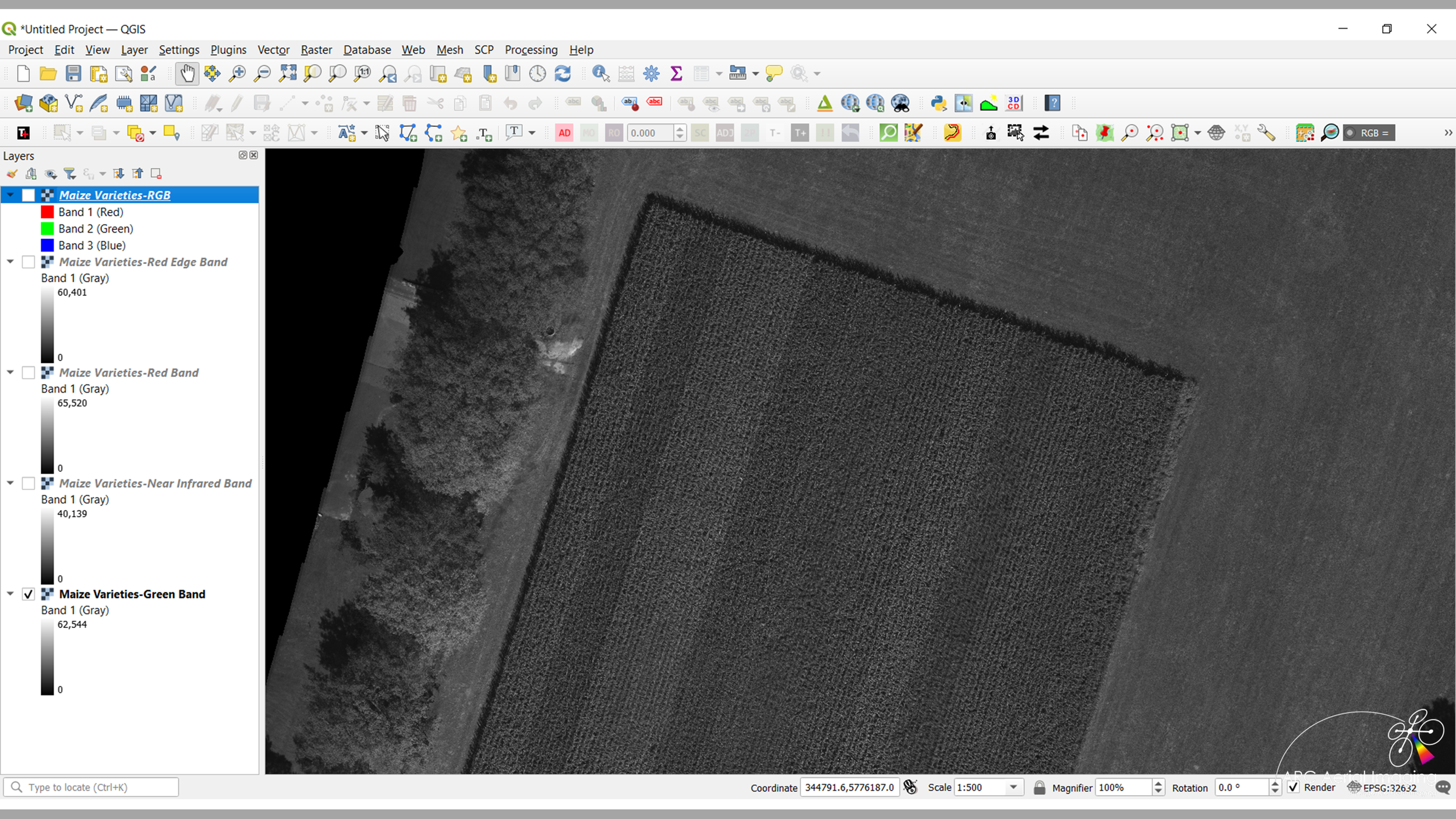

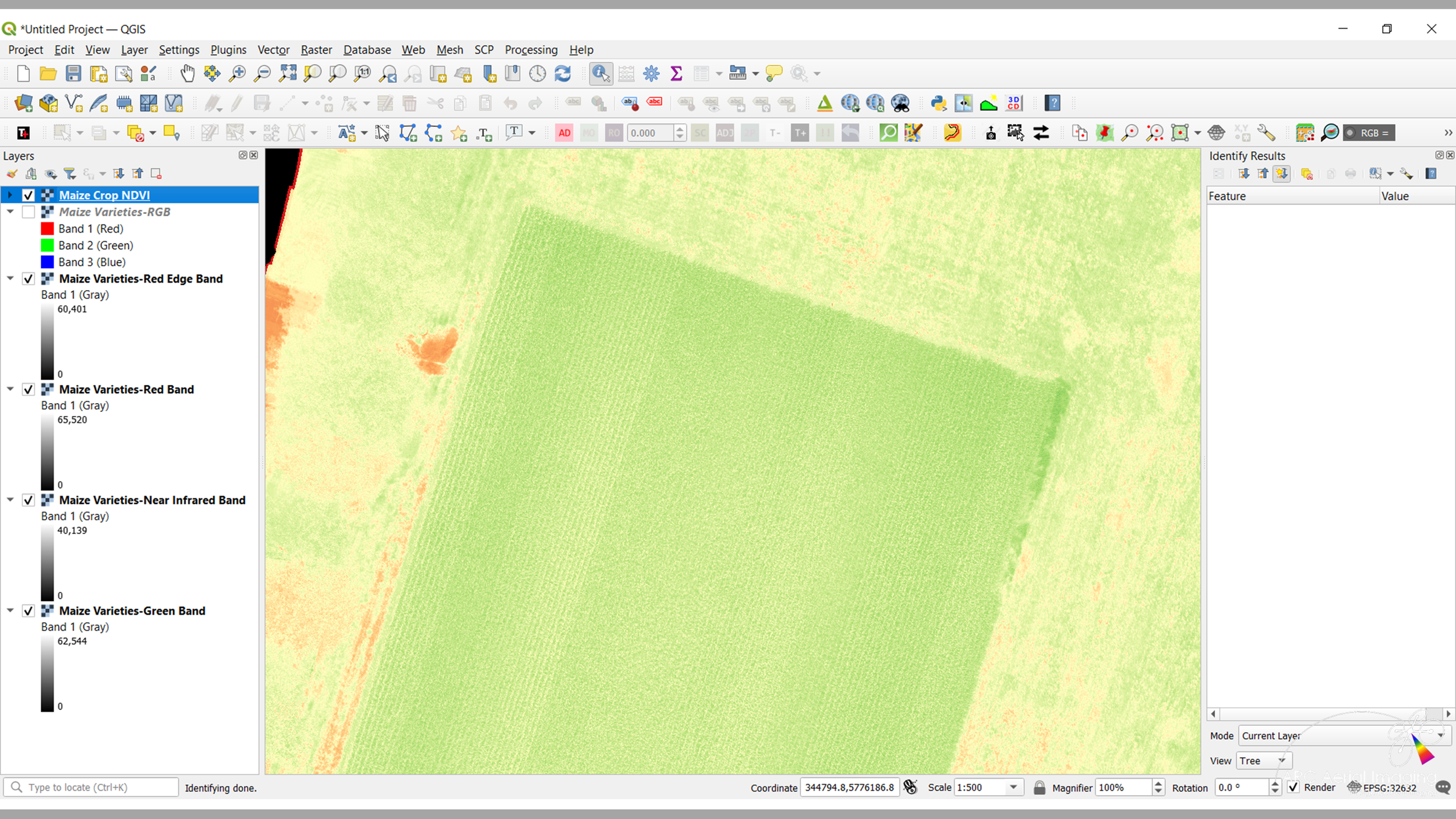
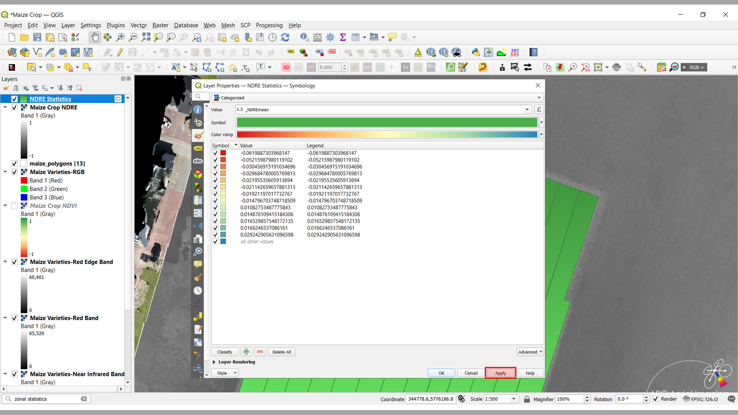
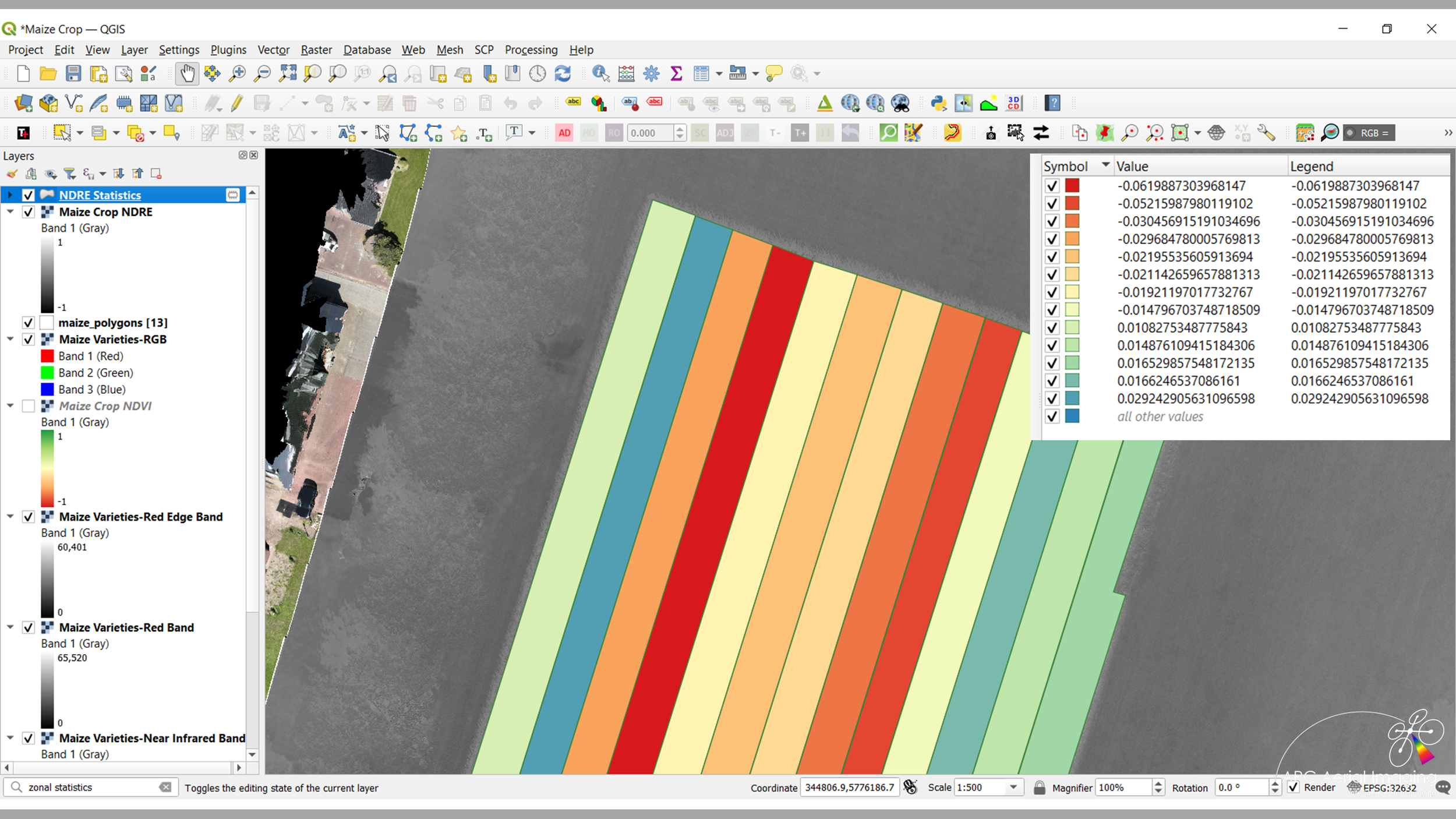
Our aerial imaging can be carefully planned and collected at specific RGB and MS resolutions (GSD), managed and disseminated to those entities for their Artificial Intelligence (AI)-based and algorithmic analysis studies or growth trends, plant and size counts, generate prescription maps, identify early indicators of plant stress through various vegetation indices and measure the zonal efficiencies of crop landholdings.


We're a recognised provider of UAV-acquired aerial imaging for agriculture.
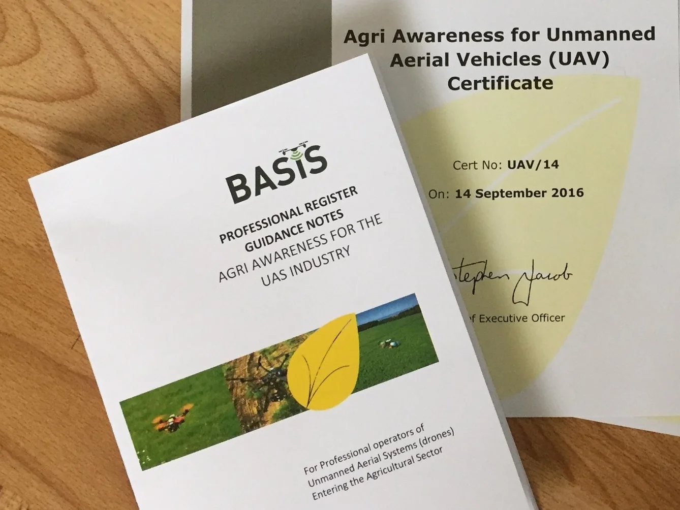
In September 2016, ARC Aerial Imaging attended the 'BASIS Agricultural Awareness Training for UAS Operators Course' at Harper Adams University.
The course served as an introduction into the basic aspects of the agricultural sector and is designed for professional operators of UAVs/drones like ARC Aerial Imaging in providing them with a fundamental level of understanding and knowledge appropriate for their work within the agricultural industry and supply chain.
Initial Elevated Inspections
Initial Elevated Inspections
Initial Elevated Inspections
Initial Elevated Inspections
ACCESSING THE UNACCESSIBLE.
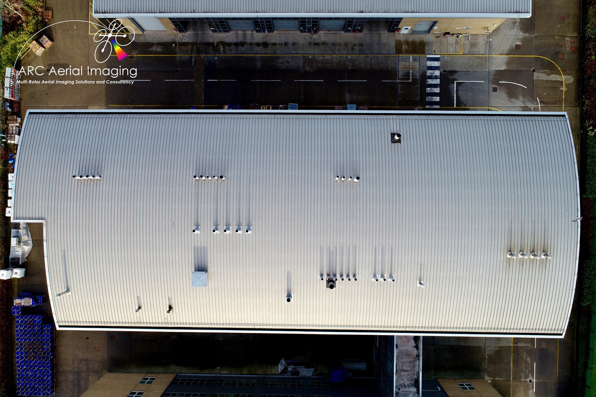
As part of our comprehensive UAV aerial imaging services, we can access the unaccessible and are able to provide an unrestricted amount of high resolution/highly detailed aerial imagery and a variety of analytical and visual products with informed and actionable information that can be incorporated into your structural inspection reporting methods.
Our powerful UAV-mounted imaging sensing can directly access difficult locations resulting in an improvement not only to safety for inspection-related undertakings but also to the speed of information gathering and the dissemination of this data to the client is rapid.


What level of initial structural survey and inspection information detail do you require?
With broader aerial imaging options for key infrastructure inspections and surveys that can be captured at various focal lengths between or specific imagery resolutions and their scaled-for imaging outputs, ARC Aerial Imaging has an impressive inventory of powerful sensing equipment in its inventory.
Its UAVs and services have proved capable by providing valuable aerial imaging imaging and data effectively, efficiently and safely to its clients.


Real time inspection feed.
Through the use of a deployed tripod-mounted field monitor, ARC Aerial Imaging can produce a live feed of your assets and critical asset infrastructure for the benefit to either a member of the facilities management or processing engineering team whilst an inspection is being carried out.
So, obtaining survey data (images) is far safer and the enhanced quality of such imaging information means that inspection, repair or maintenance teams can directly pinpoint issues, saving time and money instead of allocating initial inspection resources (scaffolding, MEWPs, etc).

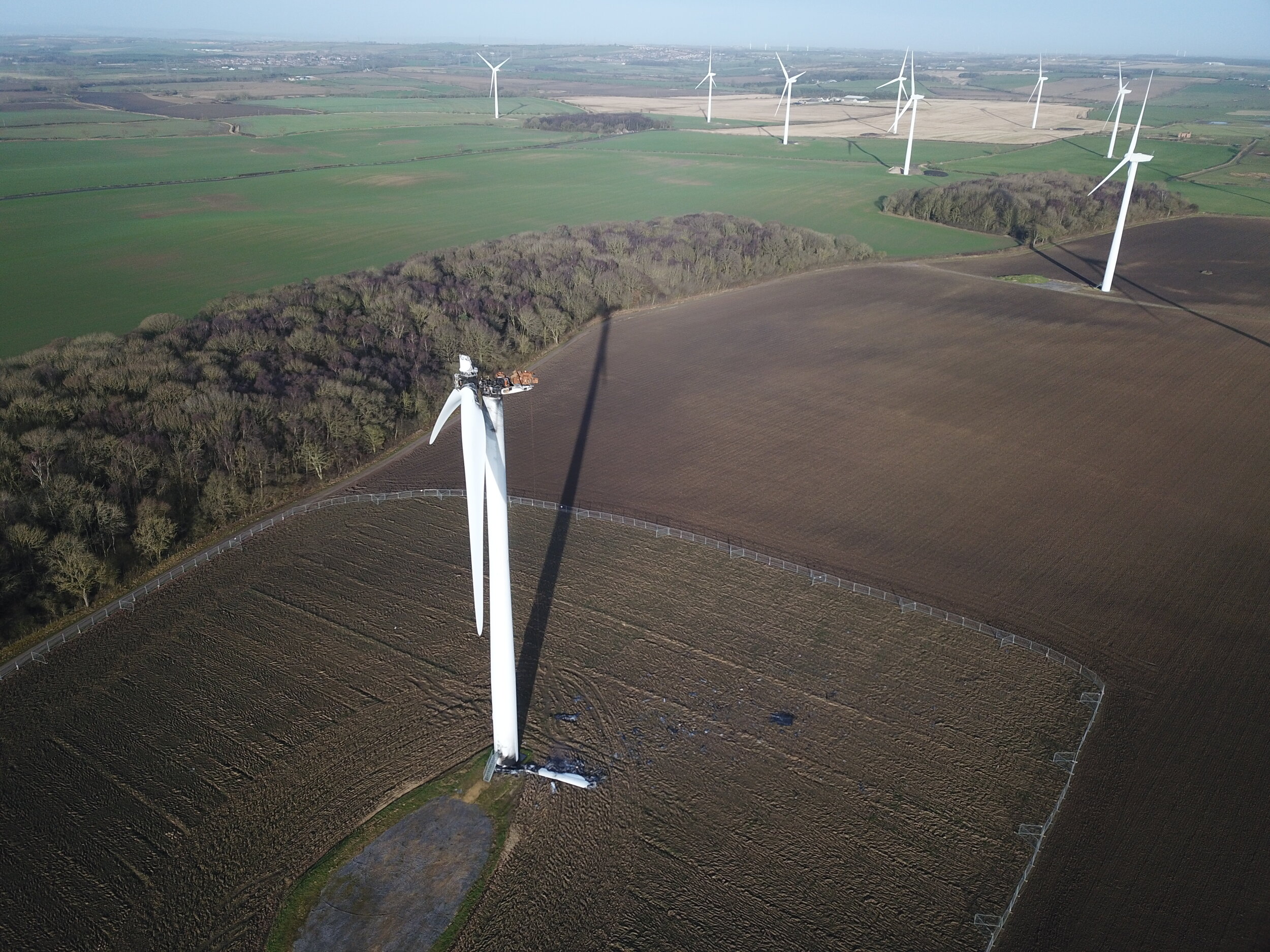
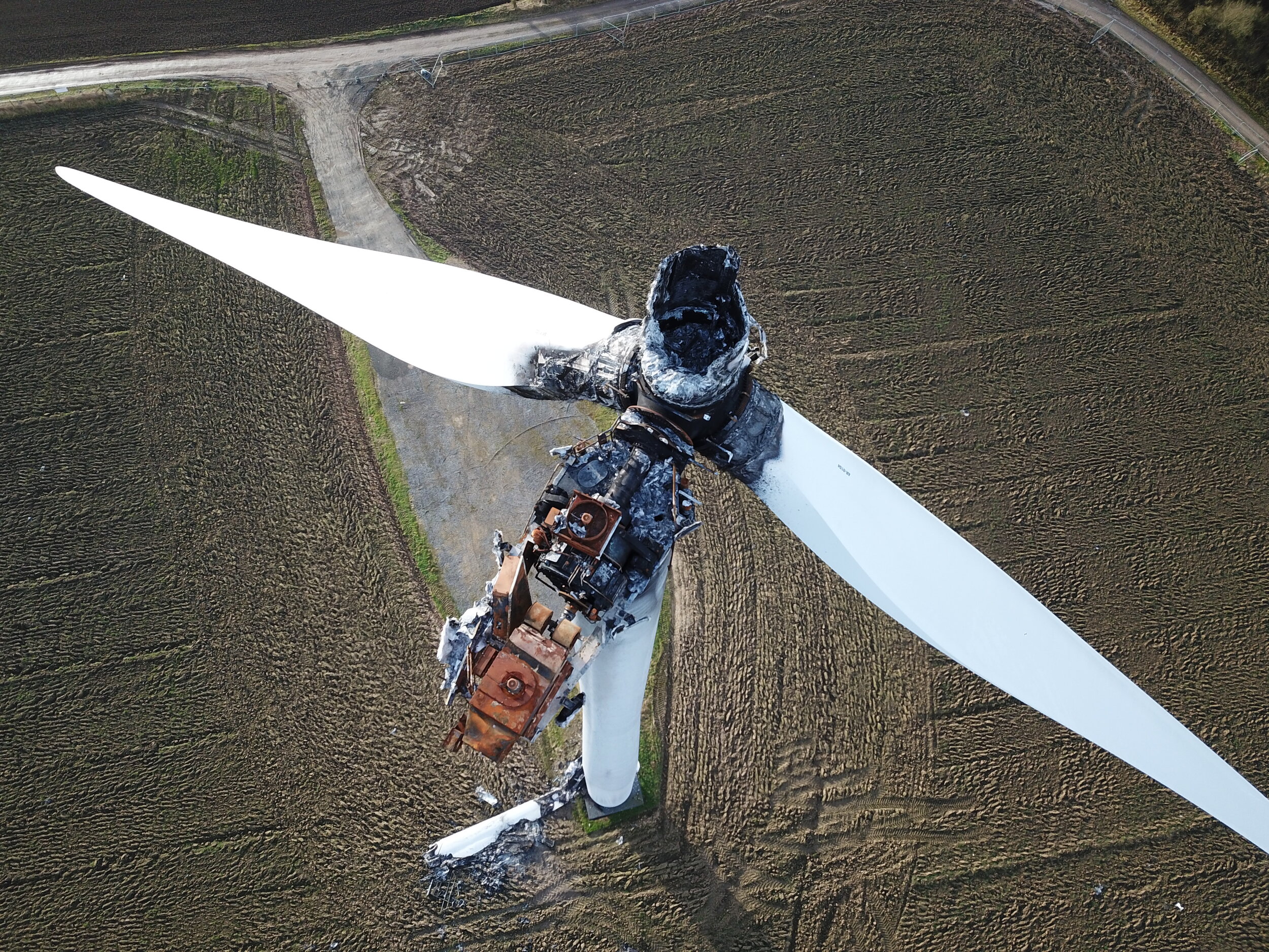
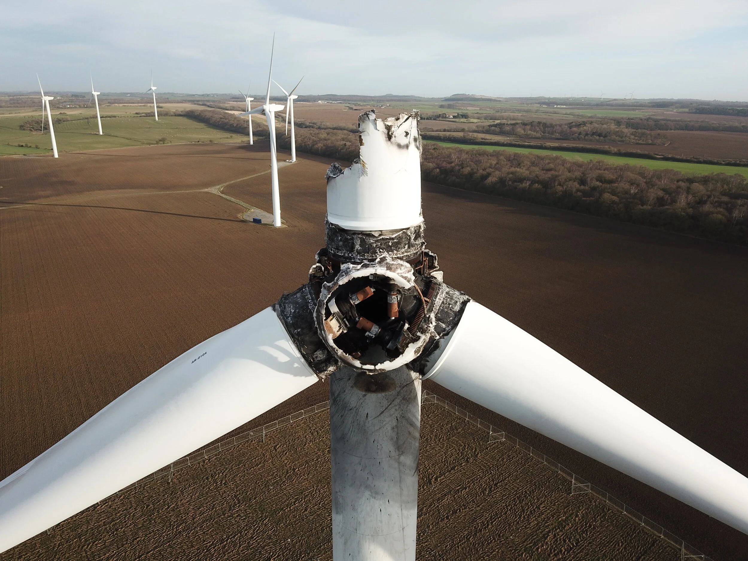
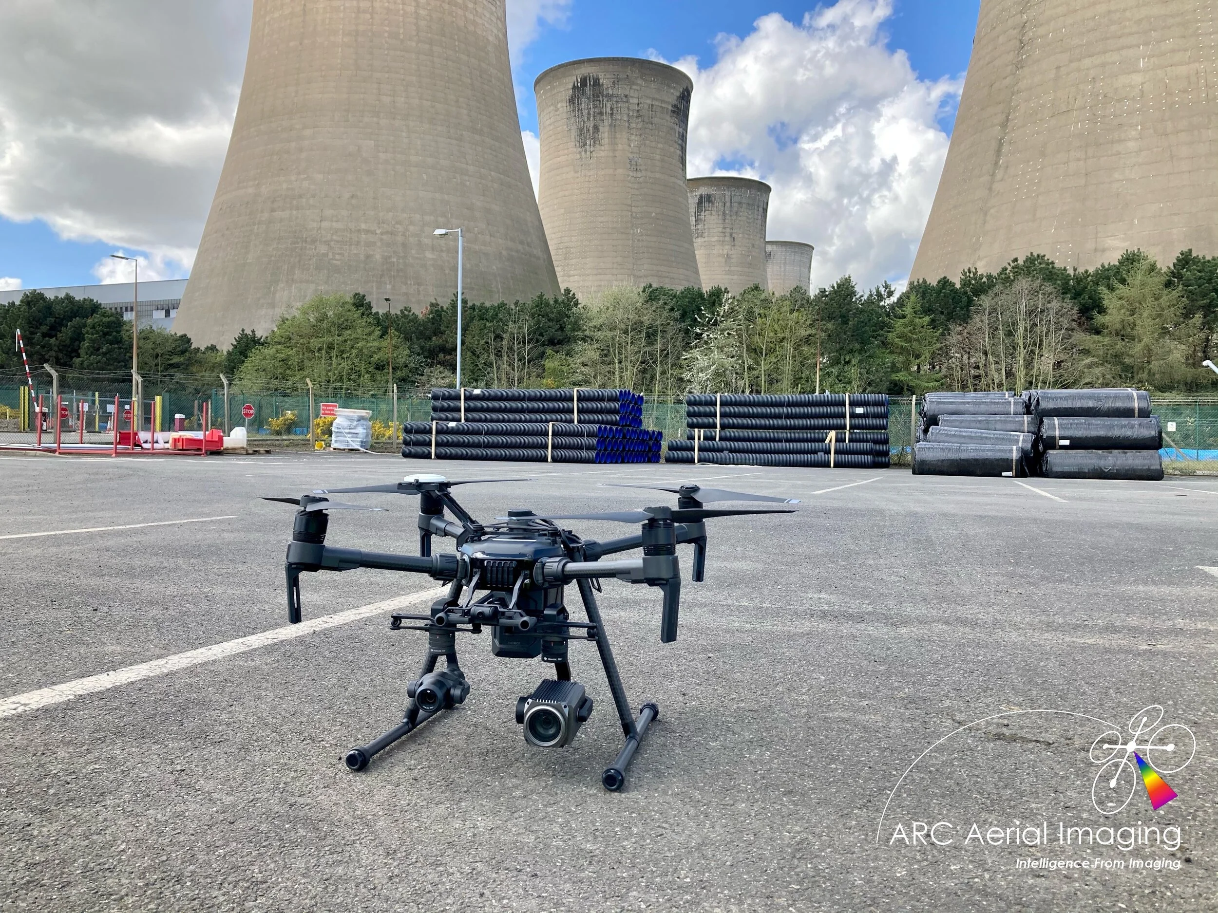
Our Matrice 210 UAV fitted with the 30x optical/6x digital zoom Zenmuse Z30 aerial camera for highly-detailed inspection imaging.

Imaging from the powerful 30x optical zoom Zenmuse Z30 aerial camera onboard our Matrice 210 UAV.
Aerial Visualisation Products.
We can also provide aerial visualisation products of infrastructure sites and their surrounds. The creation of 3D models and 360 degree visualisation panoramics taken from specific operating heights can be applied to give an immersive visual appreciation on the scale and extent of sites with products also annotated at specific points for referencing and documentation purposes.
Drone Flight Telemetry Information.
Telemetry data sourced from our drone flight operating logs can also be made available either as additional collateral information (.txt & .csv files) for technical auditing and imaging referencing uses. This can also be overlayed and rendered to inspection videos (below) enabling structural inspection teams and project managers/stakeholders to understand the drone’s positional behaviours when reviewing those inspection videos during assessments of subjects and for the inclusions into their reporting methods.
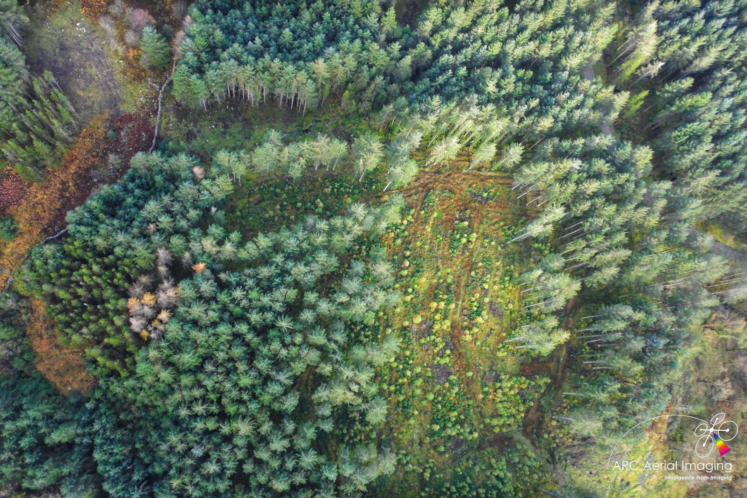
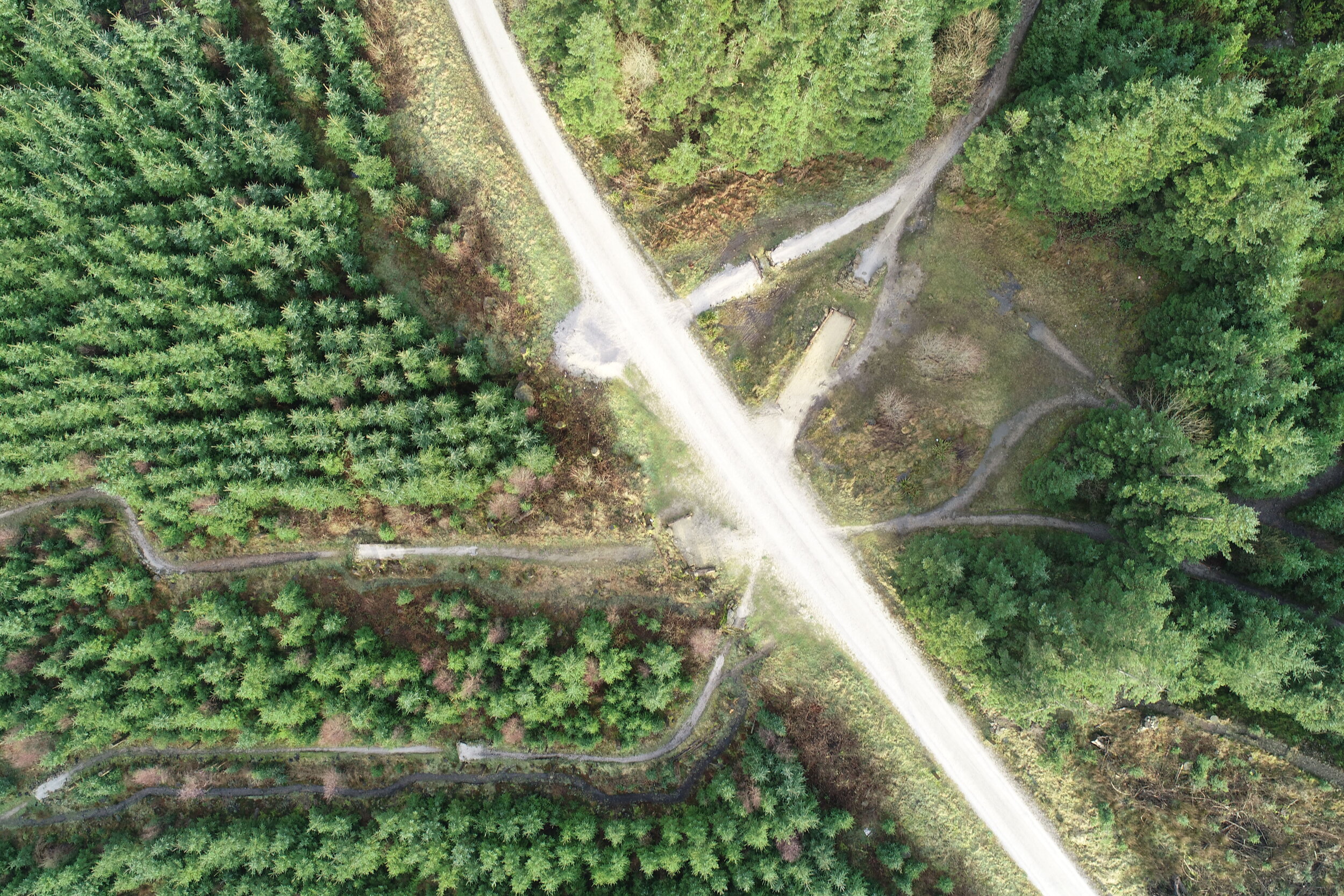
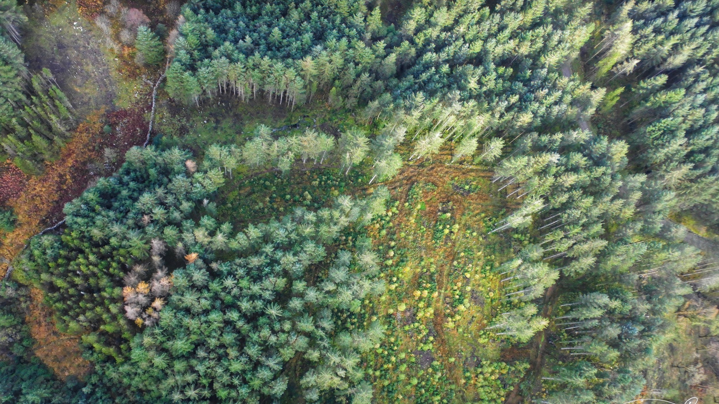
Forestry and Land Management
Forestry and Land Management
Forestry and Land Management
Forestry and Land Management
DRONE-BASED MAPPING FOR FORESTRY AND LAND MANAGEMENT
Drones have become an invaluable part of the tool kit available to forest managers. This is because they can autonomously-collect high resolution and other forms of geo-data of forests, quickly and at a relatively low price. Through this capability drones and their coupled sensing can both improve upon and fill knowledge gaps by providing up-to-date imaging data instead of using expensive and often out-of-date satellite remote imaging (eg Google Earth) or through surveys conducted by manned aircraft.

Range of drone aerial imaging applications include...
Forest acquisition surveys and promotional filming for prospective buyers or agents;
Surveys of forestry operations (eg, timber harvesting, road construction and drainage studies);
Site condition surveys and scouting with oblique videos/still photography or vertically geo-rectified aerial nadirs to generate geospatial datasets with photogrammetry for use in GIS such as…
Ground condition and crop surveys (site vegetation and species mapping);
Tree health, condition studies and monitoring;
Wind throw surveys (for land management and insurance uses).
We’ve been providing drone aerial imaging and geospatial support for the following national entity…

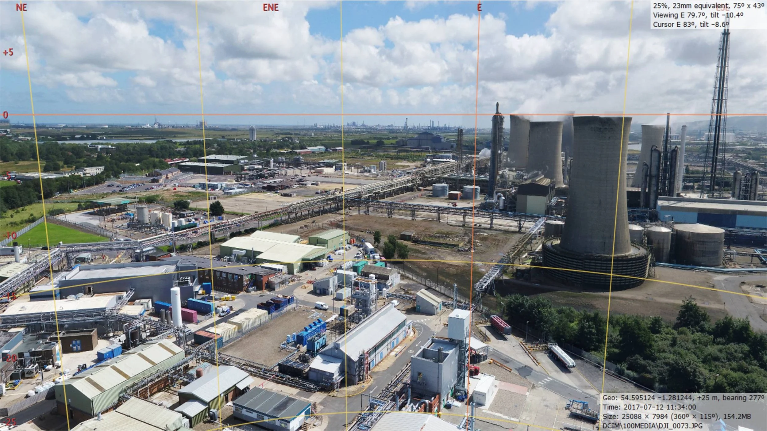
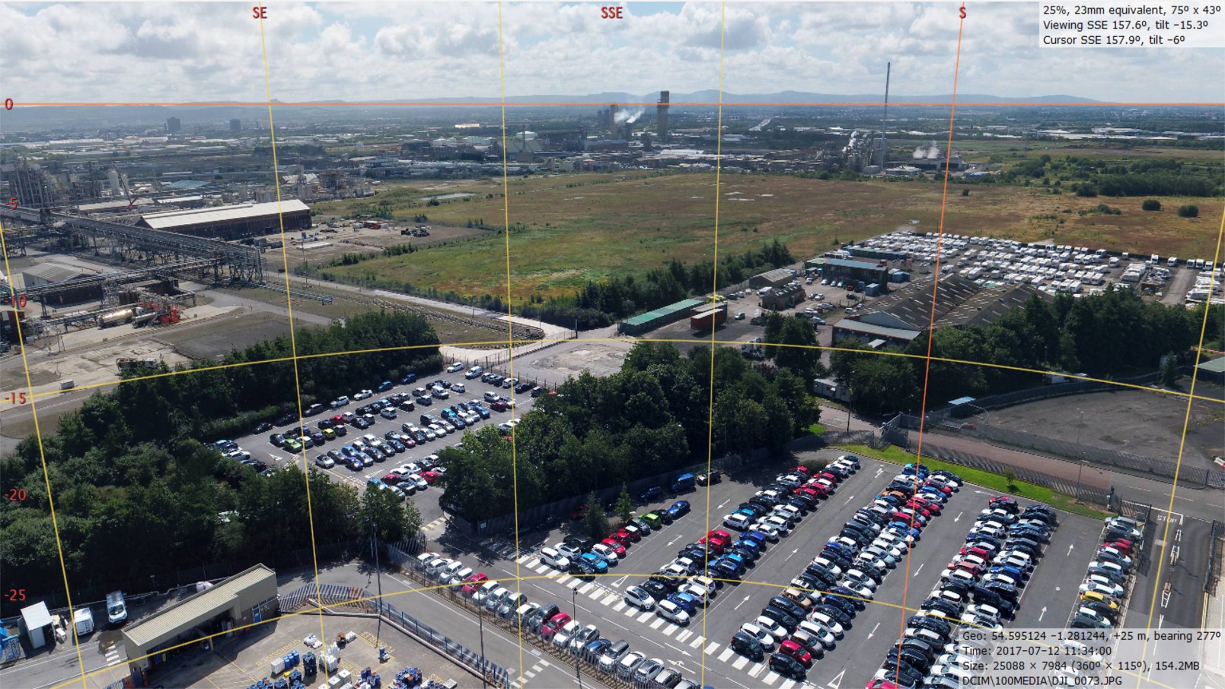
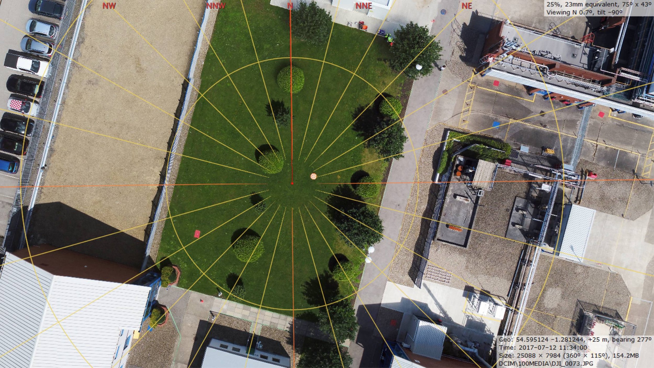
360 Degree Aerial Panoramics
360 Degree Aerial Panoramics
360 Degree Aerial Panoramics
360 Degree Aerial Panoramics
Immersive 360 Aerial Panoramas
In addition to our increasing catalogue of specialist aerial imagery and spatial products, ARC Aerial Imaging can also provide static interactive 360 degree aerial panoramics and aerial virtual tours.
Captured from various heights and at specific locations, the creation of 360 degree aerial panoramics can be applied to give a greater visual appreciation of subject scale and extents which can be applied for a variety of uses including:
Major construction project progressional visual updates for management teams and stakeholders;
Line-of-Sight studies for Telecommunications;
Commercial/Residential Property Planning and Marketing;
Overviews for Estates for Environmental and Land Management Assessment uses;
Overviews of large facilities for security applications;
Outdoor business overview visuals;
Interactive and immersive aerial visuals for business marketing.
These 360 degree aerial visuals can be provided either via online or be created as a standalone product for their intended embedding into client-administered websites.