

Data Processing Services
Data Processing Services
Data Processing Services
Data Processing Services
Creating actionable geospatial datasets from processed drone aerial imaging
Photogrammetry processing can be prohibitive for some in terms of what appropriate software to use, their individual workflows, costs, possible limited computing capabilities or are not proficient in knowing how to sufficiently use photogrammetry software to process imaging with.
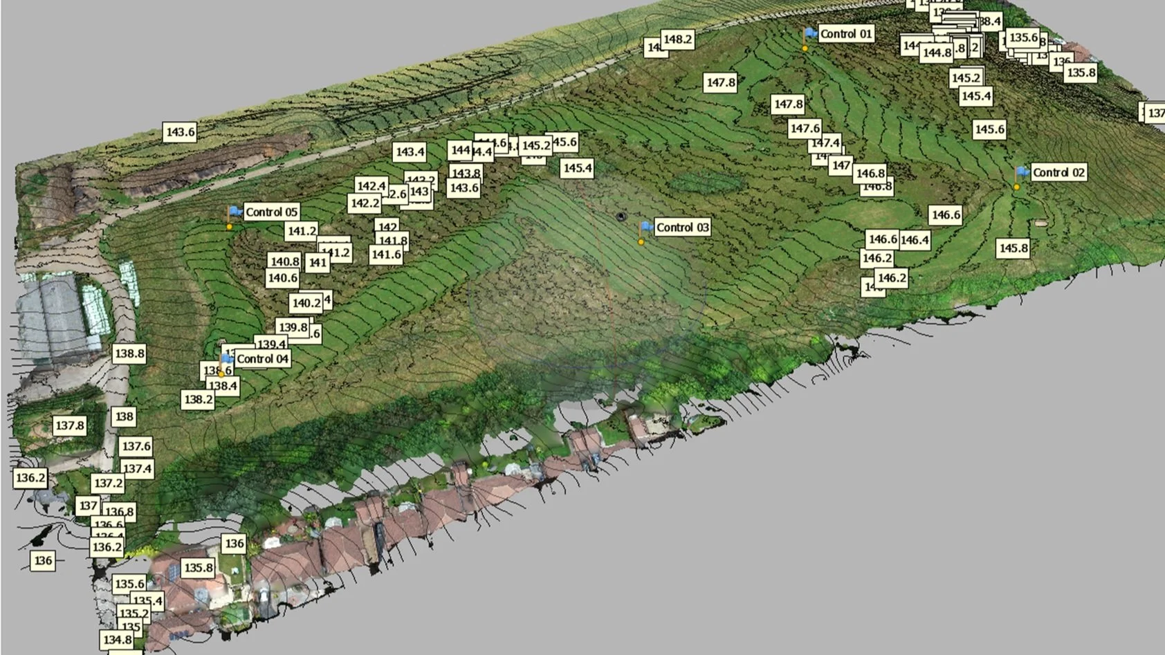
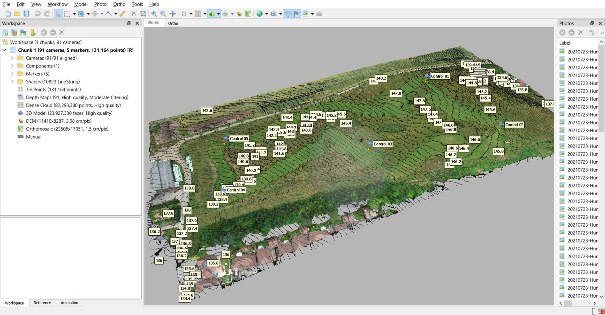
With access to several advanced photogrammetry and GIS desktop applications that are installed on our systems, we also provide an in-house comprehensive and transparent service in data processing by providing a variety of accurate project-supporting geospatial output types and in their relevant file formats for various industries and commercial applications. We’re here to provide;
Customised Solutions: Every project is specific and we can adapt our data processing services to meet bespoke requirements.
Efficiency and Precision: Our data processing workflows provide both timely and precise results.
Secure and Confidential: All of our processing is managed and conducted in-house and we do not use any third-parties.
Quality Assurance: Rigorous quality checks and validation processes ensure geodata integrity and reliability.
Requested processed outputs/formats will only be as good as the methodology of acquisition, the quantity and the integrity of the imaging that’s been provided for photogrammetry processing and geospatial product accuracies (RMSE) will also depend on how accurate those controlled means (e.g. GCPs) have been acquired/recorded.
We can also provide specialised training in such to help improve and enhance those planning approaches towards drone aerial imaging collection for onward mapping, surveying and photogrammetry applications on our industry-leading ‘Drone Aerial Imaging Masterclass Course for Mapping, Surveying and Photogrammetry’.
Our processing services fees, depending on how many images are received and required for photogrammetry processing, can be found on our services rates page.
Special Projects and Tasks
Special Projects and Tasks
Special Projects and Tasks
Special Projects and Tasks
Providing FMV Resources for ISR Training
We can also provide a variety of sUAS-derived and scenario-based aerial imaging outputs for training serials including processed geospatial datasets on behalf of entities that provide ISR-related courses.
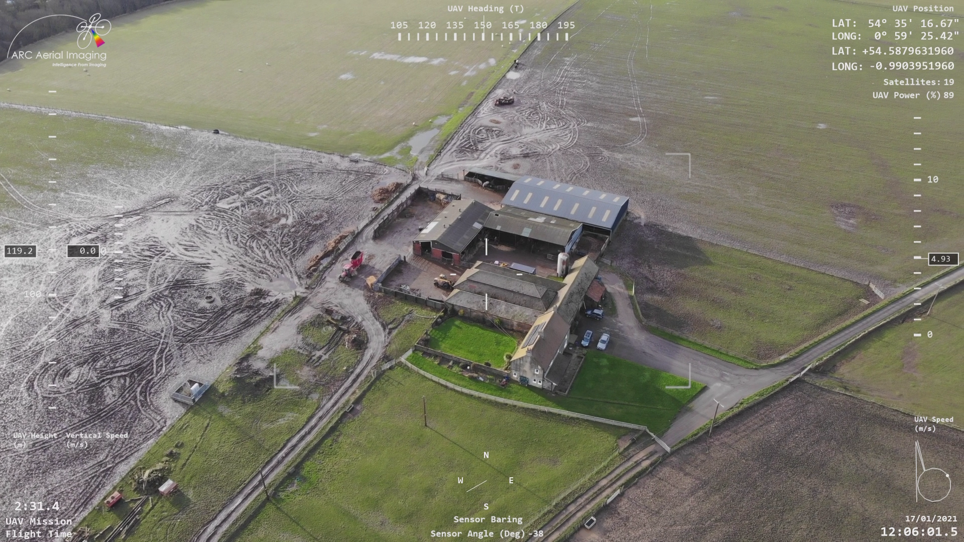
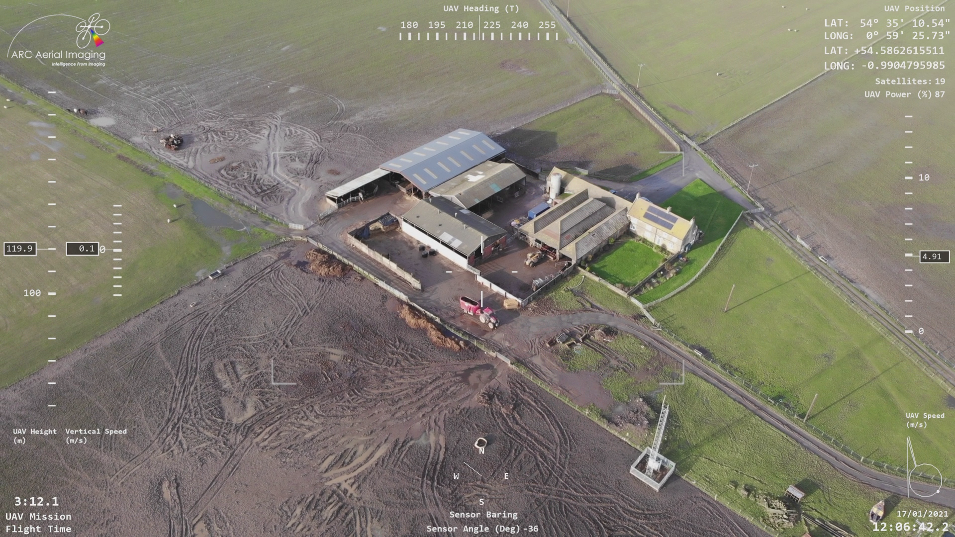
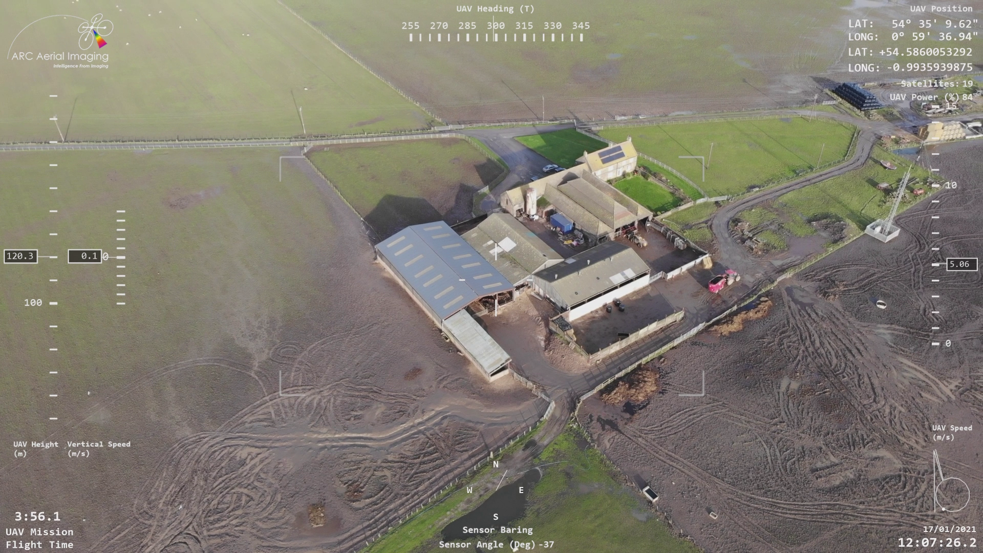
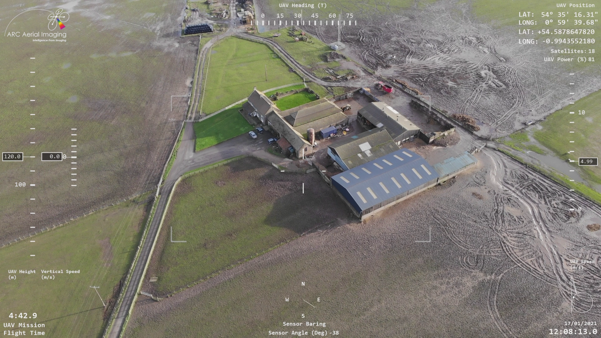
This can include autonomously planned/acquired raw aerial stills acquired at various high resolutions with different sensing coupled to its various multi rotor aerial platforms, the provision of FMV accompanied with bespoke overlaid flight telemetry data that can be created within minutes post-flight for immediate debriefing analysis right up to pre-prepared ‘Imagery Analysis Reports’ for intelligence analysis training materials for Directing Staff training solutions.
No fancy creative or ‘video game' after effects used but ACTUAL raw telemetry data extracted from a UAV flight log, synced and overlaid to high resolution Full Motion Video (FMV) using bespoke post-flight software to provide a highly informative training product.
Its aerial imaging and imagery analysis credentials stem from our formal RAF background in ISR for over two decades which involved in the production of various IMINT/GEOINT-related products that armed the ‘war fighter’ with knowledge within multi-domain operations as well as the provision of imagery-based materials supporting joint ‘white force intel’ training exercises.
With the readily availability of live feed-capable sUAS platforms for on-site training exercises, raw aerial imaging outputs acquired from different sensing formats accompanied with mission-supporting collateral data provided from an experienced entity that utilises various aerial imaging acquisition techniques and software means, get in touch if we can be of imaging support towards sUAS ISR-related training.
Imagery Analysis
Imagery Analysis
Imagery Analysis
Imagery Analysis
Providing Analysis Ready Data and Intelligence from Imagery
Recipient of a military award in 2001 for outstanding service within the specialist discipline of Imagery Analysis accompanied with over 25 years of accredited analytical skills in the exploitation from National Technical Means (NTM), Multispectral/Commercial Satellite (MSI/CSI), Electro-Optical (EO), Infrared (IR), Synthetic Aperture Radar (SAR) imaging and Ground Moving Target Indication (GMTI) data, our imagery analysis services come accompanied with our ability to provide high resolution aerial still images and UHD videos acquired from our inventory of drones and sensing to provide a comprehensive acquisition and consulting service.


Various analytical products, from textual/illustrative reports to interactive spatial products, can be created from our comprehensive range of reporting templates which can accompany and support client formal reporting on their projects.
