DRONE-BASED MAPPING FOR AGRICULTURE
AUGMENTING AGRONOMY, ASSISTING TO DETECT POTENTIAL ISSUES, MINIMISING COSTS!
With our ability to collect and analyse drone aerial imaging data, our comprehensive specialist services could augment and enhance the services of agricultural subject matter experts such as agronomists who may wish to take the advantage to identify potential crop growing problems promptly. This can be whilst reviewing live imaging on site and/or also through onward processed technical imaging data to be included into their assessments whilst making actionable decisions more promptly.
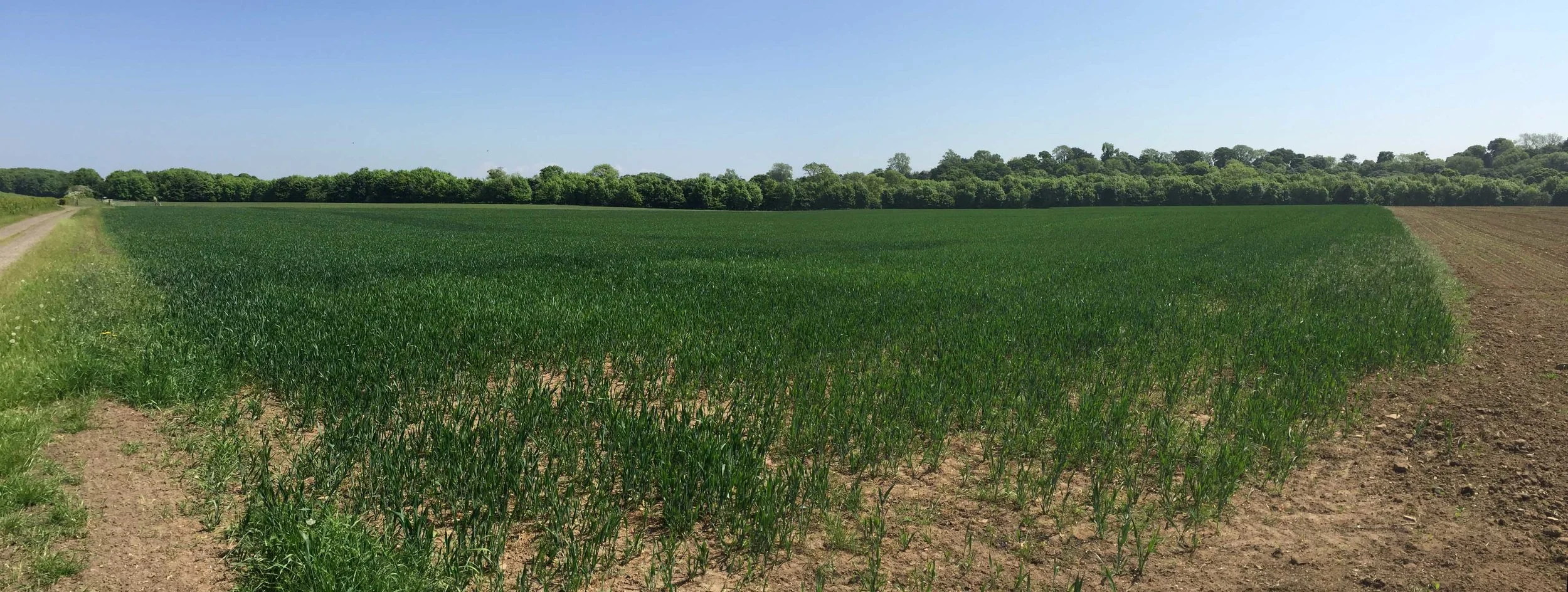
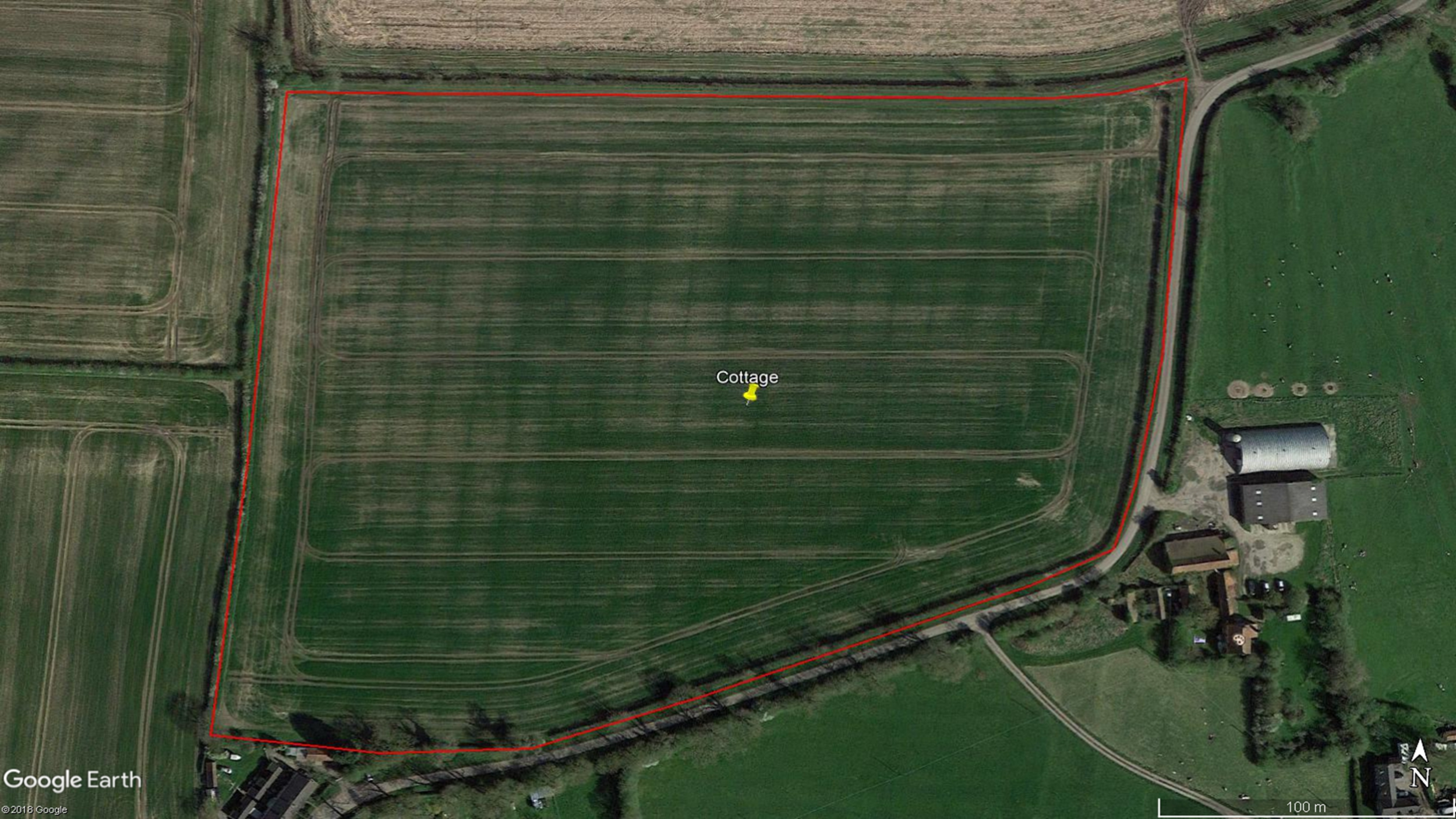
Initially assessing a crop condition can be both difficult to ascertain and time-consuming from the ground...
... yet through the use of aerial imaging, assessing continued crop growth conditions and to detect any potential problems can be timely ascertained from the air.
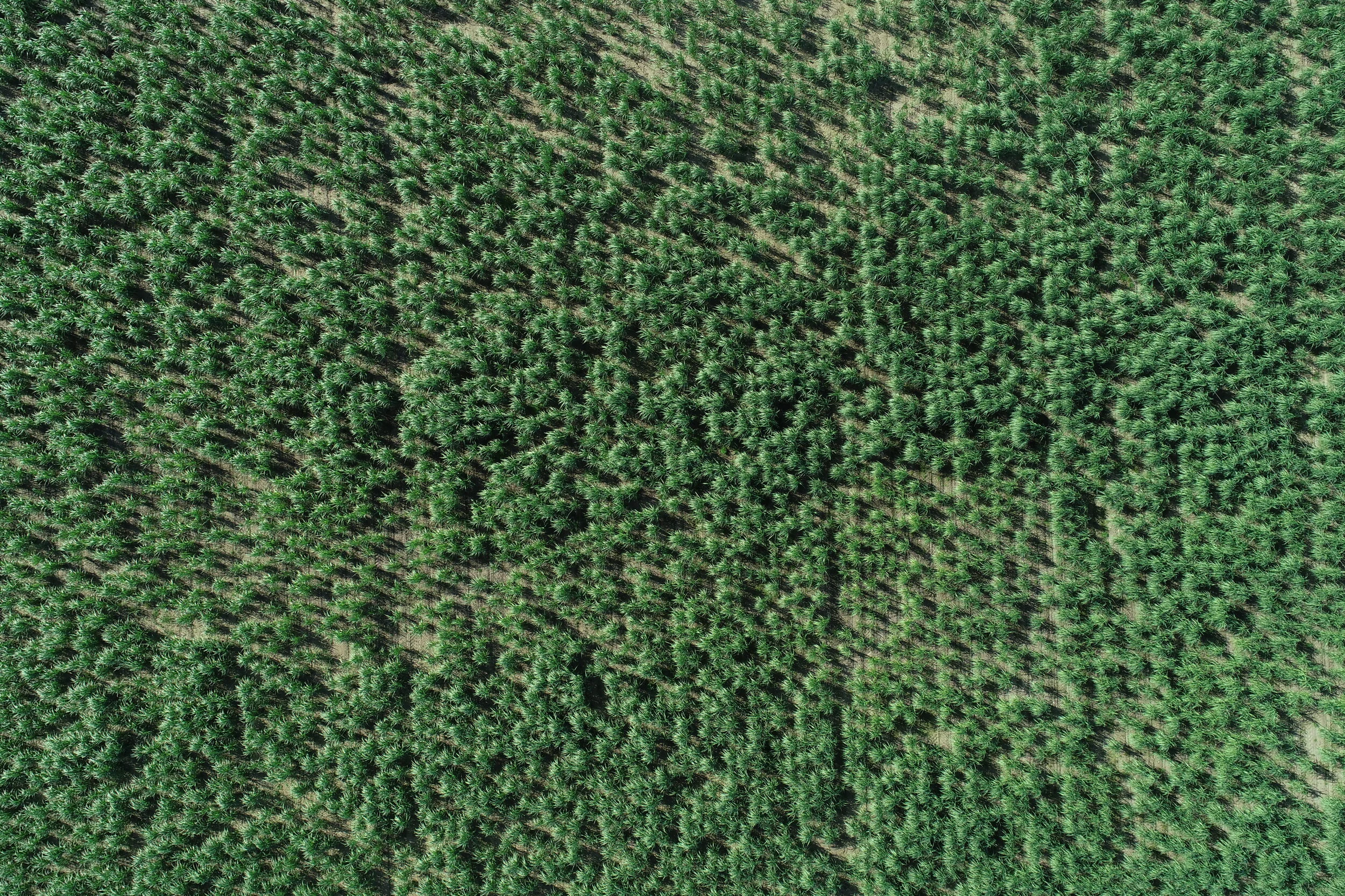
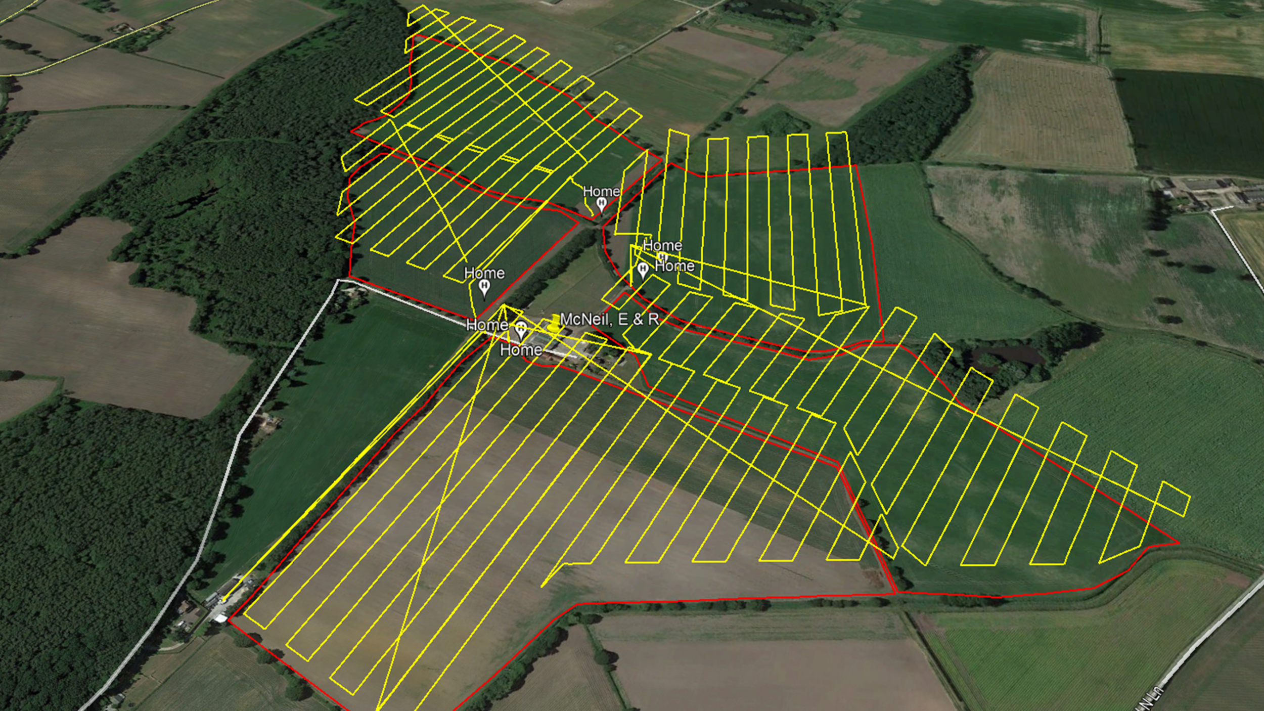
How precision multispectral drone aerial imaging can assist agriculture...
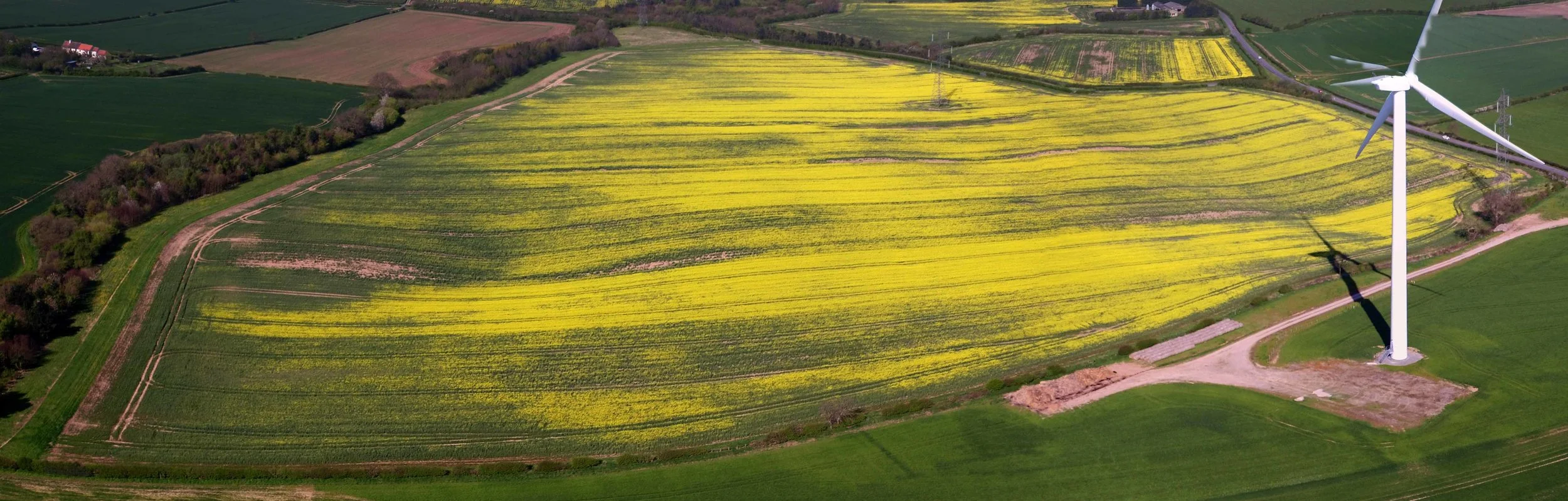
This process of collecting aerial imagery can be further repeated by applying the same autonomous flight protocols in so that, for example, periodic environmental monitoring can be continually conducted.
Prompt decisions can be crucial as it can potentially save a whole crop landholding from being affected by unhealthy sub-areas. In addition, and as soon as a potential issue is detected, a more precise or tailored crop and landholding remedy can be applied and then be further monitored.
🌱 𝗢𝗽𝘁𝗶𝗺𝗶𝘀𝗶𝗻𝗴 𝗖𝗿𝗼𝗽 𝗠𝗮𝗻𝗮𝗴𝗲𝗺𝗲𝗻𝘁
Drones can capture high-resolution imagery, enabling farmers to monitor crop health, detect issues, and make informed decisions about irrigation, fertilisation, and pest control.
🌾 𝗜𝗻𝗰𝗿𝗲𝗮𝘀𝗲𝗱 𝗬𝗶𝗲𝗹𝗱𝘀
Drone technology enables farmers to improve crop health and resource management, leading to higher yields and increased profitability.
💧 𝗪𝗮𝘁𝗲𝗿 𝗖𝗼𝗻𝘀𝗲𝗿𝘃𝗮𝘁𝗶𝗼𝗻
Drones can assist with irrigation management, providing data on water distribution and crop water needs, helping farmers conserve water and reduce costs.
🌎 𝗘𝗻𝘃𝗶𝗿𝗼𝗻𝗺𝗲𝗻𝘁𝗮𝗹 𝗦𝘂𝘀𝘁𝗮𝗶𝗻𝗮𝗯𝗶𝗹𝗶𝘁𝘆
By promoting targeted pesticide application and optimising resource use, drones contribute to more sustainable agricultural practices, reducing the industry’s environmental impact.
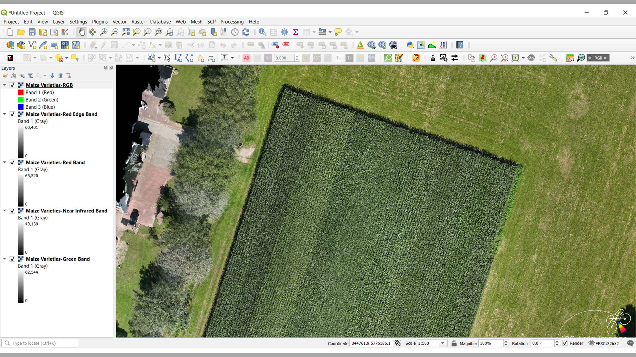
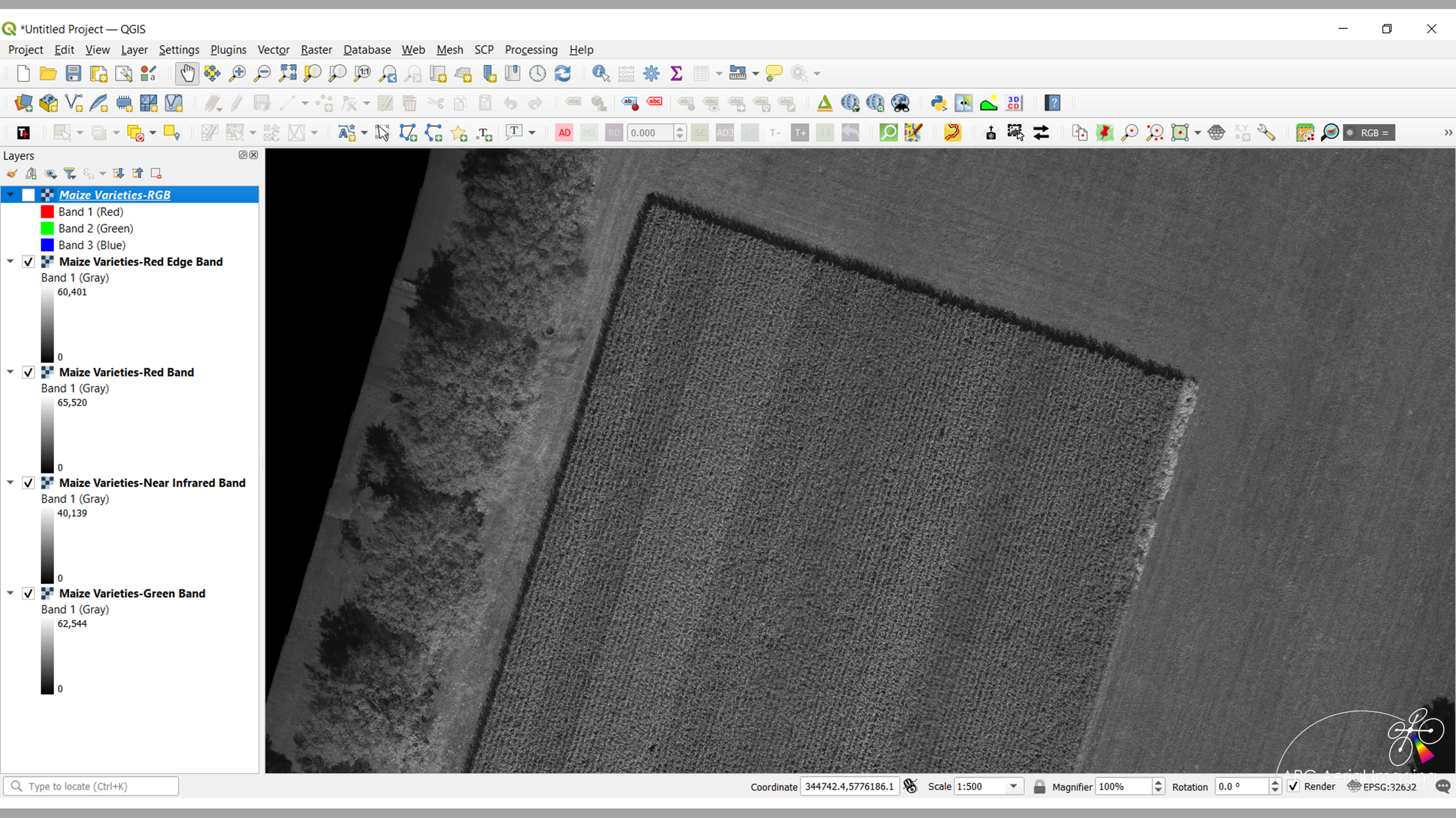

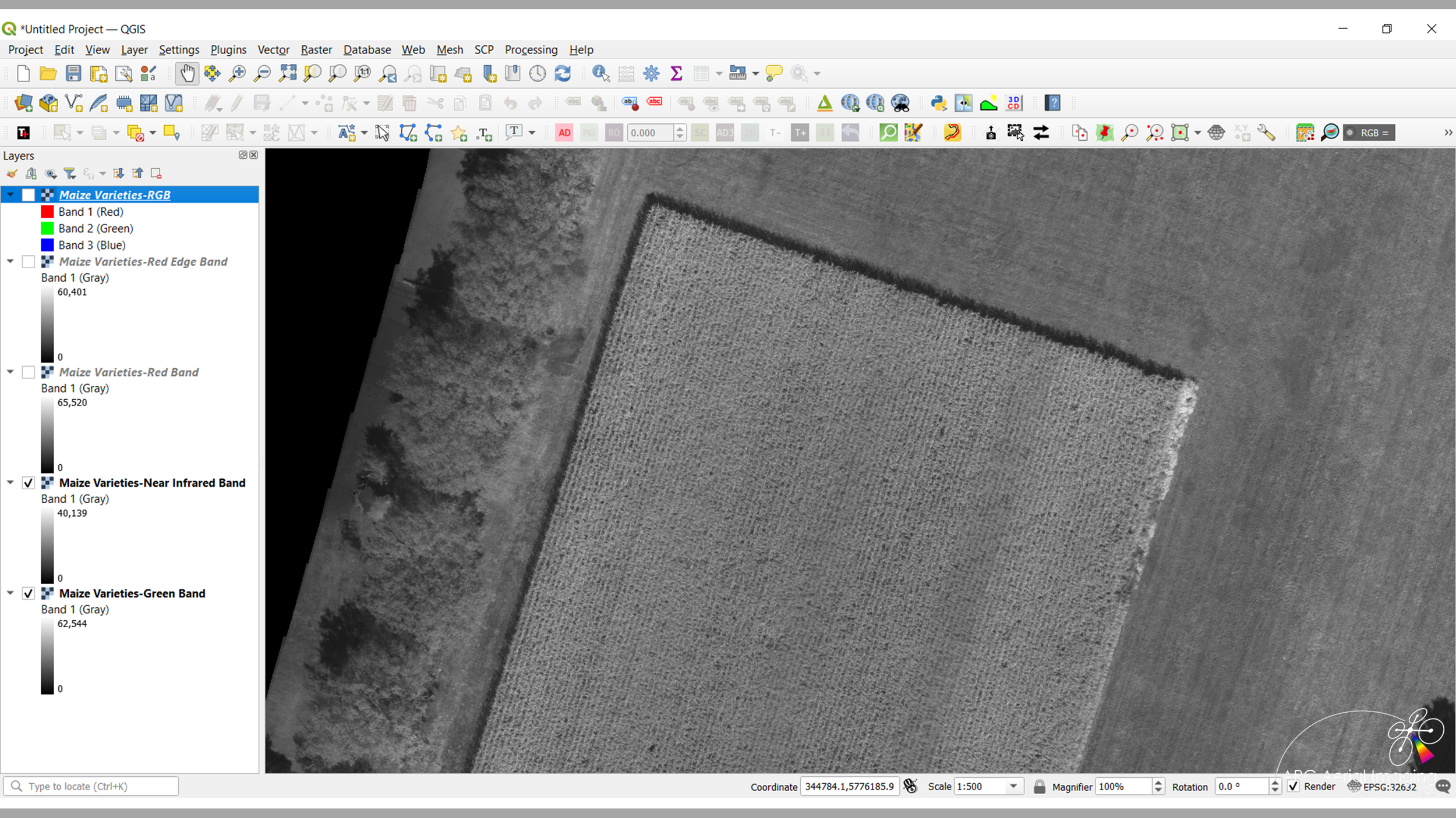
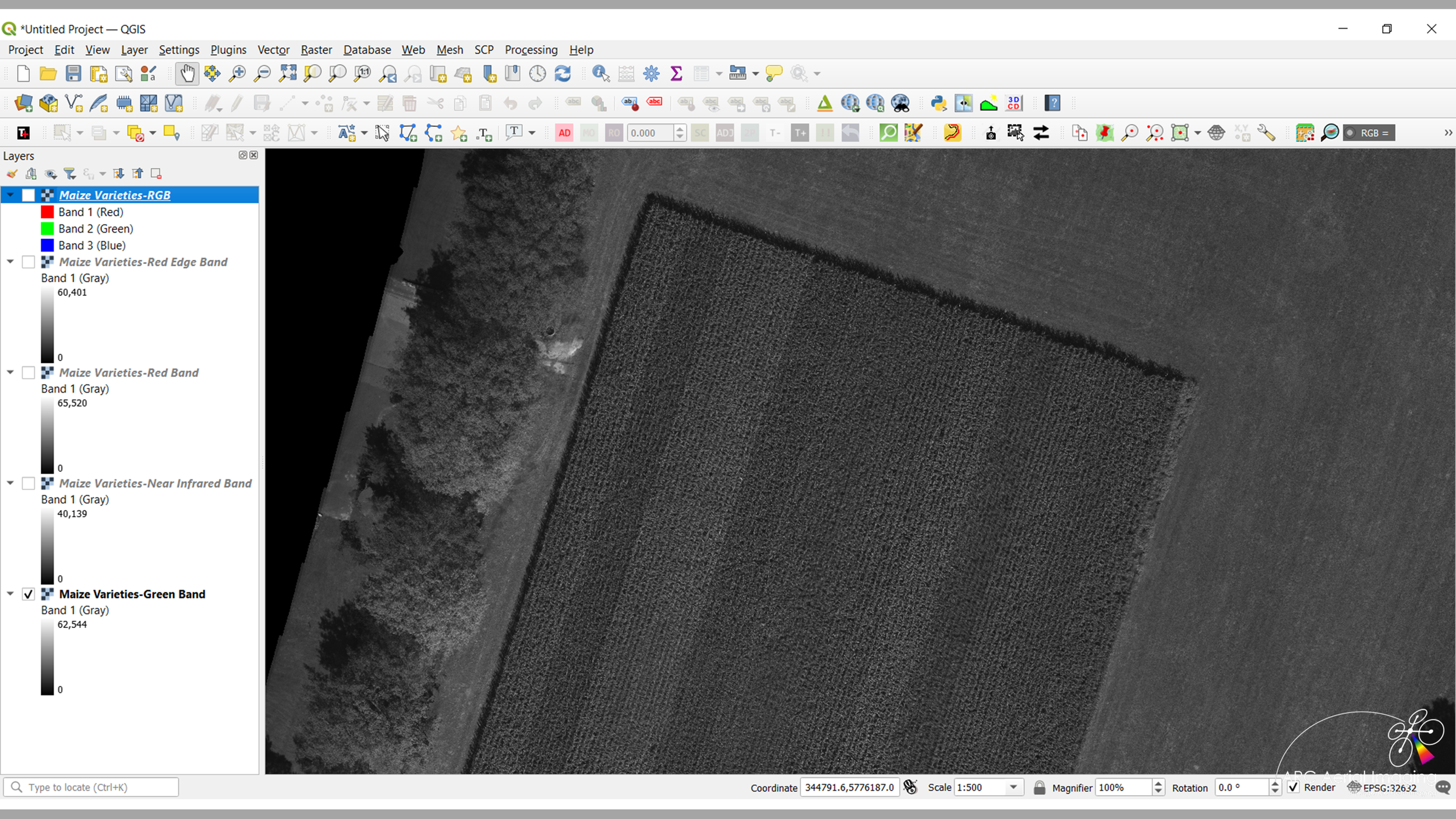
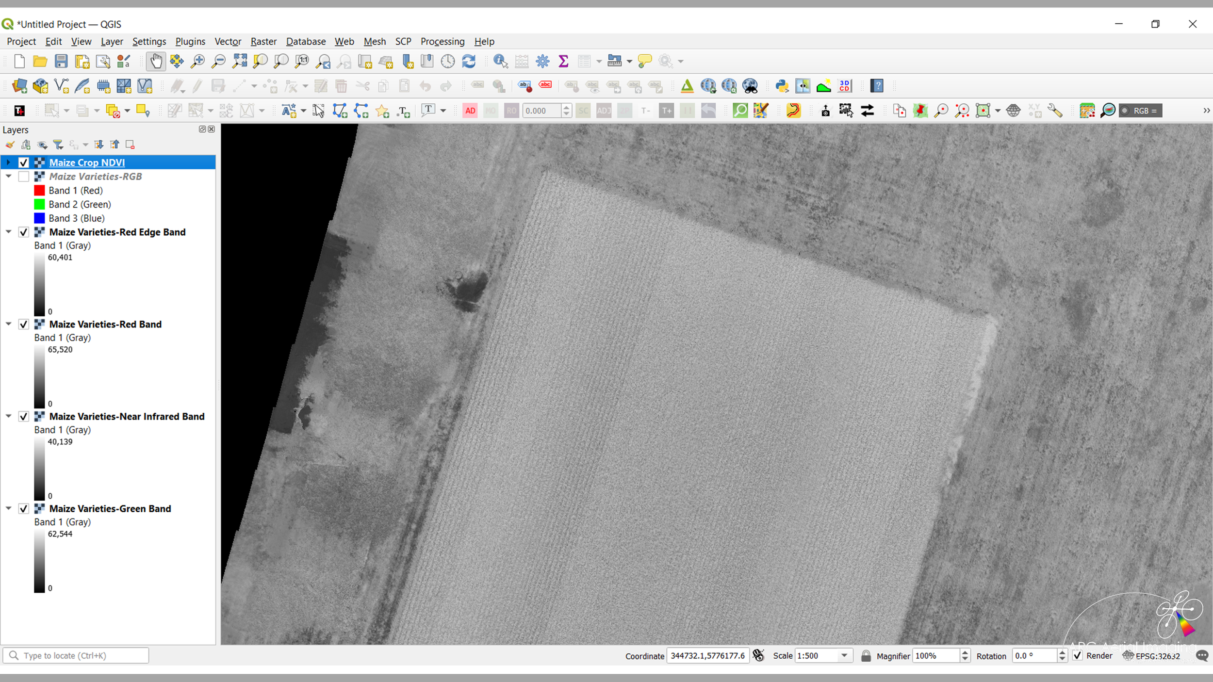

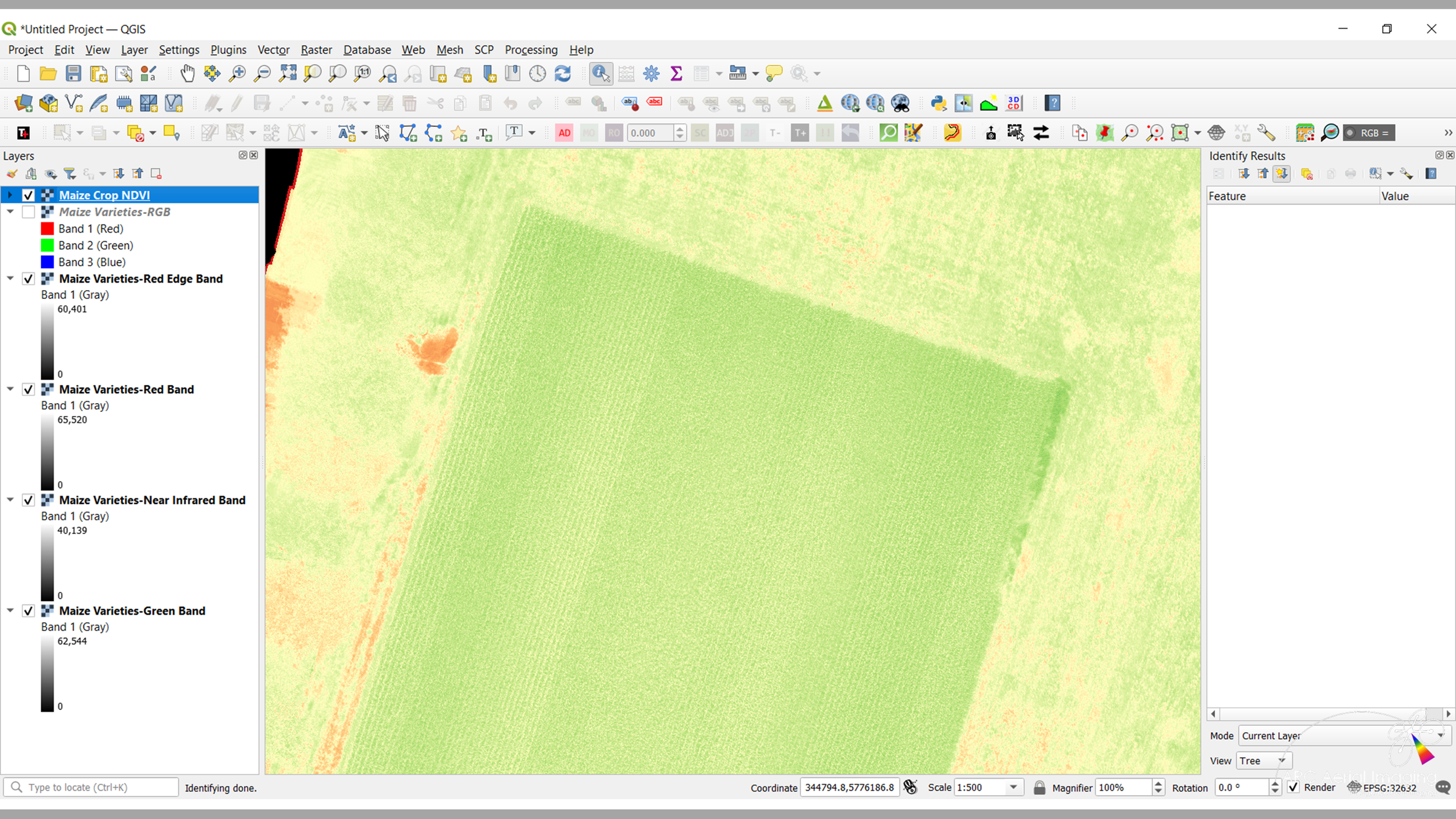
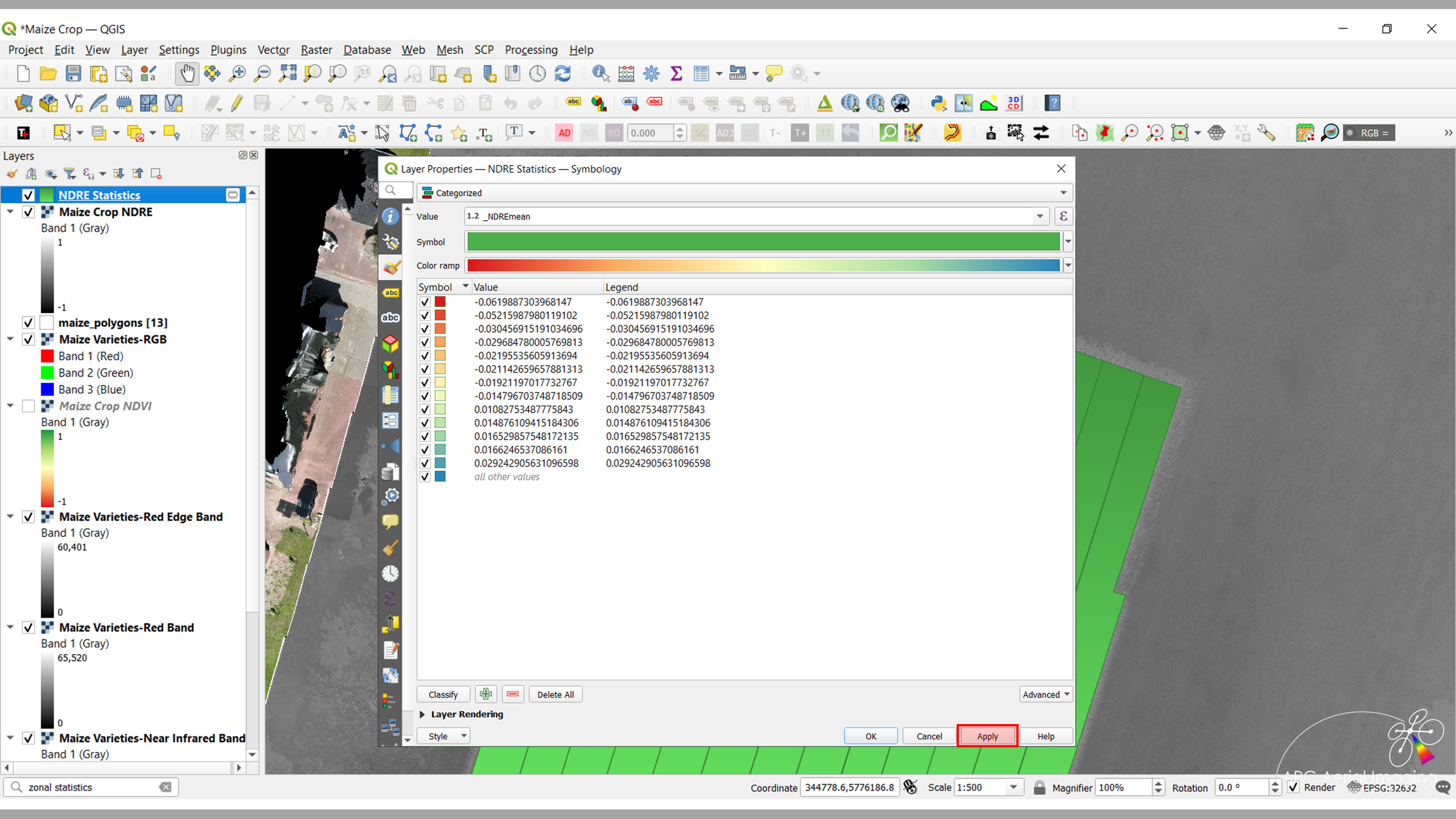
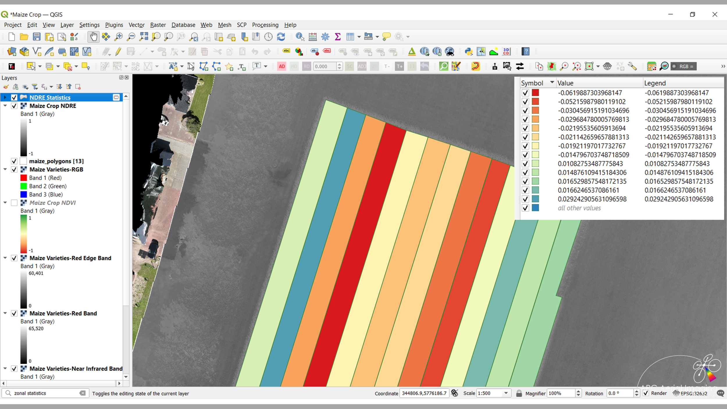
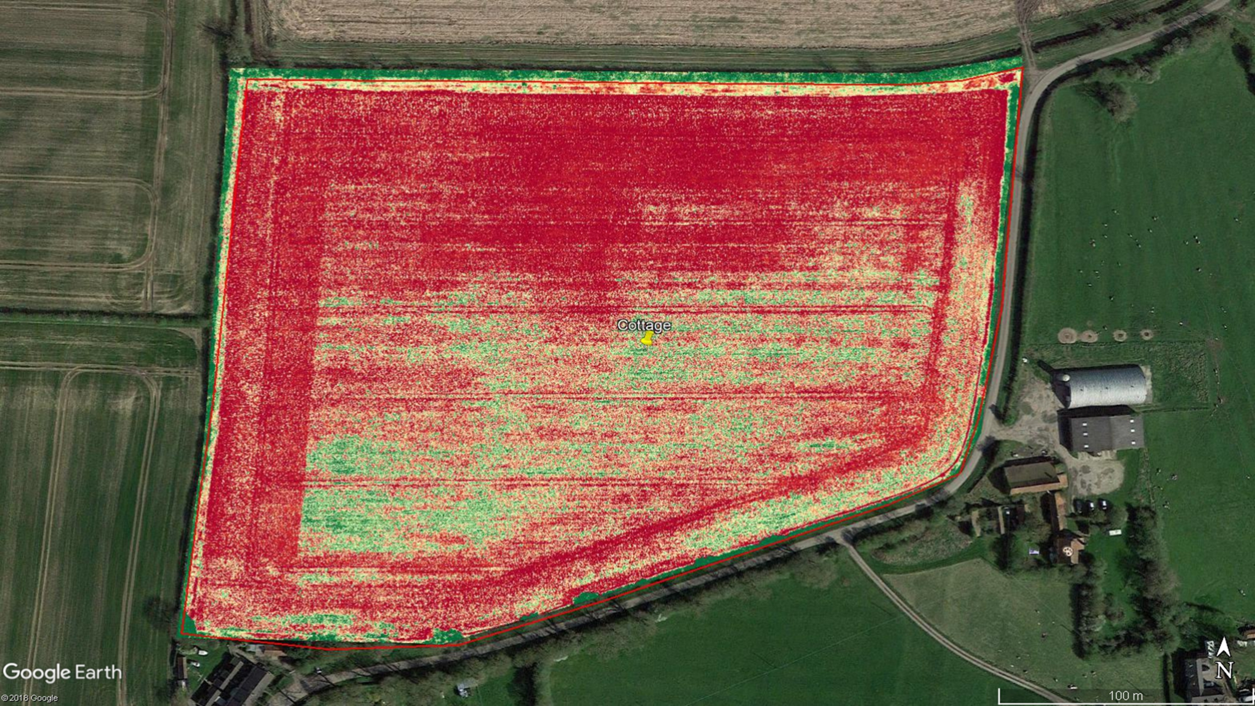
Our aerial imaging can be carefully planned and collected at specific RGB and MS resolutions (GSD), managed and disseminated to those entities for their Artificial Intelligence (AI)-based and algorithmic analysis studies or growth trends, plant and size counts, generate prescription maps, identify early indicators of plant stress through various vegetation indices and measure the zonal efficiencies of crop landholdings.


We're a recognised provider of UAV-acquired aerial imaging for agriculture.
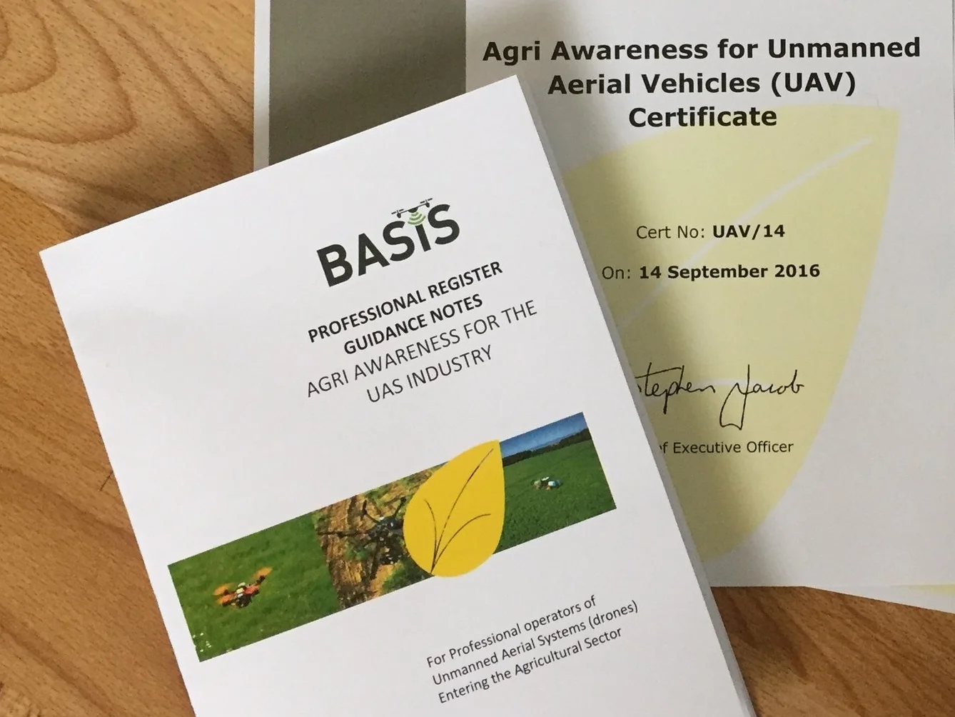
In September 2016, ARC Aerial Imaging attended the 'BASIS Agricultural Awareness Training for UAS Operators Course' at Harper Adams University.
The course served as an introduction into the basic aspects of the agricultural sector and is designed for professional operators of UAVs/drones like ARC Aerial Imaging in providing them with a fundamental level of understanding and knowledge appropriate for their work within the agricultural industry and supply chain.